🏗️ Infrastructure & Progress

Jammu & Kashmir Development Tracker

An analyzed record of completed, ongoing, and future developmental pathways across the Union Territory, sourced from official state portals and planning boards.

✍️ By J&K Administrative Archive Editorial Desk | 📅 Last reviewed: 01 September 2026

Development Analysis Overview

Development in Jammu & Kashmir is powered by a strategic mixture of the Central Government's Prime Minister’s Development Package (PMDP), the New Central Sector Scheme (NCSS), and local executions under the **Jammu and Kashmir Infrastructure Development Finance Corporation (JKIDFC)**. This tracker presents the physical ground realities of J&K's transition.

₹5,824Cr
FY 25-26 Investment
13x increase over pre-2021 industrial levels
1,305
Active Startups
Compared to just 69 startups registered in 2020
1,500+
Languishing Projects
Rescued, funded, and completed by JKIDFC
Phase I

Completed Achievements (Happened Already)

Key infrastructures, strategic tunnels, and smart corridors that are active and serving the public today.

✓ Active & Operational

The Chenab Arch & Anji Khad Railway Bridges
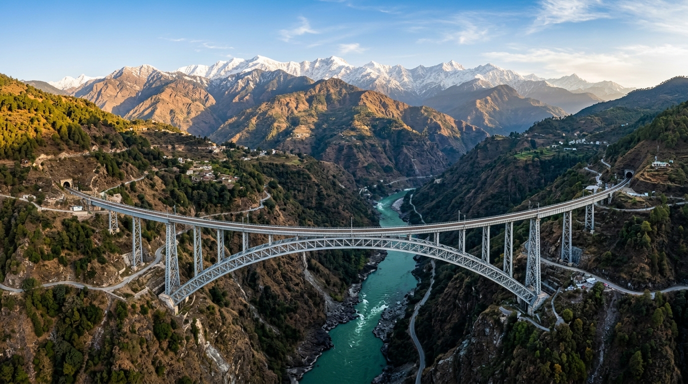
World’s Highest Chenab Rail Bridge (359m) 📷 World’s Highest Chenab Rail Bridge (359m)
Engineering marvel connecting Kashmir to the national Indian railway network.

Objective: Overcoming extreme Himalayan geography to connect Kashmir Valley with the Indian Railways grid.

The completion of the world's highest railway arch bridge over the Chenab River (elevated 359 meters above the riverbed) alongside India's first cable-stayed bridge at Anji Khad. Track laying and trial runs are complete, paving the way for direct railway links between Srinagar and Jammu.

Source: USBRL Monitoring Cell / Northern Railways
✓ Active & Operational

Z-Morh Escape Tunnel & Banihal-Qazigund Double Tube
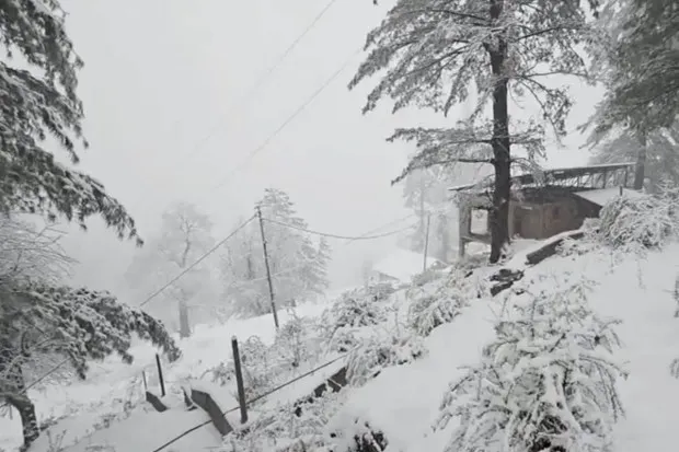
Snowbound Himalayan Landscapes 📷 Snowbound Himalayan Landscapes
Winter snow cover transforming mountain slopes and pine canopies.

Objective: Year-round, all-weather vehicular connectivity through heavy snow boundaries.

The 8.4 km Banihal-Qazigund road tunnel is fully open, bypassing landslide-prone sectors of the NH-44 highway. Concurrently, the strategic 6.5 km Z-Morh Tunnel's escape tube has been completed, providing vital winter access between Srinagar and Sonamarg.

Source: National Highways and Infrastructure Development Corporation Ltd (NHIDCL)
✓ Active & Operational

Srinagar Jhelum Riverfront Rejuvenation
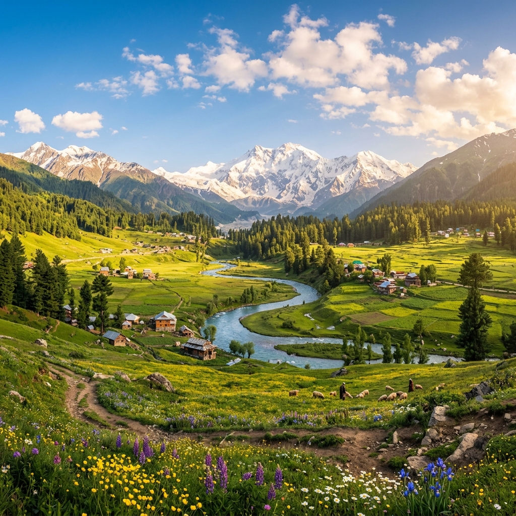
Geographical Landscape of J&K 📷 Geographical Landscape of J&K
Spanning Pir Panjal, Great Himalayas, and Zanskar mountain ranges across 20 districts.

Objective: Modernizing urban mobility and heritage spaces in Srinagar district.

Under the Srinagar Smart City initiative, the Jhelum Riverfront and Polo View market have been converted into pedestrian-friendly, high-density heritage zones. The city has also introduced a fleet of green electric transit buses to lower carbon footprint levels.

Source: Srinagar Smart City Limited (SSCL)
Phase II

Ongoing Development (In Process)

Flagship projects currently under active excavation, construction, or trial phases.

⏳ Active Construction

The Zojila Pass Tunnel Project

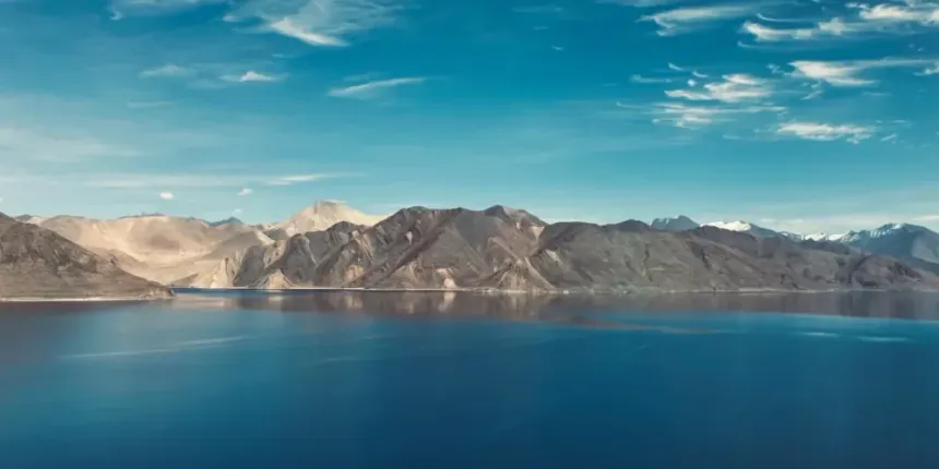
Pangong Tso & Ladakh High Lakes 📷 Pangong Tso & Ladakh High Lakes
Deep turquoise alpine lake at 14,270 ft in the cold desert plateau.

Objective: Connecting Srinagar Valley with Ladakh UT all-year round.

Excavation is actively underway on the 14.15 km Zojila Pass Tunnel. Positioned at an altitude of 11,578 feet, this will be Asia's longest bi-directional tunnel, reducing travel time across the hazardous Zojila pass from 3 hours down to just 15 minutes.

Source: National Highways and Infrastructure Development Corporation Ltd (NHIDCL)
⏳ Active Construction

Jammu Tawi Riverfront Development

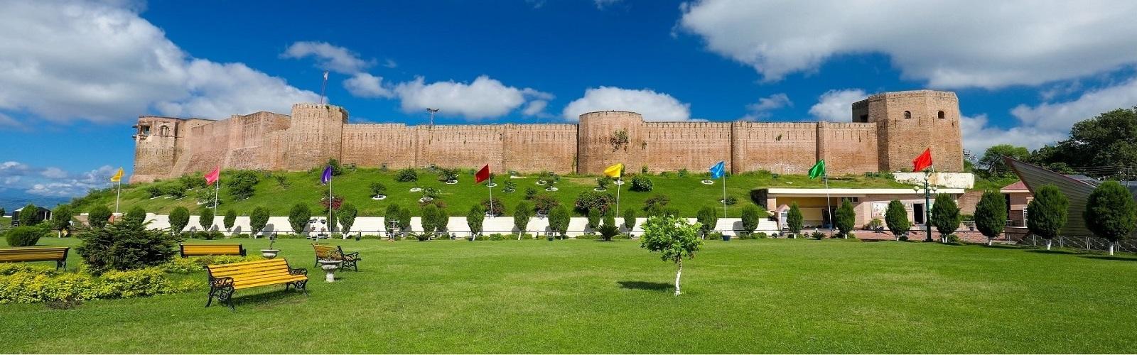
Ancient Bahu Fort Jammu 📷 Ancient Bahu Fort Jammu
Historic fortress and sacred Kali temple commanding the River Tawi gorge.

Objective: Flood control and commercial zone expansion in Jammu city.

Modeled on successful riverfront formats across Western India, work is in progress to build artificial barrages, concrete channel walls, and recreational parks along the Tawi River bed, safeguarding low-lying city margins from monsoon overflows.

Source: Jammu Smart City Limited (JSCL) / My Jammu
⏳ Active Construction

Chenab Valley Hydropower Corridors (Pakal Dul & Kiru)

Objective: Harnessing run-of-the-river power potential for regional self-sufficiency.

Construction of the 1,000 MW Pakal Dul Hydroelectric Project and the 624 MW Kiru Hydroelectric Project on the Chenab River. These projects aim to expand power availability, although they face local ecological review constraints.

Source: Chenab Valley Power Projects (CVPPPL) / Ministry of Power
Phase III

Future Plans & Frameworks

Geographical Landscape of J&K 📷 Geographical Landscape of J&K
Spanning Pir Panjal, Great Himalayas, and Zanskar mountain ranges across 20 districts.

Policy reviews, structural expansion roadmaps, and land reservation guidelines designed for J&K's future.

🔮 Planned Framework

New Industrial Policy & MSME Revival Code

Objective: Protecting local cottage industries while attracting structured mega-investments.

Under current drafting by a high-level government panel, the revised Industrial Policy seeks to bring sick MSME craft units on par with new projects for state incentives, while introducing self-certification rules to prevent bureaucratic delays.

Source: J&K Department of Industries & Commerce / FCIK Proposals
🔮 Planned Framework

PMGSY-IV Connectivity Matrix

Weather & Hydrological Monitoring 📷 Weather & Hydrological Monitoring
Real-time IMD updates and river gauge tracking across Jhelum and Chenab basins.

Objective: Standardizing road transport to remaining remote mountainous habitations.

The upcoming phase of the Pradhan Mantri Gram Sadak Yojana (PMGSY-IV) targets laying over 3,300 km of new all-weather rural roads, connecting isolated Himalayan valleys and preventing agricultural market blockages.

Source: J&K Public Works Department (PWD)
🏡 Exploring Grassroots Panchayati Raj, DDCs, BDCs & PMGSY Rural Roads? Explore the dedicated Rural Development & Panchayati Raj Master Hub for MGNREGA, PMAY-G, SBM-G, and 20-district rural governance matrix.
Open Panchayati Raj Hub ➔
🚌 Looking for Transport, SARATHI/VAHAN, Smart City e-Buses & Pass Advisories? Explore the Transport & Urban Mobility Master Hub for 200 electric buses, JKRTC fleet, Gulmarg Gondola, and 20-district registration matrix (JK-01 to JK-22).
Open Transport Hub ➔

Infrastructure Project Status Legend & Verification Protocol

OFFICIAL PROJECT TRACKER 2026
🟢 OPERATIONAL 🟡 PROJECT IN PROGRESS 🔵 APPROVED / TENDERED ⚪ PROPOSED / DPR STAGE 🔴 SEASONALLY RESTRICTED (WINTER PASSES)
📌 Dynamic Verification Disclaimer: Infrastructure project commissioning dates, train operational schedules, highway traffic advisories, tunnel excavation milestones, airport expansion tenders, and power generation capacities are subject to periodic administrative updates and seasonal Himalayan weather conditions. Verify latest notifications on official government portals (Northern Railway, NHAI, NHIDCL, BRO, NHPC, KPDCL, JPDCL) before planning travel or commercial logistics.
🚆 NATIONAL RAILWAY LINK

Udhampur–Srinagar–Baramulla Rail Link (USBRL) & Valley Railway Master Directory

World’s Highest Chenab Rail Bridge (359m) 📷 World’s Highest Chenab Rail Bridge (359m)
Engineering marvel connecting Kashmir to the national Indian railway network.

The 272 km National Project declared in 2002 to integrate the Kashmir Valley into the Indian Railways broad-gauge network across the young fold mountains of the Pir Panjal and Shivalik ranges.

USBRL Master Project

Location & District
Udhampur to Baramulla (All Divisions)
Length / Scale
272 km Broad Gauge (119 km tunnels)
Strategic & Engineering Significance
All-weather broad gauge rail corridor penetrating the Pir Panjal range. 38 tunnels & 927 bridges.
Passenger & Freight Role
Direct passenger trains (Vande Bharat, Mail/Express) & apple/fertilizer freight logistics.
Current Status
🟢 98%+ Completed / Trials
Official Source

Chenab Rail Arch Bridge

Location & District
Bakkal–Kauri gorge, Reasi
Length / Scale
1,315 m length; 359 m height above river bed
Strategic & Engineering Significance
World's highest railway arch bridge (29 m taller than the Eiffel Tower, 359 m vs 330 m). Blast-proof steel arch engineered for Zone-V seismicity and 266 km/h wind speeds.
Passenger & Freight Role
Enables broad gauge train transit connecting Katra to Reasi and Banihal.
Current Status
🟢 Completed / Track Laid
Official Source

Anji Khad Cable-Stayed Bridge

Location & District
Anji River Gorge, Reasi
Length / Scale
473 m length; 193 m central pylon height
Strategic & Engineering Significance
India's first cable-stayed railway bridge with 96 stay cables anchored into towering limestone cliffs.
Passenger & Freight Role
Connects Katra railway station with Reasi railway station.
Current Status
🟢 Completed / Trial Ready
Official Source

Pir Panjal Railway Tunnel (T-80)

Location & District
Banihal (Ramban) to Qazigund (Kulgam)
Length / Scale
11.215 km length; 1,760 m elevation
Strategic & Engineering Significance
India's longest transportation rail tunnel at commissioning. Equipped with 3 m service road alongside tracks.
Passenger & Freight Role
Operational since June 2013 carrying 20+ daily passenger services between Banihal and Baramulla.
Current Status
🟢 Fully Operational
Official Source

Tunnel T-49 & T-50

Location & District
Sumber to Arpinchala (Ramban)
Length / Scale
12.75 km (T-49) & 12.77 km (T-50)
Strategic & Engineering Significance
Surpasses Pir Panjal tunnel as India's longest railway tunnel. Utilized New Austrian Tunneling Method (NATM).
Passenger & Freight Role
Crucial link connecting Sangaldan to Khari and Banihal.
Current Status
🟢 Breakthrough / Operational

Kashmir Valley Railway Network

Location & District
Banihal–Srinagar–Baramulla
Length / Scale
138 km operational electrified line
Strategic & Engineering Significance
Full 25 kV AC electrification completed. All-weather winter transportation when highways are blocked.
Passenger & Freight Role
DEMU/MEMU trains connecting Baramulla, Sopore, Srinagar, Budgam, Awantipora, Anantnag, Qazigund, Banihal, Sangaldan.
Current Status
🟢 Fully Operational

Vande Bharat Express Corridors

Location & District
New Delhi–Jammu–Katra & Katra–Srinagar
Length / Scale
Semi-high speed 160 km/h trainsets
Strategic & Engineering Significance
Specially climate-engineered Vande Bharat Sleeper/Chair-Car trainsets fitted with anti-freeze water lines and heated cabins for sub-zero operation.
Passenger & Freight Role
High-speed pilgrimage connectivity to Katra and tourism corridor to Srinagar Valley.
Current Status
🟢 Delhi-Katra Active / Srinagar Trial
Official Source
🌉 ENGINEERING WONDERS

Major Bridges, Viaducts & River Crossings Directory

Ancient Bahu Fort Jammu 📷 Ancient Bahu Fort Jammu
Historic fortress and sacred Kali temple commanding the River Tawi gorge.

Strategic mountain gorge crossings, cable-stayed spans, highway viaducts, and river bridges engineered across the Chenab, Jhelum, and Tawi basins.

Chenab Rail Bridge

River / Valley
Chenab River Gorge
District
Reasi
Mode
Rail (USBRL)
Engineering Highlights
359 m height, 467 m main arch span, 28,660 MT structural steel, designed for -20°C.
Status
🟢 Operational
Official Source
Northern Railway / KRCL

Anji Khad Bridge

River / Valley
Anji River Gorge
District
Reasi
Mode
Rail (USBRL)
Engineering Highlights
First asymmetric cable-stayed railway bridge; 193m inverted Y-pylon; 96 high-tensile cables.
Status
🟢 Operational
Official Source
IRCON International

Ramban Chanderkote Viaducts

River / Valley
Chenab Valley / NH-44
District
Ramban
Mode
Road (NH-44 4-Lane)
Engineering Highlights
1.08 km 4-lane viaduct bypassing fragile shooting-stone slopes at Panthyal and Cafeteria Morh.
Status
🟢 Operational
Official Source
NHAI / MoRTH

Basohli Atal Setu Cable Bridge

River / Valley
Ravi River Gorge
District
Kathua
Mode
Road (Dunera-Basohli)
Engineering Highlights
592 m cable-stayed bridge connecting J&K, Punjab, and Himachal Pradesh over Ranjit Sagar Lake.
Status
🟢 Operational
Official Source
Border Roads Organisation (BRO)

Fourth Tawi Bridge (Bhagwati Nagar)

River / Valley
Tawi River
District
Jammu
Mode
Road (Urban Link)
Engineering Highlights
High-capacity urban crossing linking Bhagwati Nagar to Belicharana and Jammu Airport.
Status
🟢 Operational
Official Source
J&K PWD (R&B)

BRO Strategic Bridges (Indus / Kishanganga)

River / Valley
Kishanganga & Chenab Tributaries
District
Bandipora / Kupwara / Rajouri
Mode
Road (Defence Corridor)
Engineering Highlights
Modular double-lane steel Bailey & pre-stressed concrete bridges supporting heavy military payloads (Class 70).
Status
🟢 Operational / Upgrading
🚇 ALL-WEATHER TUNNEL NETWORK

Master Tunnels Directory of Jammu & Kashmir

Pangong Tso & Ladakh High Lakes 📷 Pangong Tso & Ladakh High Lakes
Deep turquoise alpine lake at 14,270 ft in the cold desert plateau.

Strategic mountain pass bypasses, twin-tube expressways, and high-altitude tunnels transforming winter accessibility across Jammu, Kashmir, and Ladakh.

Dr. Syama Prasad Mookerjee Tunnel (Chenani-Nashri)

Corridor & Route
NH-44 Jammu–Srinagar
District
Udhampur to Ramban
Length
9.28 km (Twin Tube)
Altitude / Geography
1,200 m (Shivalik/Patnitop bypass)
Strategic & Economic Purpose
Bypasses 31 km of hazardous snowfall curves at Patnitop; saves 2 hours of travel time; fully integrated SCADA system.
Operational Status
🟢 Fully Operational
Official Agency

Navyug Tunnel (Banihal-Qazigund)

Corridor & Route
NH-44 Jammu–Srinagar
District
Ramban to Kulgam
Length
8.45 km (Twin Tube)
Altitude / Geography
1,790 m (Pir Panjal base)
Strategic & Economic Purpose
Replaced historic single-lane Jawahar Tunnel (2,194m elevation); eliminates avalanche delays between Jammu and Kashmir.
Operational Status
🟢 Fully Operational
Official Agency

Z-Morh Tunnel

Corridor & Route
NH-1 Srinagar–Sonamarg
District
Ganderbal
Length
6.5 km + Escape tube
Altitude / Geography
2,637 m (Gagangeer to Sonamarg)
Strategic & Economic Purpose
Ensures 365-day all-weather access to the Sonamarg alpine resort and western approach to Zojila Pass.
Operational Status
🟢 Completed / Operational
Official Agency

Zoji La Tunnel

Corridor & Route
NH-1 Srinagar–Kargil–Leh
District
Ganderbal (J&K) to Kargil (Ladakh)
Length
14.15 km (Smart bi-directional)
Altitude / Geography
3,528 m / 11,578 ft (Zojila Pass)
Strategic & Economic Purpose
Asia's longest high-altitude bi-directional road tunnel; cuts transit from 3.5 hrs to 15 mins; strategic defense lifeline for Ladakh border.
Operational Status
🟡 Active Infrastructure Project
Official Agency

Panthyal T5 Tunnel & Marog Bypasses

Corridor & Route
NH-44 Ramban–Banihal stretch
District
Ramban
Length
880 m (T5) + multiple twin bypasses
Altitude / Geography
1,100 m (Chenab rockfall zone)
Strategic & Economic Purpose
Permanently bypassed the infamous Panthyal shooting-stone zone, ending decades of highway blockades.
Operational Status
🟢 Fully Operational
Official Agency

Sudhmahadev–Dranga Tunnel

Corridor & Route
NH-244 Chenani–Sudhmahadev–Khelani
District
Udhampur to Doda
Length
8.0 km (Twin Tube)
Altitude / Geography
1,800 m (Mantalai ridge)
Strategic & Economic Purpose
Provides direct alternative all-weather bypass from Jammu/Chenani to Doda-Kishtwar without touching Batote.
Operational Status
🟡 Active Infrastructure Project
Official Agency

Chattergalla Tunnel (Proposed)

Corridor & Route
Lakhanpur–Basohli–Bani–Bhaderwah
District
Kathua to Doda
Length
6.8 km (Under Chattergalla Pass)
Altitude / Geography
3,200 m (Chattergalla Pass)
Strategic & Economic Purpose
Will establish an all-weather direct tourist and strategic highway from Punjab border (Lakhanpur) to Bhaderwah/Doda.
Operational Status
🔵 Approved / DPR Review
Official Agency
🛣️ NATIONAL HIGHWAYS & STRATEGIC ARTERIES

National Highways, Mountain Passes & Strategic Road Corridors

Pangong Tso & Ladakh High Lakes 📷 Pangong Tso & Ladakh High Lakes
Deep turquoise alpine lake at 14,270 ft in the cold desert plateau.

The core vehicular highway arteries connecting the Jammu plains, Chenab Valley, Kashmir Valley, Pir Panjal frontier, and the Ladakh border.

Jammu–Srinagar National Highway

Route No.
NH-44
Districts Connected
Jammu, Samba, Udhampur, Ramban, Kulgam, Anantnag, Pulwama, Srinagar
Major Mountain Passes / Tunnels
Chenani-Nashri Tunnel, Navyug Tunnel, Banihal Pass, Panthyal T5, Marog viaducts
Economic & Strategic Role
Primary economic lifeline of J&K carrying ₹10,000+ Cr apple exports, petroleum supplies, tourist convoys, and Amarnath Yatra pilgrims.
Current Status
🟢 4-Laning Near Complete / Open
Official Agency

Batote–Kishtwar–Sinthan–Anantnag

Route No.
NH-244
Districts Connected
Ramban, Doda, Kishtwar, Anantnag
Major Mountain Passes / Tunnels
Sinthan Top Pass (3,748 m), Sudhmahadev Tunnel, Khelani bypass
Economic & Strategic Role
Alternative connector linking Jammu directly to South Kashmir via Chenab Valley; serves mega hydro projects at Pakal Dul & Kiru.
Current Status
🟡 2-Lane Widening in Progress
Official Agency

Jammu–Akhnoor–Rajouri–Poonch

Route No.
NH-144A
Districts Connected
Jammu, Rajouri, Poonch
Major Mountain Passes / Tunnels
Akhnoor Flyover, Sungal Tunnel, Nowshera & Bhimber Gali passes
Economic & Strategic Role
Border defense corridor along the Line of Control (LoC); connects Baba Ghulam Shah Badshah Univ and border trade points.
Current Status
🟡 4-Lane / Tunnels Under Exec
Official Agency

Historical Mughal Road

Route No.
State Highway
Districts Connected
Poonch, Rajouri, Shopian
Major Mountain Passes / Tunnels
Pir Ki Gali Pass (3,485 m / 11,433 ft)
Economic & Strategic Role
Historic royal transit route linking Pir Panjal with South Kashmir apple hub; reduces travel distance by over 100 km during summer.
Current Status
🔴 Open May–Dec / Winter Closed
Official Agency
J&K PWD / Mughal Road Div

Srinagar–Sonamarg–Kargil–Leh

Route No.
NH-1
Districts Connected
Srinagar, Ganderbal, Kargil, Leh
Major Mountain Passes / Tunnels
Z-Morh Tunnel, Zoji La Pass (3,528 m), Fotu La (4,108 m)
Economic & Strategic Role
Strategic defense backbone for Ladakh; tourist access to Thajiwas glacier, Baltal base camp, and Dras war memorial.
Current Status
🟢 Open with Winter Closures
Official Agency

Bandipora–Gurez Border Road

Route No.
Strategic Border Route
Districts Connected
Bandipora (Dawar, Gurez Valley)
Major Mountain Passes / Tunnels
Razdan Pass (3,556 m / 11,672 ft)
Economic & Strategic Role
Only vehicular gateway to the pristine Gurez Valley, Kishanganga HEP, and border defense posts along the LoC.
Current Status
🔴 Open May–Nov / Winter Closed
Official Agency

Kupwara–Tangdhar (Karnah) Corridor

Route No.
Border Defense Highway
Districts Connected
Kupwara (Karnah / Tangdhar)
Major Mountain Passes / Tunnels
Sadhna Pass (Nasta Chun — 3,130 m / 10,269 ft)
Economic & Strategic Role
Connects 60,000+ citizens of Karnah sub-division to district HQ Kupwara across the Shamsbari range. Proposed Sadhna Tunnel under review.
Current Status
🟢 Open Subject to Avalanches
Official Agency
🏔️ STRATEGIC MEGA PROJECT EXPLAINER

Z-Morh & Zoji La Tunnels: Engineering & Strategic Deep-Dive

Pangong Tso & Ladakh High Lakes 📷 Pangong Tso & Ladakh High Lakes
Deep turquoise alpine lake at 14,270 ft in the cold desert plateau.

Comprehensive architectural breakdown of the twin high-altitude Himalayan tunnel system conquering winter isolation between Srinagar, Sonamarg, Dras, Kargil, and Leh.

🟢 OPERATIONAL Length: 6.50 km

Z-Morh Tunnel (Gagangeer–Sonamarg)

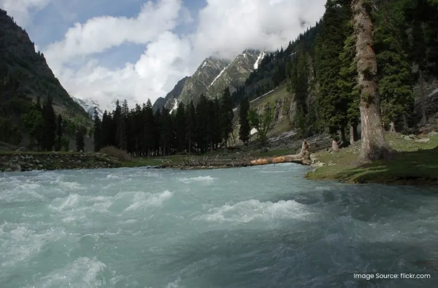
Sonamarg Meadow of Gold & Sindh Rapids 📷 Sonamarg Meadow of Gold & Sindh Rapids
Gateway to Ladakh, glacial streams, and high alpine hiking trails.
  • Location: Gagangeer to Sonamarg, Ganderbal District (Altitude ~2,637 m).
  • Structural Design: 2-lane horseshoe tunnel with parallel dedicated emergency escape tube.
  • Ventilation & Safety: Longitudinal ventilation with jet fans, fire hydrants every 100m, emergency calling booths, and CCTV coverage.
  • Strategic Impact: Converts Sonamarg from a seasonal summer retreat into a premier 365-day winter wonderland and international ski destination.
Official Agency: NHIDCL / APCO Infratech
🟡 PROJECT IN PROGRESS Length: 14.15 km

Zoji La Tunnel (Baltal–Minamarg)

Sonamarg Meadow of Gold & Sindh Rapids 📷 Sonamarg Meadow of Gold & Sindh Rapids
Gateway to Ladakh, glacial streams, and high alpine hiking trails.
  • Location: Baltal (Ganderbal) to Minamarg (Kargil, Ladakh) at 11,578 ft elevation.
  • Engineering Milestone: Single-tube bi-directional horseshoe tunnel; Asia's longest at this altitude. Includes Nilgrar 1 & 2 approach tunnels.
  • Travel Time Reduction: Cuts the perilous 3.5-hour crossing across the Zojila blizzard pass to a safe 15-minute subterranean drive.
  • Military Role: Guarantees uninterrupted year-round heavy armored logistics to Northern Command formations in Ladakh.
Official Agency: NHIDCL / Megha Engineering & Infrastructures Ltd (MEIL)
🔄 URBAN MOBILITY & BYPASSES

Srinagar & Jammu Ring Roads & Metropolitan Corridors
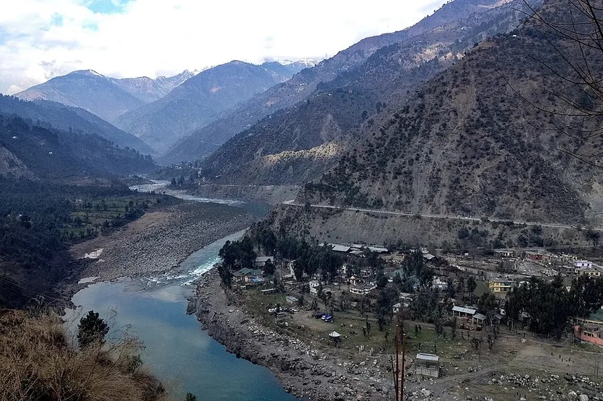
NH-44 Strategic Mountain Highway 📷 NH-44 Strategic Mountain Highway
Vital all-weather corridor connecting Jammu and Srinagar through high tunnels.

Strategic express bypasses designed to divert heavy commercial transit traffic away from urban centers, reducing city congestion and improving freight velocity.

Srinagar Semi-Ring Road (Phase-I & II)

Urban Area
Srinagar Metropolitan Region
Route Alignment
Pampore (NH-44) ➔ Budgam ➔ Narbal ➔ Ganderbal (Wayil)
Length & Scope
60.84 km 4-Lane Express Corridor
De-congestion Purpose
Bypasses central Srinagar, Batamaloo, and Pantha Chowk for traffic heading to North Kashmir (Baramulla, Kupwara, Bandipora) and Ladakh (NH-1).
Status
🟡 Advanced Execution
Official Agency

Jammu Ring Road (NH-244A)

Urban Area
Jammu Metropolitan Region
Route Alignment
Raya Morh (Samba) ➔ Bishnah ➔ Miran Sahib ➔ Marh ➔ Nagrota (NH-44)
Length & Scope
58.25 km 4-Lane Express Bypass
De-congestion Purpose
Directly connects Samba to Nagrota without entering Jammu city, reducing transit time for Katra/Srinagar bound heavy commercial convoys.
Status
🟢 Phase-I Operational / Phase-II Active
Official Agency
✈️ CIVIL AVIATION & HELIPORTS

Airports, Civil Enclaves & Advanced Landing Grounds (ALGs)

Commercial airport terminals, international air cargo facilities, defense enclaves, and regional heliports connecting remote border areas.

Srinagar International Airport (Sheikh ul-Alam)

Location & District
Budgam / Srinagar
IATA Code
SXR
Aviation Role
Commercial International / Indian Air Force (IAF)
Current Connectivity
Daily direct flights to Delhi, Mumbai, Bengaluru, Chandigarh, Jammu, Ahmedabad, Sharjah (seasonal Haj).
Major Expansion & Upgrades
₹1,500 Cr terminal expansion to handle 6.5 million annual passengers; CAT-II ILS for winter fog landing; cold-chain air cargo hub.
Status
🟢 Operational / Expanding
Official Agency

Jammu Civil Airport (Satwari)

Location & District
Satwari, Jammu
IATA Code
IXJ
Aviation Role
Civil Enclave / IAF Base
Current Connectivity
Daily flights to Delhi, Srinagar, Mumbai, Indore, Gwalior, Leh.
Major Expansion & Upgrades
New State-of-the-Art Terminal building at Belicharana (40,000 sq m); runway extension to 8,000 ft completed.
Status
🟢 Operational / New Terminal Active
Official Agency

Kishtwar Airstrip & Heliport

Location & District
Chowgan, Kishtwar
IATA Code
—
Aviation Role
RCS-UDAN / Medical Evacuation
Current Connectivity
Subsidized helicopter sorties to Jammu during winter; emergency disaster flights.
Major Expansion & Upgrades
Full airstrip construction under UDAN-4 for 19-seater small aircraft operations.
Status
🟡 Active Infrastructure Project
Official Agency
AAI / J&K Civil Aviation

Regional Helipads (Katra, Baltal, Pahalgam, Tangdhar, Gurez)

Location & District
Reasi, Ganderbal, Anantnag, Kupwara, Bandipora
IATA Code
—
Aviation Role
Pilgrimage (Yatra) & Border Winter Lifeline
Current Connectivity
Katra–Sanjichhat (Mata Vaishno Devi), Neelgrath/Pahalgam–Panjtarni (Amarnath), Kupwara–Tangdhar.
Major Expansion & Upgrades
Automated online slot booking, twin-engine helicopter safety standards, dedicated night-landing infrastructure.
Status
🟢 Fully Operational
Official Agency
SMVDSB / SASB / J&K Civil Aviation
⚡ CLEAN ENERGY & HYDROPOWER BASIN

Master J&K Hydroelectric Power Projects Directory

Harnessing 20,000+ MW estimated run-of-the-river hydroelectric potential across the Chenab, Jhelum, Ravi, and Indus river basins.

Pakal Dul HEP

River Basin
Marusudar River (Chenab tributary)
District
Kishtwar (Drangdhuran)
Installed Capacity
1,000 MW (4x250 MW)
Developer / Agency
CVPPPL (NHPC + JKSPDC Joint Venture)
Type
Run-of-the-River with Concrete-Face Rockfill Dam
Current Status
🟡 Under Active Construction
Strategic & Economic Role
Flagship mega hydro asset; 3,330 Million Units (MU) annual clean power generation.
Official Source

Ratle HEP

River Basin
Chenab River
District
Kishtwar (Drasbshalla)
Installed Capacity
850 MW (4x205 MW + 30 MW)
Developer / Agency
Ratle Hydroelectric Power Corp (NHPC+JKSPDC)
Type
Run-of-the-River with 133m Gravity Dam
Current Status
🟡 Under Active Construction
Strategic & Economic Role
Revived ₹5,300 Cr investment; provides 3,136 MU annual electricity to Northern Grid.

Kiru HEP

River Basin
Chenab River
District
Kishtwar (Patharnaki)
Installed Capacity
624 MW (4x156 MW)
Developer / Agency
CVPPPL (NHPC + JKSPDC)
Type
Run-of-the-River Dam
Current Status
🟡 Under Active Construction
Strategic & Economic Role
2,272 MU annual generation; located upstream of Kwar HEP.
Official Source

Kwar HEP

River Basin
Chenab River
District
Kishtwar
Installed Capacity
540 MW (4x135 MW)
Developer / Agency
CVPPPL (NHPC + JKSPDC)
Type
Run-of-the-River
Current Status
🟡 Under Active Construction
Strategic & Economic Role
Approved under PMDP package; 1,975 MU annual clean energy output.
Official Source

Baglihar HEP (Stage-I & II)

River Basin
Chenab River
District
Ramban (Chanderkote)
Installed Capacity
900 MW (2 x 450 MW)
Developer / Agency
JKSPDC (State Power Corporation)
Type
Run-of-the-River with 143m Concrete Gravity Dam
Current Status
🟢 Fully Operational
Strategic & Economic Role
Flagship state-owned revenue generator providing base load power to J&K and national grid.
Official Source

Salal Hydroelectric Station

River Basin
Chenab River
District
Reasi (Dhyangarh)
Installed Capacity
690 MW (6x115 MW)
Developer / Agency
NHPC Limited
Type
Concrete Gravity Dam + Rockfill section
Current Status
🟢 Fully Operational
Strategic & Economic Role
Historic mega powerhouse operational since 1987; generates ~3,000 MU annually.
Official Source

Uri-I & Uri-II HEP

River Basin
Jhelum River
District
Baramulla (Uri)
Installed Capacity
720 MW (480 MW + 240 MW)
Developer / Agency
NHPC Limited
Type
Underground Run-of-the-River Power Station
Current Status
🟢 Fully Operational
Strategic & Economic Role
Underground powerhouses utilizing the steep hydraulic drop of River Jhelum near the LoC.
Official Source

Dul Hasti HEP

River Basin
Chenab River
District
Kishtwar
Installed Capacity
390 MW (3x130 MW)
Developer / Agency
NHPC Limited
Type
Underground Run-of-the-River
Current Status
🟢 Fully Operational
Strategic & Economic Role
Features a 10.6 km headrace tunnel driven through difficult Himalayan thrust zones.
Official Source

Sawalkote HEP

River Basin
Chenab River
District
Ramban / Reasi / Udhampur
Installed Capacity
1,856 MW
Developer / Agency
NHPC Limited
Type
Mega Concrete Gravity Dam
Current Status
🔵 Approved / Pre-construction
Strategic & Economic Role
Largest proposed hydro installation in J&K, generating ~7,500 MU annual electricity.
Official Source
⚡ 400 kV REGIONAL TRANSMISSION GRID

Power Transmission, Sub-Stations & Grid Integration

High-voltage electricity evacuation corridors connecting Chenab basin hydro generating plants to the Northern Regional Grid (POWERGRID) and distribution utilities.

J&K Electricity Flow Architecture

1. Generation

Hydro (NHPC, CVPPPL, JKSPDC) + Solar

2. 400 kV / 220 kV Grid

POWERGRID Northern Grid + JKPTCL

3. 132 kV / 33 kV Substations

District Receiving Stations & Gas Insulated Lines

4. 11 kV / LT Distribution

KPDCL (Kashmir) & JPDCL (Jammu) Smart Meters

Jalandhar–Samba–Amargarh 400 kV Corridor

Sterlite Power project crossing the Pir Panjal at 11,000 ft; provides 1,000 MW bulk power transfer capacity into Kashmir Valley during harsh winter peak load demands.

Smart Pre-paid Metering & RDSS

Under the Revamped Distribution Sector Scheme (RDSS), over 10 Lakh smart pre-paid electric meters installed across Srinagar and Jammu cities to curb AT&C distribution losses below 15%.

☀️ GREEN ENERGY TRANSITION

Solarization, PM-KUSUM & Micro-Hydel Energy Ecosystem

Decentralized clean power initiatives supported by the Ministry of New and Renewable Energy (MNRE) and the Jammu and Kashmir Energy Development Agency (JAKEDA).

PM-KUSUM SCHEME

Solar Irrigation Pumps

Kashmiri Saffron Firni & Kahwa 📷 Kashmiri Saffron Firni & Kahwa
Traditional saffron-infused desserts and green tea brewed in copper samovars.

Up to 80% capital subsidy on standalone solar agriculture pumps for apple orchards, saffron fields, and vegetable farms.

Cross-reference HADP Solar Schemes ➔
PM SURYA GHAR

Rooftop Solar Program

Subsidized grid-connected rooftop solar installations (1 kW to 3 kW) with net-metering facilities across residential households in Jammu and Srinagar.

PM Surya Ghar Portal ➔
MINI & MICRO HYDEL

Remote Stream Power

Gurez Valley & Kishanganga River 📷 Gurez Valley & Kishanganga River
Pristine border valley with Dardic Shina culture beneath Habba Khatoon peak.

Community micro-hydel units (100 kW to 2 MW) utilizing glacier fed streams in Gurez, Paddar, Machil, and Marwah to ensure decentralized off-grid power.

Managed by JAKEDA
🏙️ URBAN TRANSFORMATION

Srinagar & Jammu Smart Cities Mission Master Directory

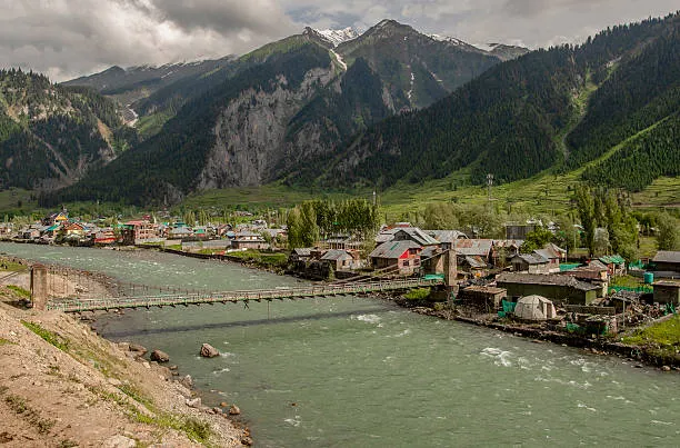
NH-44 Strategic Mountain Highway 📷 NH-44 Strategic Mountain Highway
Vital all-weather corridor connecting Jammu and Srinagar through high tunnels.

Urban renewal, digital traffic management, non-motorized heritage mobility, and sustainable waterfront development under the Smart Cities Mission.

Integrated Command & Control Centre (ICCC)

City / Jurisdiction
Srinagar & Jammu Cities
Infrastructure Type
Digital Governance & Security
Purpose & Scope
Centralized 24x7 nerve center for city surveillance, municipal solid waste tracking, emergency dispatch, and flood sensor analytics.
Key Features
1,000+ AI-powered surveillance cameras, automated red-light violation detection (RLVD), GIS mapping.
Status
🟢 Fully Operational
Official Agency

Green Electric Bus Fleet (E-Buses)

City / Jurisdiction
Srinagar & Jammu Urban Corridors
Infrastructure Type
Clean Public Transit
Purpose & Scope
200 air-conditioned zero-emission electric buses operating across 30+ intra-city and regional routes.
Key Features
GPS tracking on Chalo App, wheelchair ramps, contactless digital ticketing, live arrival displays at smart bus shelters.
Status
🟢 Fully Operational
Official Agency
SSCL / JSCL / Tata Motors

Jhelum & Tawi Riverfront Promenades

City / Jurisdiction
Srinagar (Rajbagh) & Jammu (Guijar Nagar)
Infrastructure Type
Waterfront Ecology & Tourism
Purpose & Scope
Pedestrianized cycling tracks, embankment stabilization, heritage illumination, and recreational riverfront parks.
Key Features
Zero-discharge drainage outfalls, wooden deck gazebos, eco-lighting, integration with water transport.
Status
🟢 Operational
Official Agency

Polo View & Residency Road Pedestrianization

City / Jurisdiction
Lal Chowk, Srinagar
Infrastructure Type
Urban Heritage Precincts
Purpose & Scope
Redevelopment of Polo View into J&K's first completely non-motorized, high-street shopping arcade.
Key Features
Underground utility cabling, Devri stone flooring, chinars preservation, waste segregation kiosks.
Status
🟢 Fully Operational
Official Agency
Srinagar Smart City Limited
💧 WATER GRIDS & FLOOD MITIGATION

Water Supply (Jal Jeevan Mission), Sewerage & River Flood Defense
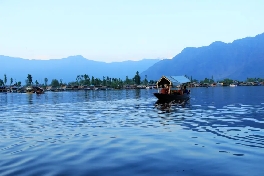
Dal Lake & Traditional Shikaras 📷 Dal Lake & Traditional Shikaras
Iconic freshwater lake surrounded by Zabarwan mountains, houseboats, and floating gardens.

Safe potable tap water supply to rural and urban households, Dal Lake STPs, and long-term comprehensive flood mitigation across River Jhelum.

Jal Jeevan Mission (JJM)

3,200+ rural water supply schemes providing Functional Household Tap Connections (FHTC) to 18+ Lakh rural households, achieving 75%+ UT coverage.

Jal Shakti Department J&K

Jhelum Flood Spill Dredging

Phase-II comprehensive flood management (₹1,623 Cr PMDP); expanded discharge capacity of Jhelum and Flood Spill Channel from 31,000 cusecs to 60,000+ cusecs.

View Flood Gauges ➔

Dal Lake & Urban STPs

Modern Sewage Treatment Plants (STPs) at Brari Nambal, Hazratbal, Habak, and Laam preventing untreated effluent discharge into Dal and Nigeen lakes.

LCMA Srinagar
🛡️ DEFENCE LOGISTICS & BRO PROJECTS

Border Roads Organisation (BRO) Strategic Corridors & Mountain Defense Lifelines

Pangong Tso & Ladakh High Lakes 📷 Pangong Tso & Ladakh High Lakes
Deep turquoise alpine lake at 14,270 ft in the cold desert plateau.

Border connectivity maintained by Project Beacon (Kashmir & Ladakh) and Project Sampark (Jammu) supporting forward troops and high-altitude border habitations.

Project Beacon (Kashmir Frontier & Zojila)

Headquartered in Srinagar. Manages winter snow clearance operations on NH-1 (Zojila Pass), Bandipora-Gurez (Razdan Pass), and Kupwara-Tangdhar (Sadhna Pass) using modern snow-blowers and avalanche warning monitoring updates.

BRO Headquarters New Delhi / Beacon

Project Sampark (Jammu & Pir Panjal Frontier)

Headquartered in Jammu. Engineered the Basohli Atal Setu bridge, Akhnoor-Poonch National Highway (NH-144A), and strategic road networks along the International Border (IB) and Line of Control (LoC).

BRO Headquarters New Delhi / Sampark
🗺️ 20-DISTRICT GEOSPATIAL MATRIX

Master 20-District Infrastructure, Connectivity & Energy Matrix

NH-44 Strategic Mountain Highway 📷 NH-44 Strategic Mountain Highway
Vital all-weather corridor connecting Jammu and Srinagar through high tunnels.

Complete district-level mapping of highways, railway stations, tunnels, airports, hydro powerhouses, and smart city assets across all 20 districts of J&K.

Srinagar (Kashmir)

Major Highways
NH-44, NH-1, Srinagar Ring Road
Railway Stations
Nowgam (Srinagar Main Station)
Major Tunnels & Bridges
Zero Bridge, Abdullah Bridge, TRC Flyovers
Aviation & Helipads
Srinagar International Airport (SXR)
Major Power Projects
220 kV Zainakote Substation, Gas Turbine Pampore
Strategic & Smart Projects
Srinagar Smart City (ICCC, E-Buses, Jhelum Riverfront, Polo View)
Geography Link

Ganderbal (Kashmir)

Major Highways
NH-1 (Srinagar–Leh Highway)
Railway Stations
— (Connected via Srinagar Nowgam)
Major Tunnels & Bridges
Z-Morh Tunnel (6.5 km), Zoji La Tunnel (14.15 km), Wayil Bridge
Aviation & Helipads
Baltal / Neelgrath Yatra Helipads
Major Power Projects
Upper Sindh Hydroelectric Project Stage-II (105 MW)
Strategic & Smart Projects
All-weather gateway to Ladakh; Baltal Amarnath base camp
Geography Link

Budgam (Kashmir)

Major Highways
Srinagar Semi-Ring Road, Airport Road
Railway Stations
Budgam Railway Junction, Mazhom Station
Major Tunnels & Bridges
Srinagar Ring Road Flyovers
Aviation & Helipads
Hosts Srinagar Airport Terminal (SXR / IAF Base)
Major Power Projects
132 kV Budgam Grid Substation
Strategic & Smart Projects
Rangreth Electronic & IT Park, Central Railway Maintenance Depot
Geography Link

Anantnag (Kashmir)

Major Highways
NH-44, NH-244 (Sinthan Top Road), NH-501
Railway Stations
Anantnag, Bijbehara, Sadura Stations
Major Tunnels & Bridges
Sangam Bridges, Sinthan Pass (3,748 m)
Aviation & Helipads
Pahalgam Helipad (Amarnath Yatra)
Major Power Projects
132 kV Mattan & Wanpoh Grid Stations
Strategic & Smart Projects
Pahalgam Tourism Hub, South Kashmir Logistics & GMC Dialgam
Geography Link

Pulwama (Kashmir)

Major Highways
NH-44 Expressway, Awantipora bypass
Railway Stations
Awantipora, Kakapora, Pampore Stations
Major Tunnels & Bridges
Jhelum Railway Bridges, Padgampora Viaduct
Aviation & Helipads
Awantipora IAF Air Base & Helipad
Major Power Projects
Pampore 132 kV Grid, Gas Turbine Plant
Strategic & Smart Projects
AIIMS Kashmir (Awantipora), India International Saffron Park (Dussu)
Geography Link

Kulgam (Kashmir)

Major Highways
NH-44 (Qazigund stretch), Kulgam-Shopian Road
Railway Stations
Qazigund Railway Station
Major Tunnels & Bridges
Navyug Tunnel Northern Portal, Pir Panjal Rail Tunnel Portal
Aviation & Helipads
— (Served via Srinagar Airport)
Major Power Projects
132 kV Kulgam Grid Substation
Strategic & Smart Projects
Gateway to Kashmir Valley; Aharbal Eco-tourism Corridor
Geography Link

Shopian (Kashmir)

Major Highways
Mughal Road, Shopian–Pulwama Highway
Railway Stations
— (Connected via Kakapora / Anantnag)
Major Tunnels & Bridges
Rambiara Bridges, Pir Ki Gali Pass (3,485 m)
Aviation & Helipads
District Administrative Helipad
Major Power Projects
132 kV Shopian Grid Substation
Strategic & Smart Projects
Largest Apple CA Cold Storage Logistics Hub in North India (Lassipora)
Geography Link

Baramulla (Kashmir)

Major Highways
NH-701A (Srinagar–Baramulla–Uri–LoC)
Railway Stations
Baramulla Terminus, Sopore, Pattan Stations
Major Tunnels & Bridges
Uri Jhelum Bridges, Gulmarg Gondola Phase 1 & 2
Aviation & Helipads
Gulmarg Helipad & Army ALGs
Major Power Projects
Uri-I (480 MW) & Uri-II (240 MW) HEP, Lower Jhelum (105 MW)
Strategic & Smart Projects
Gulmarg International Ski Hub, Cross-LoC Trade Infrastructure (Kaman Post)
Geography Link

Bandipora (Kashmir)

Major Highways
Srinagar–Bandipora–Gurez Border Road
Railway Stations
— (Connected via Sopore / Baramulla)
Major Tunnels & Bridges
Razdan Pass (3,556 m), Wular Navigation Lock
Aviation & Helipads
Dawar (Gurez) Helipad (Winter Lifeline)
Major Power Projects
Kishanganga Hydroelectric Project (330 MW)
Strategic & Smart Projects
Wular Lake Conservation Eco-Corridor & Gurez Eco-Tourism
Geography Link

Kupwara (Kashmir)

Major Highways
NH-701 (Kupwara–Handwara–Baramulla)
Railway Stations
— (Proposed Baramulla–Kupwara rail extension)
Major Tunnels & Bridges
Sadhna Pass (3,130 m), Z-Gali (Machil Pass)
Aviation & Helipads
Tangdhar & Machil Helipads, Zangli ALG
Major Power Projects
132 kV Kupwara Grid Station, Mini-hydel streams
Strategic & Smart Projects
Bangus Valley Eco-Tourism, GMC Handwara, Teetwal Border Crossing
Geography Link

Jammu (Jammu)

Major Highways
NH-44, NH-144A (Poonch), Jammu Ring Road (NH-244A)
Railway Stations
Jammu Tawi Railway Station (Main Northern Terminal)
Major Tunnels & Bridges
Bikram Chowk Flyover, 4th Tawi Bridge, Akhnoor Flyover
Aviation & Helipads
Jammu Civil Airport (IXJ / Satwari)
Major Power Projects
400 kV Gladni & Samba Grid Substation, JPDCL HQ
Strategic & Smart Projects
Jammu Smart City (Tawi Riverfront, ICCC, E-Buses), IIT & IIM Jammu (Jagti)
Geography Link

Samba (Jammu)

Major Highways
NH-44 (6-Lane Delhi-Amritsar-Katra Expressway corridor)
Railway Stations
Samba & Vijaypur Railway Stations
Major Tunnels & Bridges
Basantar River Bridges & Ring Road Interchange
Aviation & Helipads
— (Served via Jammu IXJ Airport)
Major Power Projects
400/220 kV Samba POWERGRID Substation
Strategic & Smart Projects
AIIMS Jammu (Vijaypur), Bari Brahmana Industrial Estate, Central Univ Jammu
Geography Link

Kathua (Jammu)

Major Highways
NH-44 Gateway corridor, Dunera–Basohli Road
Railway Stations
Kathua, Budhi, Hiranagar Stations
Major Tunnels & Bridges
Atal Setu Basohli Cable Bridge (592 m), Ravi River Bridges
Aviation & Helipads
Industrial Helipads & Army ALGs
Major Power Projects
Sewa-II Hydroelectric Project (120 MW), Ujh Multipurpose Dam (Proposed)
Strategic & Smart Projects
Gateway Industrial Hub (SICOP), GMC Kathua, North India's 1st Biotech Park
Geography Link

Udhampur (Jammu)

Major Highways
NH-44, Dhar Road (NH-501)
Railway Stations
Shaheed Captain Tushar Mahajan Railway Station (UHP)
Major Tunnels & Bridges
Dr. Syama Prasad Mookerjee Tunnel (9.28 km Portal), Tawi Viaducts
Aviation & Helipads
Udhampur IAF Airfield & Northern Command Helipads
Major Power Projects
132 kV Udhampur Grid Station
Strategic & Smart Projects
HQ Northern Command Indian Army, GMC Udhampur, Devika Rejuvenation Project
Geography Link

Reasi (Jammu)

Major Highways
Katra–Reasi–Pouni–Shiv Khori Highway
Railway Stations
Shri Mata Vaishno Devi Katra (SVDK), Reasi Station, Bakkal Station
Major Tunnels & Bridges
World's Highest Chenab Rail Bridge (359m), Anji Khad Cable Bridge (193m)
Aviation & Helipads
Katra Commercial Helipad & Sanjichhat Helipad
Major Power Projects
Salal Hydroelectric Project (690 MW NHPC)
Strategic & Smart Projects
Shri Mata Vaishno Devi Shrine (1 Cr+ pilgrims), SMVDU Katra, Lithium Reserves (Salal)
Geography Link

Rajouri (Jammu)

Major Highways
NH-144A (Jammu–Poonch Corridor), Mughal Road link
Railway Stations
— (Proposed Jammu–Rajouri–Poonch railway line)
Major Tunnels & Bridges
Sungal Tunnel, Nowshera Bridges
Aviation & Helipads
Rajouri Military Advanced Landing Ground (ALG) & Helipad
Major Power Projects
132 kV Rajouri Grid Station, Kalakote Thermal Power Plant (Historic)
Strategic & Smart Projects
GMC Rajouri (Mehra), BGSB University, Strategic LoC Border Infrastructure
Geography Link

Poonch (Jammu)

Major Highways
NH-144A, Mughal Road (Bafliaz–Pir Ki Gali)
Railway Stations
— (Connected by road to Jammu/Shopian)
Major Tunnels & Bridges
Suran River Bridges, Pir Ki Gali Pass (3,485 m)
Aviation & Helipads
Poonch Military Advanced Landing Ground (ALG)
Major Power Projects
Parnai Hydroelectric Project (37.5 MW)
Strategic & Smart Projects
Chakan-da-Bagh Cross-LoC Point, Shri Buddha Amarnath Shrine Mandi
Geography Link

Doda (Jammu)

Major Highways
NH-244 (Batote–Doda–Kishtwar), Bhaderwah–Chamba Road
Railway Stations
— (Connected via Udhampur / Banihal)
Major Tunnels & Bridges
Ganpat Bridge (High-level Chenab span), Khelani Tunnel (NH-244)
Aviation & Helipads
Bhaderwah & Doda Town Helipads
Major Power Projects
132 kV Khellani Substation, Baglihar reservoir catchment
Strategic & Smart Projects
GMC Doda (Ghat), Bhaderwah Eco-Tourism, Lavender Aroma Mission Capital
Geography Link

Ramban (Jammu)

Major Highways
NH-44 National Expressway
Railway Stations
Banihal, Khari, Sumber, Sangaldan Stations
Major Tunnels & Bridges
Navyug Tunnel (8.45 km), Tunnel T-49 (12.75 km), Panthyal T5, Chanderkote Viaducts
Aviation & Helipads
Ramban & Gool Helipads
Major Power Projects
Baglihar Hydroelectric Project (900 MW Stage-I & II)
Strategic & Smart Projects
Critical USBRL Railway Engineering Hub & National Highway Mountain Transit
Geography Link

Kishtwar (Jammu)

Major Highways
NH-244, Gulabgarh–Paddar–Pangi Road
Railway Stations
— (Connected via NH-244 corridor)
Major Tunnels & Bridges
Sinthan Pass (3,748 m), Marusudar River Bridges
Aviation & Helipads
Kishtwar Chowgan Airstrip (UDAN) & Gulabgarh Helipad
Major Power Projects
Pakal Dul (1000 MW), Ratle (850 MW), Kiru (624 MW), Kwar (540 MW), Dul Hasti (390 MW)
Strategic & Smart Projects
"Power Hub of North India" (3,500+ MW cluster), Machail Mata Yatra, Sapphire Mines
Geography Link
📈 MULTIPLIER EFFECT

Infrastructure Impact Matrix: Economy, Agriculture, Tourism & Logistics
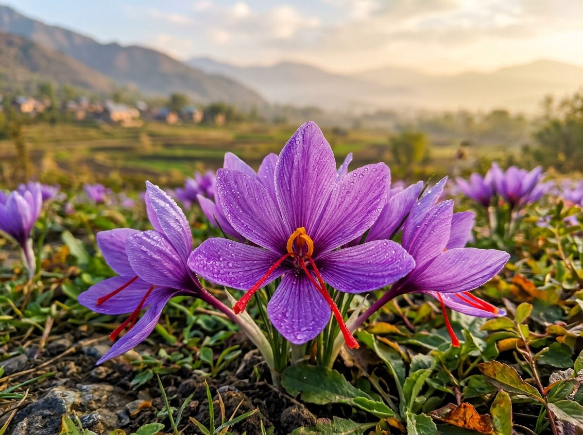
Horticulture & Agricultural Wealth 📷 Horticulture & Agricultural Wealth
High-density apple orchards, saffron, walnuts, and HADP agrarian schemes.

How national connectivity investments trigger downstream growth across Jammu & Kashmir's horticulture value chain, industrial estates, and tourist destinations.

Horticulture & Cold-Chain Express Transit

Four-laning of NH-44 and the upcoming USBRL freight rail link reduce transit time for 20+ Lakh Metric Tonnes of fresh Kashmiri apples from 72 hours to under 24 hours to Azadpur Mandi (Delhi), cutting post-harvest losses from 18% down to <4%.

Explore HADP Horticulture Hub ➔

365-Day All-Weather Tourism Circuits

The Z-Morh Tunnel transforms Sonamarg into an international year-round ski resort, while the Chenab Rail Bridge creates an iconic global engineering attraction in Reasi, distributing pilgrim traffic from Katra into Bhaderwah, Shiv Khori, and Patnitop.

Explore Travel & Heritage Directory ➔

Eco-Vulnerability Investigation

Jammu division Focus: Post-2019 Infrastructure Speed vs. Land Sinking

Since the reorganization of J&K in 2019, infrastructure project implementation has accelerated rapidly. However, the fragile young fold mountains of the Chenab Valley (Ramban, Doda, Kishtwar) are showing signs of severe geological fatigue, leading to unprecedented land subsidence (sinking) and landslide hazards.
Question 1 of 3

Loading question...

🏛️ Official Data Sources & Fact-Checking Transparency
Public Domain & Statutory Archives

All historical, demographic, examination, and geographic records across this portal are compiled from public domain repositories, including the Official Gazette of India (egazette.nic.in), Census of India Demographic Data, India Meteorological Department (IMD), and statutory notifications issued by the J&K Administration & Examination Boards.

🛡️ Editorial Policy: Academic Non-Affiliation Guidelines 📬 Grievance & Corrections: Editorial Review Desk ⚖️ License: Open Public Research (CC-BY-NC 4.0)

Explore Related Jammu & Kashmir Knowledge Clusters

Cross-Topic Navigation
📜 5,000-Year History & Dogra Dynasty 🗺️ 20 Districts & Geospatial River Maps 🎓 JKSSB & JKPSC Exam Preparation Hub 🏔️ Gulmarg Gondola & Alpine Treks 🛕 Mata Vaishno Devi & Pilgrimage Guide 🍲 36-Course Kashmiri Wazwan Atlas 🧶 GI Crafts, Pashmina & Artisans 🚗 Live NH-44 Highway & Weather Radar 💼 HADP Agriculture, Saffron & Economy 🏛️ GAD Official Directory & Helplines 📜 UT Welfare Schemes & Jan Sugam 📊 20-District Demographics & Census 📑 Master Topic Index & Directory

🏔️ Explore the J&K Geography & Environment Knowledge Cluster

High Himalayan Mountain Passes 📷 High Himalayan Mountain Passes
Strategic alpine passes offering connectivity across scenic mountain ranges.
🗺️ 20 Districts Geography Atlas
Pir Panjal, Zaskar, river basins, mountain passes & altitude
📊 Demographics & Census Data
Population distribution, literacy rates, and district metrics
🌦️ Weather & Climate Zones
20-district forecasts, snowfall monitoring, and seasonal alerts
🌾 Agriculture & HADP Subsidies
Saffron, high-density apple orchards, and irrigation systems
🚨 Disaster & River Flood Gauges
Jhelum, Chenab & Tawi flood wave levels and emergency control
🌲 Ecology & Wildlife Conservation
Protected national parks, wetlands, and biodiversity hotspots