โœ๏ธ By J&K Administrative Archive Editorial Desk | ๐Ÿ“… Last reviewed: 01 September 2026
๐Ÿ”๏ธ ADVENTURE SPORTS & ALPINE DIRECTORY

Jammu & Kashmir Alpine Trekking, Powder Skiing & Adventure Sports

Comprehensive authority guide to High-Altitude Alpine Treks (Kashmir Great Lakes, Tarsar Marsar, Seven Lakes of Rajouri), Gulmarg Mt. Apharwat Powder Skiing, White-Water River Rafting (Lidder & Chenab), Paragliding (Sanasar & Astanmarg), Trout Angling, and Alpine Safety.

๐Ÿฅพ Master Trekking Table โ›ท๏ธ Gulmarg Skiing & Gondola ๐Ÿšฃ Rafting, Paragliding & Angling ๐Ÿ›ก๏ธ Alpine Safety & AMS
๐Ÿฅพ HIGH-ALTITUDE TRAILS MATRIX Difficulty Tags: BEGINNER INTERMEDIATE ADVANCED EXPERT

Master Alpine Trekking Directory of Jammu & Kashmir
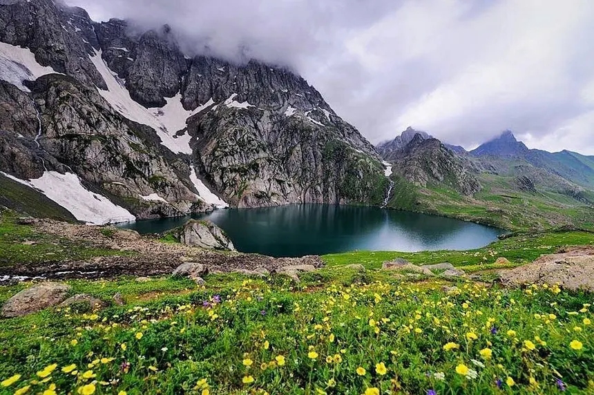
Kashmir Great Lakes (Gangabal & Harmukh) ๐Ÿ“ท Kashmir Great Lakes (Gangabal & Harmukh)
Pristine cirque glacial lakes surrounded by wildflowers and snow peaks.

Official reference matrix detailing start points, maximum pass elevations, standard itinerary durations, difficulty ratings, key alpine tarns, seasonal windows, and permit regulations:

Kashmir Great Lakes (KGL)

District
Ganderbal
Trailhead / Start Point
Shitkadi (Sonamarg)
Approx Highest Elevation
13,750 ft (4,191 m) at Gadsar Pass
Duration & Distance
7 Days / ~75 km
Difficulty Rating
ADVANCED
Major Lakes / Pass / Meadow
Vishansar, Krishansar, Gadsar, Satsar, Gangabal, Nundkol, Mt. Harmukh view
Best Season
July to September
Permit & Guide Considerations
Army ID registration & certified local guide mandatory
Major Hazards
Rapid weather shifts, steep boulder descents, AMS risk

Tarsar Marsar Trek

District
Anantnag
Trailhead / Start Point
Aru Valley (Pahalgam)
Approx Highest Elevation
13,200 ft (4,023 m) at Tarsar Pass
Duration & Distance
6 Days / ~47 km
Difficulty Rating
INTERMEDIATE
Major Lakes / Pass / Meadow
Tarsar Lake, Marsar Lake, Sundersar Lake, Lidderwat Meadow
Best Season
July to September
Permit & Guide Considerations
Wildlife Dept permit at Aru checkpost
Major Hazards
Unpredictable alpine rain, river crossings

Kolahoi Glacier Trek

District
Anantnag
Trailhead / Start Point
Aru Valley (Pahalgam)
Approx Highest Elevation
12,600 ft (3,840 m) at Glacier Base
Duration & Distance
4 Days / ~35 km
Difficulty Rating
INTERMEDIATE
Major Lakes / Pass / Meadow
Lidderwat, Satlanjan, Kolahoi Hanging Glacier, Mt. Kolahoi pyramid
Best Season
June to October
Permit & Guide Considerations
Pahalgam Development Authority clearance
Major Hazards
Glacier snout crevasses, rockfall zones

Gangabal & Naranag Lake Trek

District
Ganderbal
Trailhead / Start Point
Naranag Ancient Temple
Approx Highest Elevation
11,800 ft (3,596 m) at Gangabal
Duration & Distance
3โ€“4 Days / ~32 km
Difficulty Rating
INTERMEDIATE
Major Lakes / Pass / Meadow
Gangabal Twin Lakes, Nundkol, Mt. Harmukh (16,870 ft) backdrop
Best Season
June to October
Permit & Guide Considerations
Forest checkpost registration at Naranag
Major Hazards
Steep Butsherri forest ascent (3,000 ft in 4 km)

Tulian Lake High Tarn Trek

District
Anantnag
Trailhead / Start Point
Pahalgam / Baisaran
Approx Highest Elevation
12,000 ft (3,658 m) at Tulian
Duration & Distance
2 Days / ~16 km
Difficulty Rating
INTERMEDIATE
Major Lakes / Pass / Meadow
Tulian Frozen Lake, Baisaran Pine Bowl, Zanskar-Pir Panjal divide
Best Season
June to October
Permit & Guide Considerations
Local certified guide recommended
Major Hazards
Steep scree slope, icy patches in early summer

Seven Lakes of Rajouri (Nandan Sar)

District
Rajouri & Poonch
Trailhead / Start Point
Peer Ki Gali / Bafliaz
Approx Highest Elevation
13,200 ft (4,023 m) at Nandan Sar
Duration & Distance
5โ€“6 Days / ~45 km
Difficulty Rating
ADVANCED
Major Lakes / Pass / Meadow
Nandan Sar, Chandan Sar, Katori Sar, Neel Sar, Bhag Sar, Akash Sar
Best Season
July to September
Permit & Guide Considerations
District Police registration at Bafliaz/Shopian
Major Hazards
Total isolation, lack of designated huts, cold winds

Kailash Kund & Padri Pass Trek

District
Doda
Trailhead / Start Point
Bhaderwah / Padri Meadow
Approx Highest Elevation
13,000 ft (3,962 m) at Kund Lake
Duration & Distance
3 Days / ~28 km
Difficulty Rating
INTERMEDIATE
Major Lakes / Pass / Meadow
Sacred Kailash Kund Tarn, Padri Pass (9,900 ft), Jai Nallah
Best Season
July to September
Permit & Guide Considerations
Local guide advised for holy tarn track
Major Hazards
Sudden high-ridge fog, steep rocky ridge ascent

Marwahโ€“Wadwanโ€“Warwan Expedition

District
Kishtwar
Trailhead / Start Point
Inshan (Warwan) or Panikhar
Approx Highest Elevation
14,500 ft (4,420 m) at Bhot Khol Pass
Duration & Distance
8โ€“9 Days / ~85 km
Difficulty Rating
EXPERT
Major Lakes / Pass / Meadow
Lomvilas Glacier, Marusudar River valley, Brahma Peaks, Inshan
Best Season
July to August
Permit & Guide Considerations
District Magistrate Kishtwar approval + satellite GPS
Major Hazards
Glacier crossing, unbridged torrents, extreme remoteness

Tosamaidan Alpine Greater Lakes

District
Budgam
Trailhead / Start Point
Sita Haran / Tosamaidan Base
Approx Highest Elevation
13,000 ft (3,962 m) at Gada Sar
Duration & Distance
5 Days / ~40 km
Difficulty Rating
ADVANCED
Major Lakes / Pass / Meadow
Tosamaidan Pasture (10,500 ft), Gada Sar, Damam Sar, Pehjan Meadow
Best Season
June to September
Permit & Guide Considerations
Forest checkpost clearance at Sitharan
Major Hazards
Vast open terrain requiring experienced mountain navigation
โ›ท๏ธ WORLD-CLASS POWDER SNOW

Gulmarg Ski Resort, Gondola Phases & Winter Sports
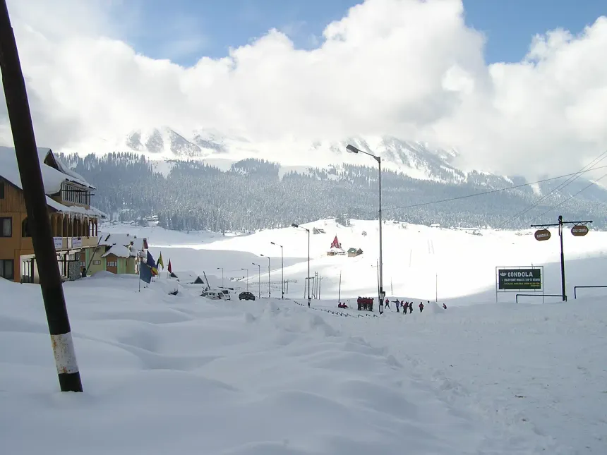
Gulmarg Mount Apharwat & Gondola ๐Ÿ“ท Gulmarg Mount Apharwat & Gondola
Asiaโ€™s premier ski resort with powder snow slopes and high cable car at 13,780 ft.

Gulmarg (Baramulla District) is universally recognized for light, dry powder snow comparable to the Swiss Alps and Canadian Rockies, operating under the Indian Institute of Skiing and Mountaineering (IISM) and Jammu & Kashmir Cable Car Corporation (JKCCC):

Gulmarg Gondola Two-Stage Cable Car

  • ๐Ÿš  Phase 1 (Gulmarg Base to Kongdoori): 8,530 ft to 10,050 ft. Beginner ski slopes, restaurants, snow scooters.
  • ๐Ÿš  Phase 2 (Kongdoori to Mt. Apharwat Ridge): 10,050 ft to 13,780 ft. Expert off-piste powder bowls, Alpather Lake access.
  • ๐Ÿช‘ Mary Shoulder Chairlift: Kongdoori to Mary Shoulder for intermediate snowboarders and skiers.
  • ๐ŸŽซ Mandatory online booking exclusively at gulmarggondola.com.

Khelo India Winter Games & Backcountry

Hosts the prestigious annual Khelo India Winter Games featuring Alpine Skiing, Nordic Skiing, Snowboarding, Snowshoeing, and Ski Mountaineering. Backcountry heli-skiing operates across Apharwatโ€™s wild southern bowls.

โ„๏ธ Season: Late December to March (Peak powder in January & February).
๐Ÿšฃ OUTDOOR SPORTS PORTFOLIO

Rafting, Paragliding, Angling, Mountaineering & Cycling

Structured activity profiles with operational hubs, safety guidelines, and permit regulations:

White-Water River Rafting & Kayaking

Difficulty: Grade II to Grade IV โ€ข April to September

โ€ข Lidder River (Pahalgam): 2.5 km joy ride (Grade II) to 8 km extreme stretch from Langanbal to Rafting Point (Grade IIIโ€“IV).
โ€ข Chenab River (Reasi / Baradari): High-volume turbulent rapids below Salal Dam.
โ€ข Sindh River (Sonamarg / Ganderbal): Glacial-fed rapids through Kangan gorge.

Tandem Paragliding & Aero-Sports

Difficulty: Beginner (Tandem with Pilot) โ€ข May to October

โ€ข Sanasar (Ramban / Udhampur): High-altitude takeoff over cup meadows.
โ€ข Astanmarg (Harwan / Srinagar): High takeoff from Zabarwan ridge landing near Dal Lake.
โ€ข Nathatop Ridge (Patnitop): Scenic flight facing Shivalik mountains.

Cold-Water Sport Trout Fishing

Difficulty: Intermediate โ€ข April to October

โ€ข Rivers: Lidder (Pahalgam), Bringi (Kokernag), Sindh (Ganderbal), Madhumati (Bandipora), Kishanganga (Gurez).
โ€ข Species: Rainbow Trout (Oncorhynchus mykiss) & Brown Trout (Salmo trutta).
โ€ข Mandatory license issued by J&K Fisheries Department (strict fly-fishing only rules).

High Peak Mountaineering & Rock Climbing

Difficulty: Advanced to Expert โ€ข June to September

โ€ข Mt. Kolahoi (17,799 ft / 5,425 m): The "Matterhorn of Kashmir." Technical rock & ice pyramid.
โ€ข Mt. Harmukh (16,870 ft / 5,142 m): Monolithic north face dominating Gangabal.
โ€ข Brahma Peaks & Sickle Moon (Kishtwar): Formidable big-wall technical granite spires.

๐Ÿ›ก๏ธ EXPEDITION PROTOCOLS

High-Altitude Safety, AMS Protocols & Environmental Responsibility
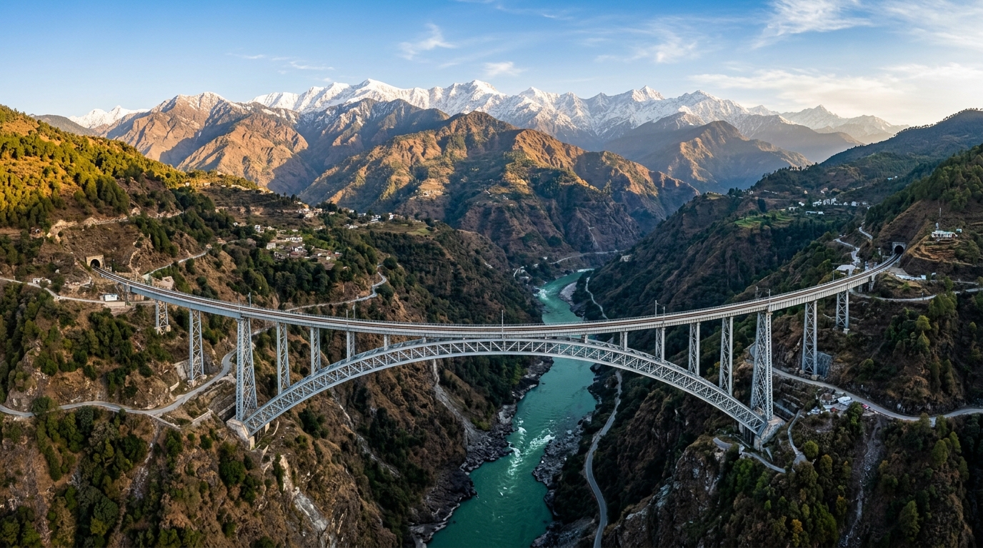
Weather & Hydrological Monitoring ๐Ÿ“ท Weather & Hydrological Monitoring
Real-time IMD updates and river gauge tracking across Jhelum and Chenab basins.

High Himalayan terrain demands rigorous preparation, specialized equipment, and zero-compromise environmental stewardship:

Acute Mountain Sickness (AMS) Management

Ascend no more than 1,000โ€“1,500 ft sleeping elevation per day above 9,000 ft. Watch for early AMS symptoms: headache, nausea, fatigue, and insomnia. If symptoms progress to ataxia (loss of coordination) or persistent cough (HAPE/HACE warning), descend immediately by at least 2,000 ft.

Certified Mountain Guides & Navigation

Never trek solo across unmarked trans-Himalayan passes (Gadsar, Tarsar, Bhot Khol). Engage certified guides registered with the J&K Tourism Department or Indian Mountaineering Foundation (IMF). Carry topographic topo maps, GPS navigation devices, and satellite emergency communicators.

Leave-No-Trace Alpine Code

Pristine glacial lakes (Gangabal, Vishansar, Nandan Sar) are drinking water sources for downstream millions. Camp at least 200 feet away from water bodies. Pack out all non-biodegradable trash, instant noodle wrappers, gas canisters, and batteries. Strictly avoid open campfires in sub-alpine forests.

๐Ÿ›๏ธ Official Data Sources & Fact-Checking Transparency
Public Domain & Statutory Archives

All historical, demographic, examination, and geographic records across this portal are compiled from public domain repositories, including the Official Gazette of India (egazette.nic.in), Census of India Demographic Data, India Meteorological Department (IMD), and statutory notifications issued by the J&K Administration & Examination Boards.

๐Ÿ›ก๏ธ Editorial Policy: Academic Non-Affiliation Guidelines ๐Ÿ“ฌ Grievance & Corrections: Editorial Review Desk โš–๏ธ License: Open Public Research (CC-BY-NC 4.0)

Explore Related Jammu & Kashmir Knowledge Clusters

Cross-Topic Navigation
๐Ÿ“œ 5,000-Year History & Dogra Dynasty ๐Ÿ—บ๏ธ 20 Districts & Geospatial River Maps ๐ŸŽ“ JKSSB & JKPSC Exam Preparation Hub ๐Ÿ›• Mata Vaishno Devi & Pilgrimage Guide ๐Ÿฒ 36-Course Kashmiri Wazwan Atlas ๐Ÿงถ GI Crafts, Pashmina & Artisans ๐Ÿš— Live NH-44 Highway & Weather Radar ๐Ÿ’ผ HADP Agriculture, Saffron & Economy ๐Ÿ›๏ธ GAD Official Directory & Helplines ๐Ÿ“œ UT Welfare Schemes & Jan Sugam ๐Ÿ“Š 20-District Demographics & Census ๐Ÿ“‘ Master Topic Index & Directory
โšก Interactive Planning Tool

Kashmir Trip & Cab Fare Budget Estimator (2026 Rates)

Gulmarg Mount Apharwat & Gondola ๐Ÿ“ท Gulmarg Mount Apharwat & Gondola
Asiaโ€™s premier ski resort with powder snow slopes and high cable car at 13,780 ft.

Calculate your complete transportation, Gondola, Shikara, and stay cost across Srinagar, Gulmarg, Pahalgam & Sonamarg.

Estimated Total Trip Budget
โ‚น32,400
Includes Dedicated Cab (Innova/Etios), Hotels, Gondola & Shikara