Survey Benchmark · 2026 Gazetteer Survey of India & J&K Remote Sensing Baseline

What is the Geographic Area, Population, and Division of Jammu & Kashmir?

The Union Territory of Jammu & Kashmir covers an administrative area of 42,241 square kilometers across 20 districts. It is divided into Jammu Division (10 districts, 26,293 sq km) and Kashmir Division (10 districts, 15,948 sq km). According to the Census of India 2011, the population of Jammu & Kashmir UT (20 districts) was exactly 12,267,013 (or 12,541,302 including Ladakh's Leh and Kargil districts), with 2026 projected population at approximately 13.6 million.

Total Geographical Area 42,241 km² (UT Administration Official Cadastre)
Total Districts 20 Districts (10 Jammu Division + 10 Kashmir Division)
Summer Capital Srinagar (May to October · 1,585 m)
Winter Capital Jammu (November to April · 327 m)
Major Rivers Jhelum (Vyath), Chenab (Chandrabhaga), Tawi, Ravi, and Indus tributaries
Survey Record · Physical Atlas & 20-District Gazetteer Western Himalayas & Pir Panjal Arc

Land of the Three Ranges: Physical Geography & 20-District Gazetteer of Jammu & Kashmir

✍️ J&K Portal Gazetteers & Cartography Desk 📅 Baseline: [2026 Edition] ⏱️ 47 min comprehensive dossier (~10,550 words across 20 districts)

The Union Territory of Jammu & Kashmir covers an administrative area of 42,241 square kilometers across 20 districts. Drained by the colossal Jhelum (Vitasta), Chenab (Chandrabhaga), Indus (Sindhu), Tawi (Surya Putri), and Ravi river networks, the territory bridges the subtropical plains of the Shivaliks to the glaciated peaks of the Pir Panjal and Great Himalayan ranges.

20 Districts (10 Jammu + 10 Kashmir) 42,241 km² Cadastral Area 3 Ranges: Pir Panjal · Great Himalayas · Zanskar 2 Drainage Basins: Vitasta & Chandrabhaga 118+ Cartographic Features
20 Districts Jump: Srinagar Ganderbal Budgam Anantnag Pulwama Shopian Kulgam Baramulla Bandipora Kupwara Jammu Samba Kathua Udhampur Reasi Ramban Doda Kishtwar Rajouri Poonch
GLOBAL GEOSPATIAL LOCATION

Where is Jammu & Kashmir? Location, Boundaries & Coordinates

Western Himalayas

Jammu & Kashmir is a Union Territory in northern India, situated in the western Himalayan and Pir Panjal mountain ranges. It occupies a pivotal geopolitical position in South Asia, linking the Indian plains with the high alpine valleys of Central and Inner Asia.

🌐 Global Coordinates
• Latitude: 32°17′ N to 37°05′ N
• Longitude: 72°31′ E to 80°20′ E
• Total Area: 42,241 km²
🗺️ Regional Boundaries
• South: Himachal Pradesh & Punjab
• North & East: Ladakh Union Territory
• West & Northwest: Pakistan & PoJK (across LoC)
🏔️ Topographic Divisions
• Jammu: Shivalik foothills, Chenab basin & plains
• Kashmir: Oval lacustrine valley & Jhelum basin
• Mountain Walls: Pir Panjal & Great Himalayas

The 5 Major Physiographic Zones of J&K

From the southwest subtropical plains to the trans-Himalayan glaciated heights, the physical geography of Jammu & Kashmir is divided into five distinct structural zones from west to east:

1. The Plains Zone (Jammu Lowlands)

Narrow plains belt along Jammu characterized by interlocking sandy alluvial fans deposited by foothill streams and pediment covered by Pleistocene loams and loess (11,700 to 2.6M years old). Receives 15–20 inches of rainfall during summer monsoon; dominated by thorn scrub and coarse grasses.

Vegetation: Thorn Scrub, Acacia, & Alluvial Grasses

2. The Foothills Zone (Outer & Inner Duns)

Rising from 2,000 to 7,000 ft (600–2,100m). Outer zone comprises sandstones and clays folded into long valleys called Duns. Inner zone consists of folded Miocene red sandstones forming steep spurs and alluvium basins surrounding Udhampur and Poonch. Pine forests dominate higher ridges.

Key Basins: Udhampur Dun, Poonch Basin

3. The Pir Panjal Range

Southernmost Lesser Himalayan rampart with an average crest line of 12,500 ft (3,800m) and peaks reaching 15,000 ft (4,600m). Features an ancient granite, gneiss, and slate core heavily glaciated during the Pleistocene. Drained by the Jhelum, Poonch, and Chenab rivers.

Passes: Banihal Pass, Pir Panjal Pass (Mughal Road)

4. The Vale of Kashmir

A deep asymmetrical intermontane basin at 5,300 ft (1,620m) elevation between the Pir Panjal and Great Himalayas. Formerly occupied by ancient Lake Karewa; filled with lacustrine Karewa sediments and Jhelum alluvium. Features rich forest zones: Deodar/Blue Pine/Walnut (up to 7,000ft), Fir/Spruce (to 10,500ft), and Birch/Alpine meadows (above 12,000ft).

Soil Feature: Karewa Soil Terraces (Saffron & Orchards)

5. The Great Himalayas Zone & Sickle Moon (Bharanzar) Peak

Extending along the eastern border, the Great Himalayas contain glaciated peaks exceeding 20,000 ft (6,100m). The highest summit within J&K is Sickle Moon Peak (Bharanzar) in Kishtwar District at an elevation of 21,568 feet (6,574 meters). This zone acts as a dramatic climatic divide, transitioning from the Indian monsoon to the cold, dry continental climate of Central Asia.

Wildlife Sanctuary & Fauna Highlights

  • Hangul (Kashmir Stag - Cervus elaphus hanglu): Critically endangered red deer species protected within Dachigam National Park near Srinagar.
  • Markhor (Capra falconeri): World's largest wild goat with spiral horns, inhabiting protected cliff sanctuaries along the Pir Panjal Range.
  • Carnivores & Waterfowl: Himalayan Black Bears, Brown Bears, Snow Leopards, and vast winter flocks of migratory game birds and wild ducks in Kashmir wetlands.
🌲 Explore the comprehensive J&K Environment, Forests & Wildlife Master Hub: Open Environment Master Hub ➔
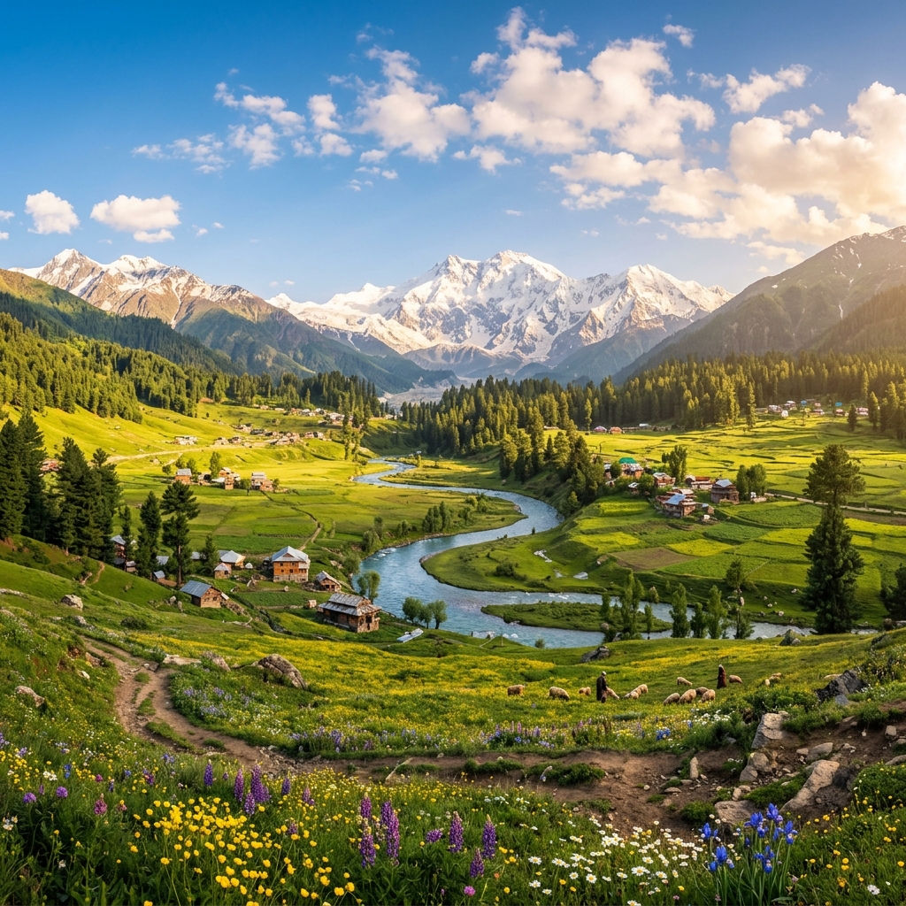
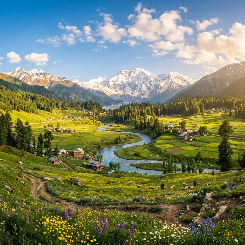
Panoramic view of the Kashmir Valley
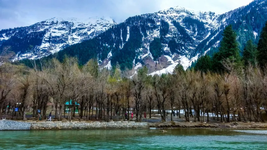
Kashmir Valley Landscape: Intermontane Jhelum basin bordered by snow-capped Pir Panjal and Greater Himalayan ranges.

Greater Himalayan Range

Location
Northern & Eastern boundary
Significance
Main watershed; glaciated peaks including Sickle Moon / Bharanzar Peak (6,574m in Kishtwar); Zojila pass

Pir Panjal Range

Location
SW of Kashmir Valley
Significance
Separates Kashmir Valley from Jammu region; Markhor habitat; Banihal pass & Mughal Road

Shivalik Hills

Location
Southern fringe
Significance
Foothills transitioning to plains; Kandi soil belt; sacred temples & Dun valleys

Zaskar Range

Location
Between Kashmir & Ladakh
Significance
High-altitude mountain wall framing Suru and Zanskar valleys
HYDROLOGICAL ARCHITECTURE

J&K Master River Basins & Drainage Systems

Source: Central Water Commission (CWC)

Jammu & Kashmir's hydrology is structured around two massive Himalayan drainage arteries—the Jhelum River Basin (draining the intermontane Kashmir Valley) and the Chenab River Basin (carving deep gorges through the Jammu Himalayas), supplemented by the Tawi and Ravi systems:

KASHMIR VALLEY DRAINAGE

River Jhelum (Vitasta / Hydaspes)

  • Hydrological Origin: Springs from the deep octagonal limestone pool at Verinag in Anantnag District.
  • Right-Bank Tributaries: Lidder River, Sindh River (joins at Shadipora), Erin Nallah, Madhumati Stream.
  • Left-Bank Tributaries: Veshav River, Rambiara River, Romshi Stream, Doodhganga, Sukhnag, Pohru River.
  • Natural Delta & Outlet: Expands into Wular Lake (Asia's largest freshwater lake), exits Kashmir through the deep granite gorge at Baramulla into PoK.
JAMMU MOUNTAIN DRAINAGE

River Chenab (Asikni / Chandrabhaga)

  • Hydrological Origin: Formed in Himachal Pradesh by confluence of Chandra and Bhaga rivers at Tandi, enters J&K at Paddar in Kishtwar.
  • Key Tributaries: Marusudar River (largest tributary, joins at Bhandarkoot), Neeru River (Bhaderwah), Bichleri, Ans River.
  • Hydropower Cascade: Pakal Dul (1,000 MW), Dul Hasti (390 MW), Baglihar (900 MW), Salal (690 MW), Ratle (850 MW).
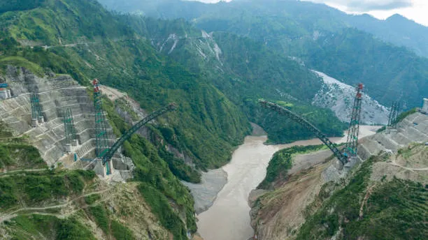
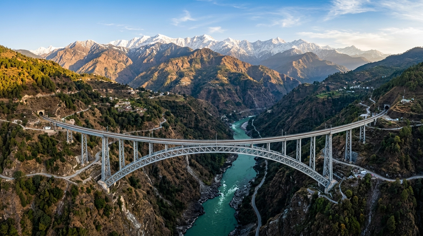
  • Plains Transition: Carves through Reasi beneath the world's highest rail bridge and enters the plains at Akhnoor in Jammu.
SUB-HIMALAYAN TRACT

Tawi & Ravi River Systems

  • River Tawi ('Surya Putri'): Originates from Kali Kundi glacier in Bhaderwah; flows through Chenani, Udhampur, and Jammu City before joining Chenab in Pakistan.
  • River Ravi: Forms the southeastern boundary of J&K in Kathua District; impounded by the massive Ranjit Sagar Dam (Thein Dam).
  • Subterranean Devika River: Sacred underground stream flowing through Udhampur, Purmandal, and Utterbehni in Samba.

📌 Verify latest notification/rules: River discharge levels and flood danger gauges (Sangam, Ram Munshi Bagh, Asham) are monitored in real time by the Irrigation & Flood Control (I&FC) Department.

STRATEGIC TRANSIT CORRIDORS

Mountain Passes & High-Altitude Gateways

Source: Border Roads Organisation (BRO)

Key mountain passes that cut through the Pir Panjal, Great Himalayas, and Zanskar ranges to link isolated valleys, districts, and neighboring regions:

Zojila Pass

Altitude
3,528 m (11,575 ft)
Mountain Range
Great Himalayas
Connects (Route)
Ganderbal (Kashmir) ➔ Dras / Kargil / Leh (Ladakh) on NH-1D
Strategic & Transit Status
Lifeline of Ladakh; 14.15 km Zojila All-Weather Tunnel under active development.

Sinthan Top

Altitude
3,748 m (12,297 ft)
Mountain Range
Pir Panjal Range
Connects (Route)
Anantnag (Kashmir) ➔ Kishtwar (Jammu) via NH-244
Strategic & Transit Status
Crucial alternative inter-division transit highway via Daksum-Chhatroo.

Peer Ki Gali (Pir Panjal Pass)

Altitude
3,490 m (11,450 ft)
Mountain Range
Pir Panjal Range
Connects (Route)
Shopian (Kashmir) ➔ Bafliaz / Rajouri / Poonch (Jammu) via Mughal Road
Strategic & Transit Status
Historic imperial route; operational during snow-free months (May–Nov).

Razdan Pass

Altitude
3,557 m (11,672 ft)
Mountain Range
Harmukh / Great Himalayas
Connects (Route)
Bandipora ➔ Gurez Valley
Strategic & Transit Status
High-altitude snow corridor linking border Gurez Valley across Tragbal ridge.

Sadhna Pass (Nastachun)

Altitude
3,124 m (10,250 ft)
Mountain Range
Shamsbari Range
Connects (Route)
Kupwara ➔ Karnah / Tangdhar (LoC frontier)
Strategic & Transit Status
Strategic lifeline for frontier Karnah valley across Shamsbari mountains.

Banihal Pass (Navyug Tunnel Corridor)

Altitude
2,832 m (9,291 ft)
Mountain Range
Pir Panjal Range
Connects (Route)
Ramban (Jammu) ➔ Qazigund / Anantnag (Kashmir) on NH-44
Strategic & Transit Status
Bypassed by 8.45 km twin-tube Navyug Tunnel & 11.2 km USBRL rail tunnel.

Padri Pass

Altitude
3,000 m (9,842 ft)
Mountain Range
Pir Panjal / Shivalik fringe
Connects (Route)
Bhaderwah (Doda) ➔ Chamba (Himachal Pradesh)
Strategic & Transit Status
Scenic alpine meadow pass linking Jammu region directly to Himachal.

📌 Verify latest notification/rules: Pass opening schedules and snow clearance updates are issued by the J&K Traffic Police and BRO. Always check real-time road advisories before winter travel.

20 DISTRICTS COMPREHENSIVE DIRECTORY

Geospatial & Administrative Profile of All 20 J&K Districts

Jammu & Kashmir comprises 20 administrative districts divided equally across two geographical divisions: Kashmir Valley Division (10 Districts) and Jammu Division (10 Districts). Explore official demographic baselines (Census 2011), elevations, river catchments, passes, and economic specializations below.

GEOSPATIAL CARTOGRAPHY

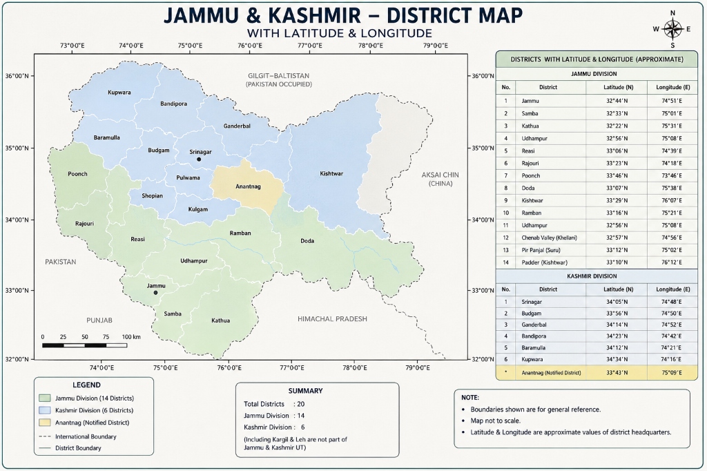
Jammu & Kashmir — 20-District Map with Latitude & Longitude

📐 Complete Coordinates Table & Administrative Boundaries
Jammu & Kashmir 20-District Map with Latitude and Longitude Coordinates
District Cartography Reference: Spatial layout and approximate geographic coordinates of all 20 district headquarters across Jammu Division (10) and Kashmir Division (10).
Filter by Division:
Showing all 20 district monographs
Kashmir Valley

Srinagar District

👑 Summer Capital
🏛️ Administrative Snapshot & Historical Demographics Census 2011 Baseline
Headquarters Srinagar CitySummer Capital & Commercial Core
Population (2011) 12,36,829 (12.37 Lakhs)Census of India
Literacy Rate 69.41%Census 2011 Baseline
Sex Ratio 888 F / 1000 MFemales per 1000 M
Geographic Area 294 km² (Urban Core) / 1,979 km² (Catchment)Revenue Survey
HQ Elevation 1,585 m (5,200 ft)Mean Sea Level
Key River Basin Jhelum River (Vyeth)Primary Drainage
Tehsils (LGD) 7 TehsilsSrinagar South, Srinagar North, Shalteng, Chanapora...
Serving as the civilizational and administrative heart of the Kashmir Valley across more than two millennia, Srinagar is built along the meandering loops of the River Jhelum (Vyath) and Dal Lake. The city functions as an international artisan guild metropolis, where centuries-old lineages of master craftsmen sustain GI-certified Kani pashmina weaving, walnut wood carving, and paper-mâché ateliers within the historic dense urban fabric of Shehr-e-Khas.
🌊 Hydrology & Lakes: River Jhelum (Vitasta), Dal Lake, Nigeen Lake, Harwan Reservoir, Anchar Lake.
⛰️ Passes & Transit: NH-44 terminus, Sheikh ul-Alam International Airport (SXR), Srinagar Railway Junction.
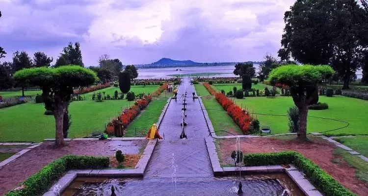
🏛️ Heritage & Landmarks: Dal Lake & Shikaras, Shankaracharya Hill Temple, Mughal Gardens (Shalimar, Nishat, Chashme Shahi, Pari Mahal), Historic Jamia Masjid, Hazratbal Shrine, Hari Parbat Fort.
🌾 Economy & GI Produce: Tourism, GI Pashmina & Kani Shawl weaving, Hand-knotted Silk Carpets, Wood Carving, Paper Machie, IT & Commerce.
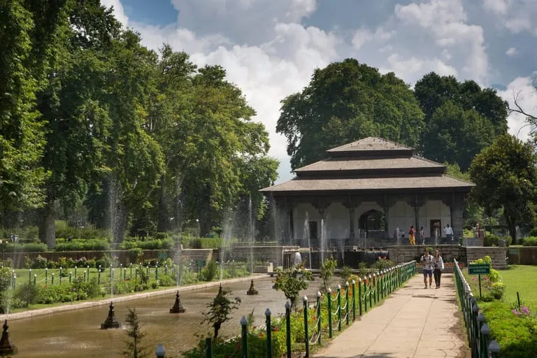
Shalimar Bagh Mughal Pavilion
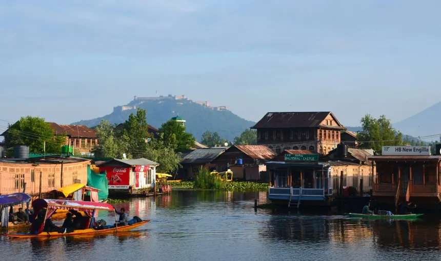
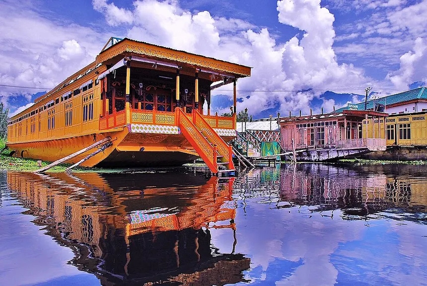
Dal Lake Houseboats with Hari Parbat Fort
Handcrafted Cedar Houseboat
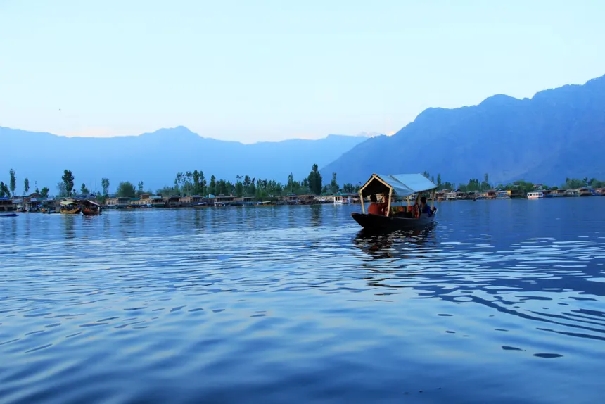
Shikara boat on Dal Lake
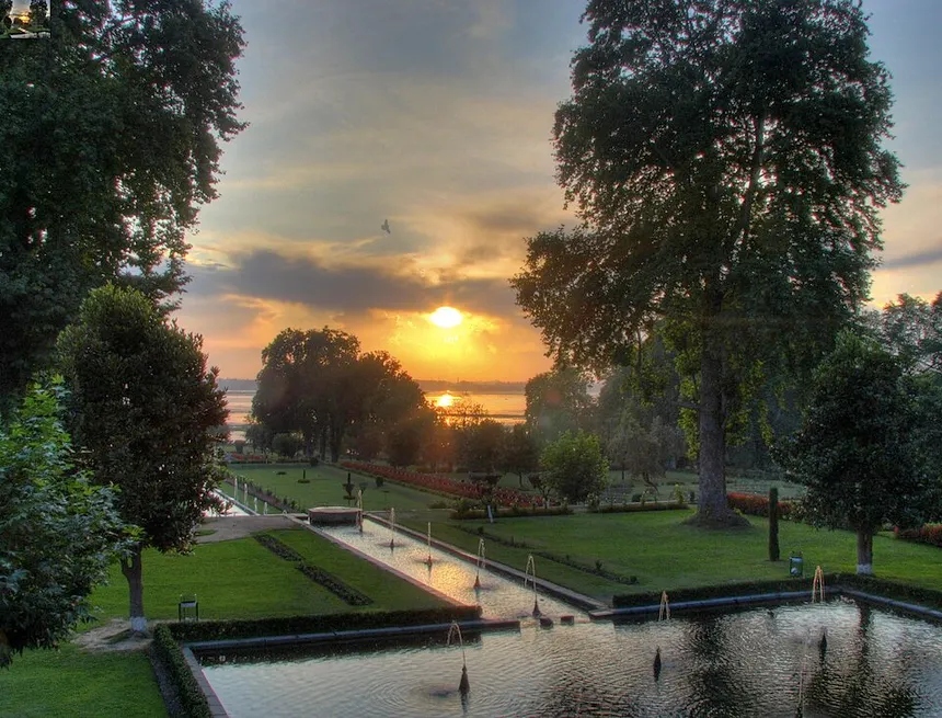
Nishat Bagh Sunset looking towards Dal Lake
Kashmir Valley

Ganderbal District

🏔️ Gateway to Ladakh
🏛️ Administrative Snapshot & Historical Demographics Census 2011 Baseline
Headquarters GanderbalHydrological Conduit & Amarnath Route
Population (2011) 2,97,446 (2.97 Lakhs)Census of India
Literacy Rate 58.04%Census 2011 Baseline
Sex Ratio 874 F / 1000 MFemales per 1000 M
Geographic Area 1,045 km²Revenue Survey
HQ Elevation 1,619 m (5,312 ft)Mean Sea Level
Key River Basin Sindh River (Jhelum Basin)Primary Drainage
Tehsils (LGD) 6 TehsilsGanderbal, Kangan, Lar, Tullamulla...
Carved by the roaring glacial torrents of the Sindh River, Ganderbal forms the central hydrological conduit of the Kashmir basin. The district anchors the primary high-altitude mountaineering circuits of the Great Lakes (Vishansar, Gangabal) and serves as the strategic staging base for the Baltal axis of the annual Shri Amarnath Yatra, while its fertile riverbeds produce prized Sindh valley cherries and freshwater trout.
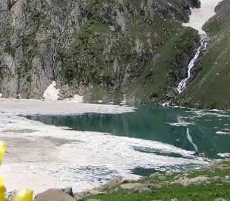
🌊 Hydrology & Lakes: Sindh River, Manasbal Lake (deepest lake in India), Gangabal Alpine Lake, Thajiwas Glacier.
⛰️ Passes & Transit: Zojila Pass (3,528 m / 11,575 ft) connecting Kashmir to Kargil & Ladakh on NH-1D.
🏛️ Heritage & Landmarks: Sonamarg ('Meadow of Gold'), 8th-C Naranag ancient temple complex ruins, crystal-clear Gangabal Lake, Sacred Kheer Bhawani Spring Temple (Tullamulla), Great Lakes Alpine Trek Basecamp (Vishansar/Gadsar/Gangabal), Baltal Amarnath basecamp.
🌾 Economy & GI Produce: Upper Sindh Hydropower Projects, Cold-water Trout Fisheries, Walnut production, Agro-tourism.
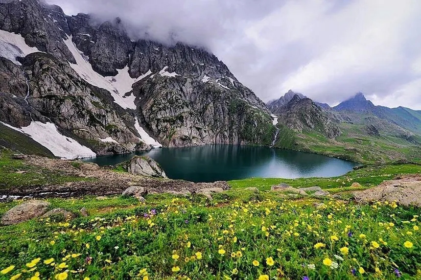
Gangabal Lake with buttercups
Thajiwas glacial tarn and waterfall
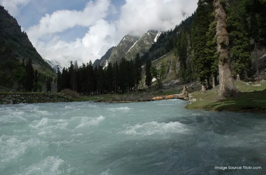
Sindh River Sonamarg rapids
Vishansar Lake alpine pass
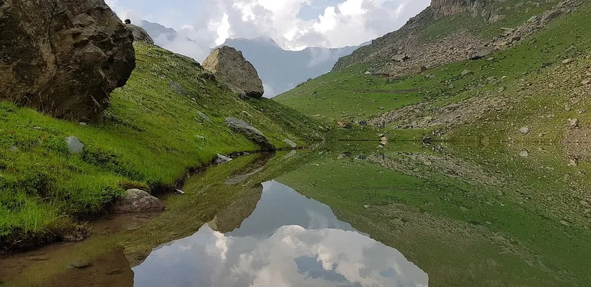
Alpine tarn mirror reflection
Kashmir Valley

Budgam District

🧶 Craft & Meadow Hub
🏛️ Administrative Snapshot & Historical Demographics Census 2011 Baseline
Headquarters BudgamKarewa Agro-Plateau & Tech Cluster
Population (2011) 7,53,745 (7.54 Lakhs)Census of India
Literacy Rate 56.08%Census 2011 Baseline
Sex Ratio 883 F / 1000 MFemales per 1000 M
Geographic Area 1,371 km²Revenue Survey
HQ Elevation 1,610 m (5,282 ft)Mean Sea Level
Key River Basin Doodh Ganga & Sukhnag StreamPrimary Drainage
Tehsils (LGD) 9 TehsilsBudgam, Beerwah, Chadoora, Khansahib...
Characterized by extensive terraced Karewa (Wudar) formations rising above the central valley floor, Budgam holds immense spiritual and cultural significance as the resting place of Kashmir’s patron saint, Sheikh Noor-ud-Din Noorani (Nund Rishi), at Charar-i-Sharief. Beyond its sacred heritage, the district’s high plateaus sustain extensive saffron cultivation, brick-kiln clusters, and expansive sub-alpine meadows at Doodhpathri and Yusmarg.
🌊 Hydrology & Lakes: Doodhganga Stream, Sukhnag Stream, Nilnag Lake, extensive lacustrine Karewa terraces.
⛰️ Passes & Transit: Tosamaidan Pass highland trails connecting to Poonch; hosts Srinagar International Airport.
🏛️ Heritage & Landmarks: Doodhpathri ('Valley of Milk'), Yusmarg pine meadows, Tosamaidan alpine plateau, Shrine of Sheikh Noor-ud-Din Wali (Nund Rishi) at Charar-i-Sharief, Khan Sahib Shrine.
🌾 Economy & GI Produce: Kanihama GI Kani Shawl weaving village, High-Density Apple Orchards, Brick Kiln industry, Pottery.
Tosamaidan stream and alpine valley
Village stream with mustard fields
Doodhpathri pine forest bowl
Tosamaidan rolling pastures
Nilnag lake in pine forest
Kashmir Valley

Anantnag District

🌸 Springs & Heritage
🏛️ Administrative Snapshot & Historical Demographics Census 2011 Baseline
Headquarters Anantnag (Islamabad)South Kashmir Agrarian & Tourism Hub
Population (2011) 10,78,692 (10.79 Lakhs)Census of India
Literacy Rate 62.69%Census 2011 Baseline
Sex Ratio 927 F / 1000 MFemales per 1000 M
Geographic Area 3,574 km²Revenue Survey
HQ Elevation 1,600 m (5,249 ft)Mean Sea Level
Key River Basin Jhelum (Lidder & Bringi Confluence)Primary Drainage
Tehsils (LGD) 12 TehsilsAnantnag, Bijbehara, Dooru, Kokernag...
Positioned as the agrarian and commercial gateway to South Kashmir, Anantnag (Islamabad) is defined by its network of perennial karst limestone springs, including Achabal and Kokernag *(koh-ker-nahg)*. The district encompasses the monumental 8th-century stone architecture of the Martand Sun Temple, the confluence of the Bringi, Sandran, and Lidder streams, and the traditional mountain pilgrimage trailhead of Pahalgam.
🌊 Hydrology & Lakes: Verinag Spring (Source of River Jhelum), Lidder River, Brengi Stream, Kokernag botanical springs.
⛰️ Passes & Transit: Sinthan Top (3,748 m / 12,297 ft) linking Anantnag to Kishtwar via NH-244; Navyug & Jawahar Tunnels entry.
🏛️ Heritage & Landmarks: Pahalgam & Betaab Valley, Aru Valley, 8th-C Martand Sun Temple (King Lalitaditya), Achabal Mughal Garden, Holy Amarnath Cave traditional yatra route via Chandanwari.
🌾 Economy & GI Produce: Kashmiri Willow Cricket Bat manufacturing cluster (Bijbehara/Sangam), Trout hatcheries, Walnuts, Apples.
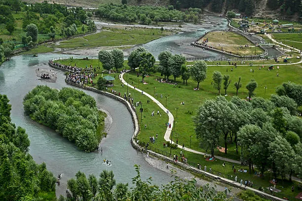
Betaab Valley aerial river park
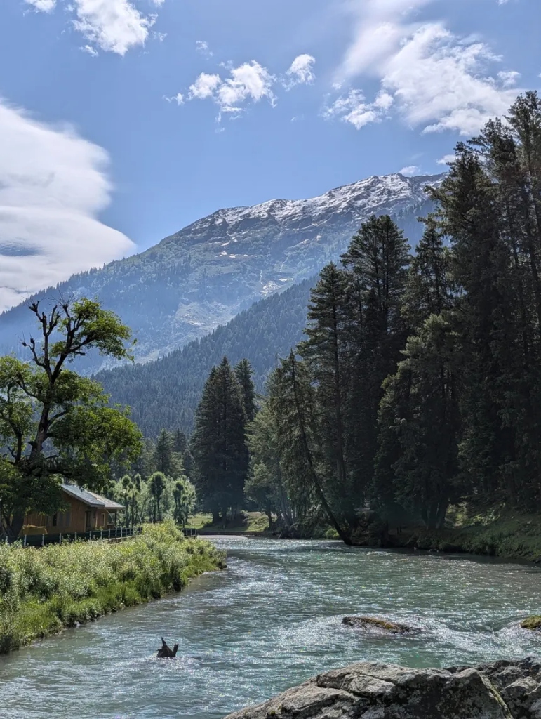
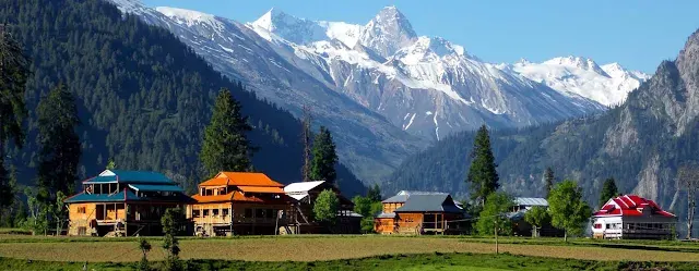
Aru Valley wooden cabin on stream
Lidder river rushing waters
Pahalgam riverbank and snow peaks
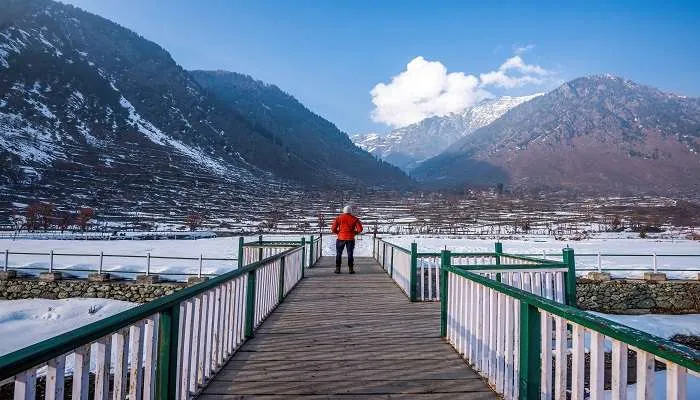
Pahalgam winter snow terraces bridge
Kashmir Valley

Pulwama District

🌾 Saffron Bowl of India
🏛️ Administrative Snapshot & Historical Demographics Census 2011 Baseline
Headquarters PulwamaSaffron Karewas & CA Cold Storage Hub
Population (2011) 5,60,440 (5.60 Lakhs)Census of India
Literacy Rate 64.30%Census 2011 Baseline
Sex Ratio 912 F / 1000 MFemales per 1000 M
Geographic Area 1,090 km²Revenue Survey
HQ Elevation 1,630 m (5,348 ft)Mean Sea Level
Key River Basin Jhelum & Rambiara RiverPrimary Drainage
Tehsils (LGD) 8 TehsilsPulwama, Pampore, Tral, Awantipora...
Celebrated globally for the purple autumn saffron plateaus of Pampore, Pulwama constitutes the agrarian industrial powerhouse of the valley. The district is distinguished by its high-density dairy cooperative infrastructure earning it the title of the 'Anand of Kashmir', along with willow cleft woodcraft clusters at Sangam supplying professional cricket bats across the international sporting circuit.
🌊 Hydrology & Lakes: River Jhelum, Rambiara River, Romshi Stream, fertile Pampore Karewas.
⛰️ Passes & Transit: National Highway NH-44 corridor, Central Kashmir railway stations (Kakapora/Awantipora).
🏛️ Heritage & Landmarks: Vast saffron fields of Pampore ('Saffron Town'), lush Aripal Valley, 9th-C Avantishwar & Avantiswami Temple ruins (King Avantivarman), Shikargah Wildlife Sanctuary (Tral), Payar Stone Temple.
🌾 Economy & GI Produce: Kashmir Saffron (GI Tagged, Crocin Grade A+), Dairy Production ('Milk Grid of J&K'), Almond & Apple Orchards.
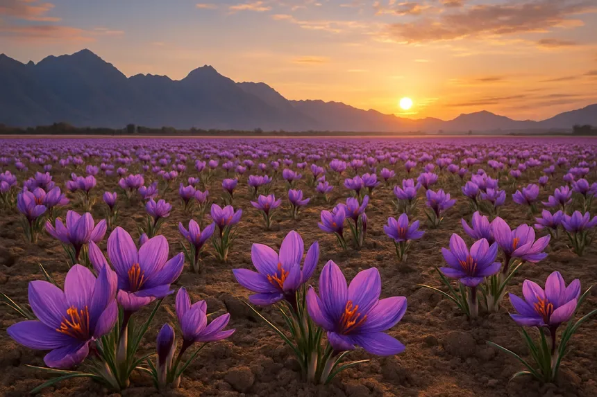
Kashmir Pampore Saffron Fields at Sunset
GI Tagged Kashmir Saffron Crocus Satious
Kashmir Valley

Kulgam District

🌊 Rice Bowl of Kashmir
🏛️ Administrative Snapshot & Historical Demographics Census 2011 Baseline
Headquarters KulgamRice Bowl & Pir Panjal Foothills
Population (2011) 4,24,483 (4.24 Lakhs)Census of India
Literacy Rate 59.23%Census 2011 Baseline
Sex Ratio 951 F / 1000 MFemales per 1000 M
Geographic Area 1,067 km²Revenue Survey
HQ Elevation 1,738 m (5,702 ft)Mean Sea Level
Key River Basin Veshav River (Aharbal Feeder)Primary Drainage
Tehsils (LGD) 7 TehsilsKulgam, Damhal Hanjipora, Devsar, Yaripora...
Traditionally revered as the 'Rice Bowl of Kashmir', Kulgam lies along the fast-flowing Veshaw River fed by the glacial heights of the Pir Panjal range. The district is known for the dramatic Aharbal waterfall plunging through a sheer basaltic gorge, rich apple orchards, and pristine high-altitude trekking routes leading to the sacred oligotrophic alpine lake of Kausar Nag.
🌊 Hydrology & Lakes: Veshav River (perennial glacier-fed Jhelum tributary), Kausar Nag / Kounsarnag Alpine Lake (3,962 m), Kund Springs.
⛰️ Passes & Transit: Pir Panjal foothill corridor connecting to Reasi/Ramban via historic mountain tracks.
🏛️ Heritage & Landmarks: Aharbal Waterfall ('Niagara of Kashmir', 25m drop), Kounsarnag Alpine Lake, Dachnipora fruit orchards, Chimmer Meadows, Shrine of Mir Syed Ali Hamadani.
🌾 Economy & GI Produce: Paddy agriculture ('Rice Bowl of Kashmir'), dense fruit and apple orchards, cold-water fisheries.
Kulgam Rice Terraces and Pastoral Valley
Aharbal and Vishaw River Watershed
Kashmir Valley

Shopian District

🍎 Apple Capital of India
🏛️ Administrative Snapshot & Historical Demographics Census 2011 Baseline
Headquarters ShopianApple Capital & Mughal Road Gateway
Population (2011) 2,66,215 (2.66 Lakhs)Census of India
Literacy Rate 60.76%Census 2011 Baseline
Sex Ratio 951 F / 1000 MFemales per 1000 M
Geographic Area 612 km²Revenue Survey
HQ Elevation 2,057 m (6,749 ft)Mean Sea Level
Key River Basin Rambiara & Sasara StreamsPrimary Drainage
Tehsils (LGD) 7 TehsilsShopian, Keller, Herman, Zainapora...
Perched at the base of the Pir Panjal range along the historic imperial Mughal Road, Shopian represents the highest-producing commercial apple and walnut district in the Himalayas. The district’s steep alpine topography, temperate soil microclimates, and proximity to the high mountain pass of Peer Ki Gali (3,490 m) give it a distinct horticultural identity and crucial transit connectivity between the Kashmir Valley and the Rajouri-Poonch border belt.
🌊 Hydrology & Lakes: Rambiara River, Sasowani Stream, Kungwattan alpine spring, high-altitude Pir Panjal glacier catchments.
⛰️ Passes & Transit: Peer Ki Gali / Pir Panjal Pass (3,490 m / 11,450 ft) along the historic Mughal Road.
🏛️ Heritage & Landmarks: Historic Mughal Road caravan sarais (Aliabad Sarai), Peer Ki Gali Shrine, Kungwattan spring, Hirpora Wildlife Sanctuary (Markhor habitat), Padpawan.
🌾 Economy & GI Produce: Dense apple orchards (Delicious, Kulu, Gala), Walnut exports, High-Density Apple farming.
Mughal Road High Pass connecting Shopian across Pir Panjal
Peer Ki Gali mountain gorge towards Shopian
Kashmir Valley

Baramulla District

🎿 Skiing & Fruit Hub
🏛️ Administrative Snapshot & Historical Demographics Census 2011 Baseline
Headquarters BaramullaNorth Kashmir Trade & Horticulture Hub
Population (2011) 10,08,039 (10.08 Lakhs)Census of India
Literacy Rate 64.63%Census 2011 Baseline
Sex Ratio 885 F / 1000 MFemales per 1000 M
Geographic Area 4,243 km²Revenue Survey
HQ Elevation 1,592 m (5,223 ft)Mean Sea Level
Key River Basin Jhelum River Outflow GorgePrimary Drainage
Tehsils (LGD) 16 TehsilsBaramulla, Sopore, Uri, Tangmarg...
Flanking the northern banks of the River Jhelum as it exits the Kashmir Valley toward the Uri gorge, Baramulla is the historical northwestern trade threshold of the region. The district combines diverse economic pillars: the premier winter sports resort of Gulmarg atop Mount Apharwat (13,780 ft), the major fruit trade hub of Sopore handling thousands of metric tonnes of export apples daily, and key border trade infrastructure along the Line of Control.
🌊 Hydrology & Lakes: River Jhelum (flowing through the Baramulla Gorge into PoK), Wular Lake shorelines (Asia's largest freshwater lake), Ningli Nallah, Ferozepora Nallah.
⛰️ Passes & Transit: Baramulla-Uri-Muzaffarabad historic road corridor, Northern Kashmir railway terminal.
🏛️ Heritage & Landmarks: Gulmarg alpine meadows & Apharwat Peak (4,200 m summit ridge / 3,980 m Gondola Phase 2 upper station), World's Highest Cable Car (Gulmarg Gondola), Shrine of Baba Payam-ud-Din Reshi (Baba Reshi), Tangmarg, Eco-park Baramulla, Gurdwara Chatti Padshahi.
🌾 Economy & GI Produce: Winter sports & skiing tourism, High-yield Apple horticulture (Sopore Apple Mandi — largest in Asia), Walnut processing.
Gulmarg meadow with tarn pond
Watlab viewpoint garden over Wular Lake
Emerald alpine mountain lake
Shikara on mirror lake against snowy mountains
Watlab pier into Wular Lake
Kashmir Valley

Kupwara District

🌲 The Coronet of Kashmir
🏛️ Administrative Snapshot & Historical Demographics Census 2011 Baseline
Headquarters KupwaraFrontier Mountain & Forest Catchment
Population (2011) 8,70,354 (8.70 Lakhs)Census of India
Literacy Rate 64.51%Census 2011 Baseline
Sex Ratio 835 F / 1000 MFemales per 1000 M
Geographic Area 2,379 km²Revenue Survey
HQ Elevation 1,615 m (5,299 ft)Mean Sea Level
Key River Basin Pohru, Lolab & Kehmil RiversPrimary Drainage
Tehsils (LGD) 11 TehsilsKupwara, Handwara, Karnah, Trehgam...
Occupying the extreme frontier forest rim of North Kashmir, Kupwara is defined by sweeping valleys of virgin deodar and pine, notably Lolab, Karnah, and the vast virgin meadow plateau of Bangus. The district holds strategic border significance along the Shamshabari mountain range, while sustaining high-quality walnut orchards, mountain apiculture, and timber resources.
🌊 Hydrology & Lakes: Kishanganga River (in Keran & Karnah), Pohru River, Mawar River, Kehmil Stream, dense conifer forests.
⛰️ Passes & Transit: Sadhna Pass / Nastachun Pass (3,124 m / 10,250 ft), Pharkian Gali pass to Keran Valley.
🏛️ Heritage & Landmarks: The 'Coronet of Kashmir', pristine Bungus Valley alpine wetland bowl, lush Lolab Valley ('Valley of Love'), Keran Valley river border overlooking Pakistan, Teetwal village-to-village LoC view & Mata Sharda Devi Temple, Drangyari meadows, Reshwari, Kheer Bhawani Shrine at Tikker.
🌾 Economy & GI Produce: Forestry timber, Walnuts, Red rice, Cold-climate apples, Apiculture (honey).
Bungus Valley green wetland bowl
Lolab Valley green paddy fields
Kishanganga river in Keran gorge
Bungus alpine campsite
Gujjar sod huts in Bungus
Kashmir Valley

Bandipora District

🦆 Freshwater & Gurez Hub
🏛️ Administrative Snapshot & Historical Demographics Census 2011 Baseline
Headquarters BandiporaWular Lake Shoreline & Gurez Valley
Population (2011) 3,92,232 (3.92 Lakhs)Census of India
Literacy Rate 56.28%Census 2011 Baseline
Sex Ratio 889 F / 1000 MFemales per 1000 M
Geographic Area 345 km² (Valley Floor) / ~3,000 km² (Total)Revenue Survey
HQ Elevation 1,578 m (5,177 ft)Mean Sea Level
Key River Basin Madhumati & Kishanganga (Gurez)Primary Drainage
Tehsils (LGD) 7 TehsilsBandipora, Sumbal, Gurez, Ajas...
Stretching from the northern shores of Wular Lake (Asia’s largest freshwater wetland and Ramsar Site #1107) across the snowbound Razdan Pass to the border enclave of Gurez Valley, Bandipora is historically celebrated as the city of 'Ilm, Adab aur Aab' (Knowledge, Literature, and Water). It is home to the 330 MW Kishanganga Hydroelectric Project, water-chestnut (singhara) harvesting, and the iconic Habba Khatoon pyramid peak in Dawar.
🌊 Hydrology & Lakes: Wular Lake (Asia's largest freshwater lake, Ramsar Site #1107), Kishanganga River (in Gurez), Madhumati & Erin streams.
⛰️ Passes & Transit: Razdan Pass (3,557 m / 11,672 ft) connecting Bandipora across Tragbal ridge to Gurez Valley.
🏛️ Heritage & Landmarks: Gurez Valley (Dawar & Habba Khatoon Peak), Kishanganga Hydroelectric Dam (330 MW), Wular Lake wetlands & birdwatching, Shrine of Baba Shakur-ud-Din atop Watlab hill.
🌾 Economy & GI Produce: 330 MW Kishanganga Hydroelectric Project, Wular fisheries & Water chestnut (Singhara) harvesting, Handicrafts.
Dawar village and suspension bridge
Kishanganga river in Gurez valley
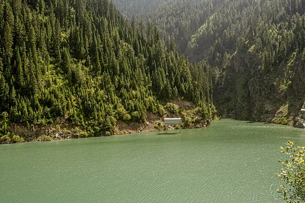
Kishanganga reservoir mountain view
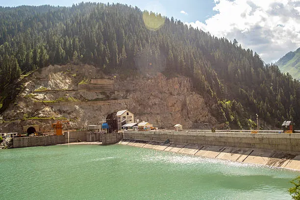
Kishanganga 330MW hydro dam
Emerald lake surrounded by pines
Jammu Division

Jammu District

👑 Winter Capital & Temples
🏛️ Administrative Snapshot & Historical Demographics Census 2011 Baseline
Headquarters Jammu CityWinter Capital & Rail Gateway
Population (2011) 15,29,958 (15.30 Lakhs)Census of India
Literacy Rate 83.60%Census 2011 Baseline
Sex Ratio 880 F / 1000 MFemales per 1000 M
Geographic Area 2,342 km²Revenue Survey
HQ Elevation 327 m (1,073 ft)Mean Sea Level
Key River Basin Tawi River & Chenab (Akhnoor)Primary Drainage
Tehsils (LGD) 11 TehsilsJammu, Jammu South, Jammu West, R.S. Pura...
Anchored on the banks of the River Tawi ('Surya Putri'), Jammu District functions as the historic winter capital and premier commercial nerve center of the Union Territory. Renowned as the 'City of Temples' for the revered shrines of Raghunath Temple, Bawe Wali Mata at Bahu Fort, and Peer Kho, the district is also celebrated for the GI-tagged R.S. Pura aromatic Basmati rice fields and the major industrial corridors of Bari Brahmana.
🌊 Hydrology & Lakes: River Tawi ('Surya Putri'), River Chenab (entering plains at Akhnoor), Ranbir Canal irrigation network.
⛰️ Passes & Transit: Jammu Tawi Railway Junction (Northern Railway hub), Jammu Airport (IXJ), NH-44 terminus.
🏛️ Heritage & Landmarks: Raghunath Temple complex, Bahu Fort & Bawe Wali Mata Temple, Mubarak Mandi Palace, Akhnoor Fort & Jia Pota Ghat, Peer Kho Cave Temple, Suchetgarh Border Outpost.
🌾 Economy & GI Produce: Trade & commercial hub, Basmati Rice cultivation (R.S. Pura GI Rice), Industrial estates (Bari Brahmana), Tourism transit.
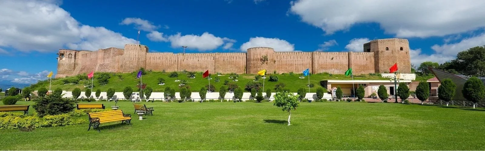
Ancient Bahu Fort overlooking River Tawi in Jammu
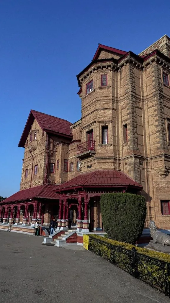
Amar Mahal Palace Museum along Tawi River
Jammu Division

Reasi District

🛕 Global Pilgrimage & Rail Marvel
🏛️ Administrative Snapshot & Historical Demographics Census 2011 Baseline
Headquarters ReasiPilgrimage, Hydro & Chenab Rail Arc
Population (2011) 3,14,667 (3.15 Lakhs)Census of India
Literacy Rate 58.15%Census 2011 Baseline
Sex Ratio 890 F / 1000 MFemales per 1000 M
Geographic Area 1,719 km²Revenue Survey
HQ Elevation 466 m (1,529 ft)Mean Sea Level
Key River Basin Chenab River & BangangaPrimary Drainage
Tehsils (LGD) 9 TehsilsReasi, Katra, Pouni, Mahore...
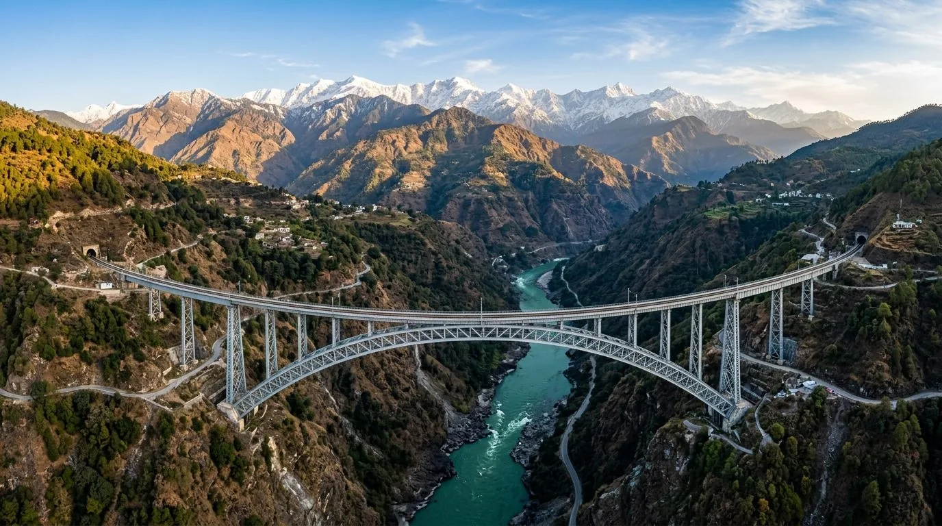
Situated in the southern foothills of the Pir Panjal range along the River Chenab, Reasi is an internationally prominent pilgrimage hub hosting the sacred cave shrine of Shri Mata Vaishno Devi at Katra, which draws 8 to 9 million devotees annually. The district is also home to monumental civil engineering feats, including the world’s highest railway arch bridge over the Chenab gorge (359 m) and the massive Salal Hydropower Dam.
🌊 Hydrology & Lakes: River Chenab Gorge, Anji Khad Stream, Salal Dam reservoir, Baba Dhansar turquoise karst spring.
⛰️ Passes & Transit: Chenab Railway Arch Bridge (359m - World's Highest) and Anji Khad Cable-Stayed Bridge, Katra Railway Station.
🏛️ Heritage & Landmarks: Shri Mata Vaishno Devi Shrine (Katra basecamp), Shiv Khori limestone cave shrine (Ransoo), Bhimgarh Fort, Siar Baba waterfall.
🌾 Economy & GI Produce: High-volume pilgrimage tourism (8–9M annual pilgrims), Salal Hydropower generation, Limestone, Lithium deposits (Salal-Haimana block).
📖 Detailed administrative dossier, Chenab bridge engineering data & 9 tehsils: Explore Dedicated Reasi District Profile ➔
World's Highest Chenab Railway Arch Bridge in Reasi
Trikuta Foothills and Terraced Slopes of Reasi
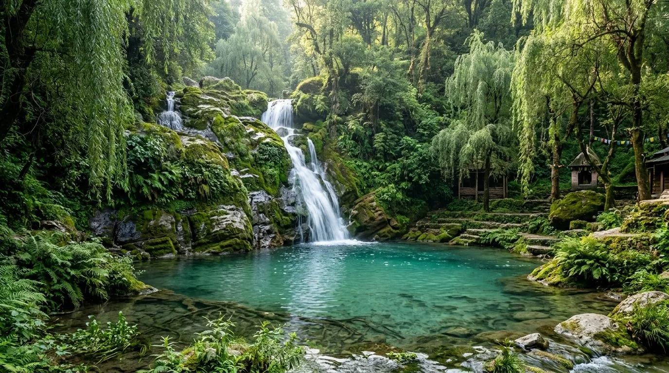
Siar Baba and Karst Springs of Reasi
Jammu Division

Udhampur District

🌲 Military HQ & Ancient Temples
🏛️ Administrative Snapshot & Historical Demographics Census 2011 Baseline
Headquarters UdhampurNorthern Command & Shivalik Rail Hub
Population (2011) 5,54,985 (5.55 Lakhs)Census of India
Literacy Rate 68.49%Census 2011 Baseline
Sex Ratio 870 F / 1000 MFemales per 1000 M
Geographic Area 2,637 km²Census 2011 DCHB
HQ Elevation 756 m (2,480 ft)Mean Sea Level
Key River Basin Tawi of Udhampur & DevikaPrimary Drainage
Tehsils (LGD) 8 TehsilsUdhampur, Ramnagar, Chenani, Majalta...
Strategically positioned as the Headquarters of the Northern Command of the Indian Army, Udhampur bridges the Shivalik plains with the Middle Himalayas. The district holds immense archaeological importance with the 9th-century Nagara-style stone temple complex at Krimchi, popular hill stations at Patnitop and Sanasar, and a distinctive culinary tradition centered on the indigenous artisan Kalari cheese.
🌊 Hydrology & Lakes: River Tawi, Birunalah, Dudhar Stream, Shivalik Dun valleys, subtropical pine belt.
⛰️ Passes & Transit: Chenani-Nashri Tunnel (Dr. Syama Prasad Mookerjee Tunnel, 9.28 km) on NH-44, Northern Command HQ, Udhampur Railway Station.
🏛️ Heritage & Landmarks: Patnitop & Sanasar hill stations, 8th–12th C Krimchi & Manwal Group of Stone Temples (ASI Monuments), Sudh Mahadev & Mantalai Shiva shrines.
🌾 Economy & GI Produce: Kalari Cheese (GI registered indigenous Dogra ripened cheese), Defense establishments, Horticulture.
Sanasar lake meadow bowl
Sanasar lake panorama and gazebo
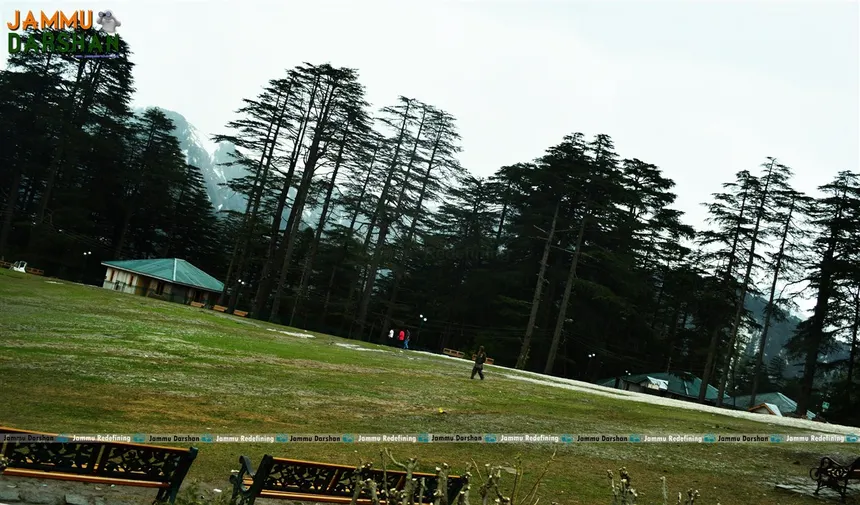
Patnitop giant deodar cedar park
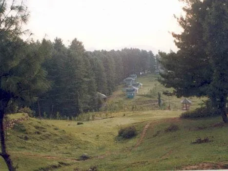
Patnitop pine chalets
Alpine cottages under snow peaks
Jammu Division

Kathua District

🎨 Gateway of J&K & Basohli Art
🏛️ Administrative Snapshot & Historical Demographics Census 2011 Baseline
Headquarters KathuaIndustrial Gateway & Basohli Arts
Population (2011) 6,16,435 (6.16 Lakhs)Census of India
Literacy Rate 73.09%Census 2011 Baseline
Sex Ratio 890 F / 1000 MFemales per 1000 M
Geographic Area 2,502 km²Revenue Survey
HQ Elevation 307 m (1,007 ft)Mean Sea Level
Key River Basin Ravi River & Ujh RiverPrimary Drainage
Tehsils (LGD) 11 TehsilsKathua, Hiranagar, Billawar, Basohli...
Serving as the southern gateway to Jammu & Kashmir along the Ravi River border with Punjab, Kathua is a vital industrial and artistic corridor. The historic town of Basohli within the district is the birthplace of the globally acclaimed, GI-certified Basohli Miniature Painting school, while the vast blue reservoir of the Ranjit Sagar (Thein) Dam forms a major regional hydrological asset.
🌊 Hydrology & Lakes: River Ravi, Ujh River, Sewa River, Ranjit Sagar Dam (Thein Dam) reservoir, Kandi belt rolling hills.
⛰️ Passes & Transit: Lakhanpur border corridor (Gateway of J&K on NH-44), Kathua Railway Station.
🏛️ Heritage & Landmarks: Basohli Miniature Painting & Pashmina Weaving (GI Tagged), Atal Setu Cable-stayed bridge over Ravi, Lohai Malhar forest range, Jasrota Fort & Wildlife Sanctuary, Sukrala Mata Temple, Sarthal alpine snow meadows.
🌾 Economy & GI Produce: Basohli GI Miniature Paintings, Basohli Pashmina weaving, Cement manufacturing & Industrial complexes, Ujh Multipurpose Project.
Kathua District Foothills and Ravi River Gateway
GI Basohli Miniature Painting Heritage of Kathua
Jammu Division

Samba District

⚔️ Land of Martyrs & Holy Shrines
🏛️ Administrative Snapshot & Historical Demographics Census 2011 Baseline
Headquarters SambaIndustrial Corridors & Dogra Forts
Population (2011) 3,18,898 (3.19 Lakhs)Census of India
Literacy Rate 81.41%Census 2011 Baseline
Sex Ratio 886 F / 1000 MFemales per 1000 M
Geographic Area 904 km²Revenue Survey
HQ Elevation 384 m (1,260 ft)Mean Sea Level
Key River Basin Basantar RiverPrimary Drainage
Tehsils (LGD) 6 TehsilsSamba, Vijaypur, Ramgarh, Ghagwal...
Bordered by the Shivalik hills and the international border, Samba is historically known as the land of brave Dogra warriors and the strategic 14-towered Samba Fort. The district is distinguished for its centuries-old tradition of hand-block calico printing (Chhint), while housing modern manufacturing and export hubs along the NH-44 highway belt.
🌊 Hydrology & Lakes: Basantar River, subterranean Devika River aquifer, Shivalik foothill tract.
⛰️ Passes & Transit: NH-44 highway corridor, Samba Railway Station.
🏛️ Heritage & Landmarks: Historic Samba Fort, Sacred riverbank shrines of Purmandal & Uttarbehni ('Chhota Kashi'), Baba Chamliyal border shrine on Zero Line, Mansar Lake (Ramsar Wetland #1573 shared with Udhampur).
🌾 Economy & GI Produce: Calico hand-block printing, SIDCO Industrial Complex (Pharma & Manufacturing), Traditional wheat and mustard farming.
Historic Samba Fort and Border Plains Landscape
Jammu Division

Ramban District

⚡ Central Mountain Transit Hub
🏛️ Administrative Snapshot & Historical Demographics Census 2011 Baseline
Headquarters RambanChenab Hydropower & NH-44 Transit
Population (2011) 2,83,713 (2.84 Lakhs)Census of India
Literacy Rate 54.27%Census 2011 Baseline
Sex Ratio 902 F / 1000 MFemales per 1000 M
Geographic Area 1,329 km²Revenue Survey
HQ Elevation 1,156 m (3,793 ft)Mean Sea Level
Key River Basin Chenab River (Bichleri Stream)Primary Drainage
Tehsils (LGD) 8 TehsilsRamban, Banihal, Batote, Gool...
Bisected by the tumultuous gorge of the River Chenab, Ramban forms the essential geographical throat of the Jammu-Srinagar national highway corridor. The district’s rugged, landslide-prone geology is the site of historic engineering breakthroughs, including the 8.5 km Navyug Tunnel and the 12.8 km T-49 railway tunnel on the USBRL rail link, surrounded by secluded sub-alpine valleys like Pogal Paristan.
🌊 Hydrology & Lakes: Chenab River Gorge, Pogal-Paristan streams, steep structural Pir Panjal cliffs.
⛰️ Passes & Transit: Banihal-Qazigund Navyug Tunnel (8.45 km), Banihal Railway Station & USBRL Pir Panjal Railway Tunnel (T-80, 11.2 km).
🏛️ Heritage & Landmarks: Batote pine hill station, Patnitop outskirts, Baglihar Hydroelectric Dam (900 MW) on Chenab River, Sanasar lake meadows (upper boundary), Pogal Paristan valley, Tata Pani hot sulfur spring, scenic Chenab bridges.
🌾 Economy & GI Produce: Hydropower generation, Highway transit economy, Walnut and quince fruit production.
Historic Ramban suspension bridge
Chenab rail arch bridge construction
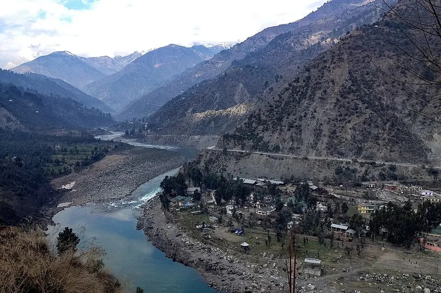
Chenab valley highway and mountains
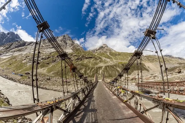
Mountain suspension bridge
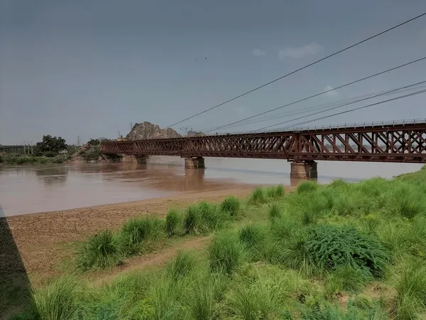
Steel truss railway bridge
Jammu Division

Doda District

💜 Mini Kashmir & Lavender Valley
🏛️ Administrative Snapshot & Historical Demographics Census 2011 Baseline
Headquarters DodaChenab Highlands & Lavender Valley
Population (2011) 4,09,936 (4.10 Lakhs)Census of India
Literacy Rate 64.68%Census 2011 Baseline
Sex Ratio 919 F / 1000 MFemales per 1000 M
Geographic Area 2,625 km²Census 2011 DCHB
HQ Elevation 1,107 m (3,632 ft)Mean Sea Level
Key River Basin Chenab River & Neeru RiverPrimary Drainage
Tehsils (LGD) 17 TehsilsDoda, Bhaderwah, Gandoh, Thathri...
Encompassing the expansive river basins and deep valleys of the Middle Himalayas, Doda is a botanically rich mountainous district known for the verdant bowl of Bhaderwah ('Mini Kashmir'). Bhaderwah has emerged as the pioneer center of India’s Purple (Lavender) Revolution, while preserving ancient serpent-worship temple traditions at Vasuki Nag and extensive deodar forestry.
🌊 Hydrology & Lakes: River Chenab, Neeru River (Bhaderwah basin), Kalgoni stream, high alpine ranges.
⛰️ Passes & Transit: Padri Pass (3,000 m / 10,500 ft) connecting Bhaderwah to Chamba (Himachal Pradesh), NH-244.
🏛️ Heritage & Landmarks: Bhaderwah Valley ('Mini Kashmir of Jammu'), Jai Valley alpine meadows, Guldanda snow bowl, Gandoh (Bhalesa) deep snow capital, Gupt Ganga Temple, Vasuki Nag Temple, Seoj Dhar highland.
🌾 Economy & GI Produce: Aroma Mission & Purple Revolution (Lavender Essential Oil hub), Bhaderwah Rajmash (GI Tagged red kidney beans), Cedar/Deodar timber.
Doda township and snow peaks
Bhaderwah green valley bowl
Chenab river canyon and bridges
Bhaderwah mountain clouds vista
Chenab gorge mountain ridge view
Jammu Division

Kishtwar District

💎 Land of Saffron & Sapphire
🏛️ Administrative Snapshot & Historical Demographics Census 2011 Baseline
Headquarters KishtwarHydropower Hub & Sapphire Highlands
Population (2011) 2,30,696 (2.31 Lakhs)Census of India
Literacy Rate 56.20%Census 2011 Baseline
Sex Ratio 920 F / 1000 MFemales per 1000 M
Geographic Area 7,737 km² (Largest District in J&K)Revenue Survey
HQ Elevation 1,638 m (5,374 ft)Mean Sea Level
Key River Basin Chenab, Marusudar & WarwanPrimary Drainage
Tehsils (LGD) 11 TehsilsKishtwar, Paddar, Marwah, Warwan...
Dominated by the towering granite peaks of the Greater Himalayas and the Chenab River gorge, Kishtwar is an ecologically dramatic high-mountain territory known for the legendary blue sapphire mines of Paddar. The district produces high-potency mountain saffron and functions as the hydropower capital of J&K with massive run-of-the-river projects including Pakal Dul, Kiru, Kwar, and Ratle.
🌊 Hydrology & Lakes: River Chenab, Marusudar River (largest Chenab tributary), Sickle Moon / Bharanzar Peak (6,574 m / 21,568 ft - Highest summit within J&K UT).
⛰️ Passes & Transit: Sinthan Pass (3,748 m / 12,297 ft) connecting to Kashmir Valley, Mughal Maidan, Margan Top connecting to Warwan Valley.
🏛️ Heritage & Landmarks: Machail Mata shrine in Paddar Valley ('Land of Sapphires'), Sinthan Top alpine pass, Mughal Maidan meadows, Kishtwar High Altitude National Park (Snow Leopard habitat), Chowgan plateau ground, Shrine of Shah Asrar-ud-Din & Shah Farid-ud-Din, Warwan & Marwah alpine valleys.
🌾 Economy & GI Produce: Kishtwar Sapphire (Paddar mines — world famous cornflower blue sapphire), Kishtwar Saffron, Major Hydropower Cascade (Pakal Dul 1,000 MW, Kiru 624 MW, Kwar 540 MW, Ratle 850 MW).
High Glaciated Summits of Kishtwar Himalaya
Jammu Division

Rajouri District

🏰 Historic Hill Kingdom & Mughal Road
🏛️ Administrative Snapshot & Historical Demographics Census 2011 Baseline
Headquarters RajouriFrontier Foothills & Mughal Road Transit
Population (2011) 6,42,410 (6.42 Lakhs)Census of India
Literacy Rate 68.17%Census 2011 Baseline
Sex Ratio 860 F / 1000 MFemales per 1000 M
Geographic Area 2,630 km²Revenue Survey
HQ Elevation 915 m (3,002 ft)Mean Sea Level
Key River Basin Ans River & Nowshera TawiPrimary Drainage
Tehsils (LGD) 13 TehsilsRajouri, Darhal, Thanamandi, Nowshera...
Tracing the southwestern foothills of the Pir Panjal range along the Line of Control, Rajouri holds a rich royal history as an ancient principality on the Mughal imperial transit highway. The district is marked by historical forts at Chingus and Nowshera, a deeply integrated Gujjar-Bakarwal agro-pastoral economy, and the serene Sufi shrine of Baba Ghulam Shah Badshah at Shahdara Sharief.
🌊 Hydrology & Lakes: Ans River, Tawi of Rajouri (Nowshera Tawi), Darhal Stream, Sukhtaw River, Kali Kund (Seven alpine tarns).
⛰️ Passes & Transit: Scenic Mughal Road southern ascent, NH-144A (Jammu-Poonch National Highway).
🏛️ Heritage & Landmarks: Historic Mughal Road, Noori Chhamb waterfall (named by Emperor Jahangir for Noor Jahan), Kali Kund lakes, Shahdara Sharief Shrine (Baba Ghulam Shah Badshah), Chingus Sarai Fort, Historic Rajouri Fort & Dhanidhar Fort, Dehra Ki Gali (DKG).
🌾 Economy & GI Produce: Rajouri Chikri Woodcraft (GI Tagged), Maize and wheat agriculture, Dairy farming.
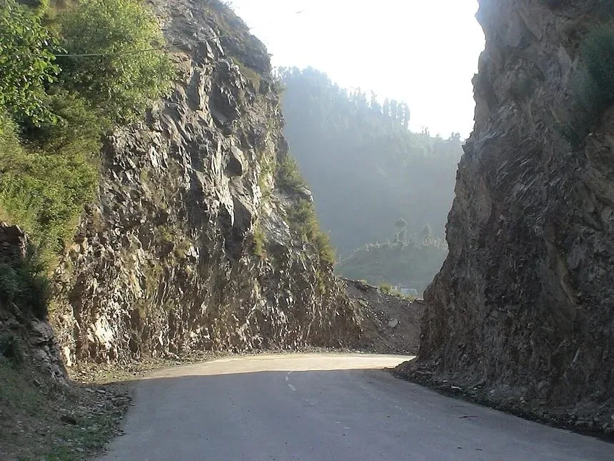
Mughal Road rock gorge pass
Thannamandi hillside village and stream
Ans river mountain gorge
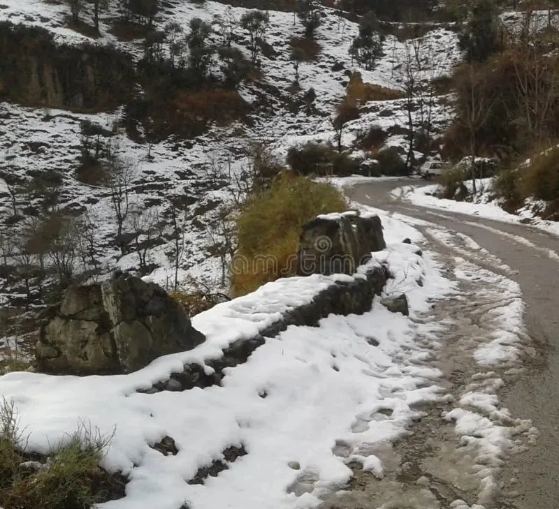
Mughal Road DKG snowy ascent
Mountain stream rapids and boulders
Jammu Division

Poonch District

🏔️ Frontier Border & Pir Panjal Pass
🏛️ Administrative Snapshot & Historical Demographics Census 2011 Baseline
Headquarters PoonchFrontier Border & Alpine Seven Lakes
Population (2011) 4,76,835 (4.77 Lakhs)Census of India
Literacy Rate 66.74%Census 2011 Baseline
Sex Ratio 893 F / 1000 MFemales per 1000 M
Geographic Area 1,674 km²Revenue Survey
HQ Elevation 981 m (3,219 ft)Mean Sea Level
Key River Basin Poonch River (Suran & Mandi)Primary Drainage
Tehsils (LGD) 6 TehsilsHaveli (Poonch), Mandi, Surankote, Mendhar...
Flanked on three sides by the Line of Control, Poonch is a historic frontier mountain district characterized by the high Pir Panjal alpine Seven Lakes circuit (including Nandansar and Sukh Sar). The district preserves the historic Poonch Royal Fort palace, the sacred Shivalik stone temple of Swami Budha Amarnath at Mandi, and the Mughal transit outpost of Surankote.
🌊 Hydrology & Lakes: Poonch River (Suran River + Mandi River confluence), Betar Nallah, Seven Alpine Tarns of Pir Panjal (Nandan Sar, Chandan Sar, Katora Sar, Sukh Sar, Neel Sar, Bhag Sar, Gum Sar).
⛰️ Passes & Transit: Pir Panjal Pass / Pir Ki Gali (3,490 m) on Mughal Road, Chakan Da Bagh Line of Control crossing gate.
🏛️ Heritage & Landmarks: Historic Poonch Fort, Pir Ki Gali alpine pass, Loran Valley, Nandishool waterfall, Tatakooti peak (4,759m), Chakan Da Bagh LoC crossing, Swami Buddha Amarnath Temple (Mandi), Shrine of Sain Baba Miran Sahib.
🌾 Economy & GI Produce: Mountain agriculture, Horticulture (Walnuts, Plums), Traditional handicrafts.
Pir Panjal snow massif over Poonch
Mandi river and shrine valley view
Suran River under blue skies
Mandi valley town vista
Mandi valley in winter snow
📊 GEOSPATIAL INTELLIGENCE CONSOLE

20-District Grand Statistical Comparison Matrix

Comprehensive reliable comparative benchmark across all 20 districts of Jammu & Kashmir covering administrative divisions, demographic density, forest canopy, primary river hydrology, and GI-certified economic drivers:

District Division Area (km²) Population (2011) Literacy HQ Elevation Primary River Basin Key Economic Engine / GI Produce
Srinagar Kashmir 294 12,36,829 69.41% 1,585 m Jhelum (Vyath) & Dal Lake Tourism, GI Pashmina & Kani Shawls, Silk Carpets, Wood Carving
Ganderbal Kashmir 1,045 2,97,446 58.04% 1,619 m Sindh River (Jhelum Basin) Sonamarg Alpine Tourism, Cold-water Trout, Hydropower, Cherries
Budgam Kashmir 1,371 7,53,745 56.08% 1,610 m Doodh Ganga & Sukhnag GI Kani Shawls (Kanihama), High-Density Apples, Brick Kilns
Anantnag Kashmir 3,574 10,78,692 62.69% 1,600 m Lidder, Bringi & Sandran Pahalgam Tourism, Willow Cricket Bats (Sangam), Fresh Trout
Pulwama Kashmir 1,090 5,60,440 64.30% 1,630 m Jhelum & Rambiara GI Kashmir Saffron (Pampore), Dairy Hub ('Anand of J&K'), Apple Orchards
Shopian Kashmir 612 2,66,215 60.76% 2,057 m Rambiara River Premier Apple Capital (Delicious & Kullu), Mughal Road Transit
Kulgam Kashmir 1,067 4,24,483 59.23% 1,739 m Vishaw River (Kousar Nag) Rice Granary of Kashmir, Aharbal Waterfall Eco-Tourism, Walnut
Baramulla Kashmir 4,243 10,08,039 64.63% 1,593 m Lower Jhelum Basin & Pohru Gulmarg Ski Tourism, Uri-I & II Hydropower, Sopore Apple Mandi
Bandipora Kashmir 3,344 3,92,232 56.28% 1,578 m Madhumati, Arin & Kishanganga Wular Freshwater Fish, Gurez Border Tourism, Kishanganga HEP (330 MW)
Kupwara Kashmir 2,379 8,70,354 64.51% 1,615 m Pohru, Mawer & Kishanganga Lolab & Bangus Eco-Tourism, Walnut Orchards, Deodar Timber
Jammu Jammu 2,342 15,29,958 83.60% 327 m Tawi River (Surya Putri) & Chenab Winter Capital, R.S. Pura GI Basmati Rice, Commerce, Pilgrim Hub
Samba Jammu 904 3,18,898 81.41% 384 m Basantar River Bari Brahmana & Samba Industrial Estates, Traditional Calico Printing
Kathua Jammu 2,502 6,16,435 73.09% 307 m Ravi River, Ujh & Sewa GI Basohli Paintings & Pashmina, Ranjit Sagar Dam, Agro-Processing
Udhampur Jammu 2,637 5,54,985 68.49% 756 m Tawi, Birma & Ans Northern Command Defence Hub, Patnitop Tourism, GI Kalari Cheese
Reasi Jammu 1,719 3,14,667 58.15% 466 m Chenab & Anji Khad Mata Vaishno Devi Shrine (Katra), World's Highest Rail Bridge, Salal Dam
Ramban Jammu 1,329 2,83,713 54.27% 1,156 m Chenab & Bichleri GI Ramban Sulai Honey, Anardana, Strategic NH-44 Transit Corridor
Doda Jammu 2,625 4,09,936 64.68% 1,107 m Chenab & Neeru (Bhaderwah) Bhaderwah Rajmash (GI), Purple Lavender Farming Revolution, Walnuts
Kishtwar Jammu 7,737 2,30,696 56.20% 1,638 m Chenab, Marusudar & Wadwan GI Kishtwar Saffron, Paddar Blue Sapphire, Mega Chenab Hydel Hub (3000+ MW)
Rajouri Jammu 2,630 6,42,410 68.17% 915 m Manawar Tawi & Ans GI Chikri Woodcraft, Maize, Olive Cultivation, Mughal Road Historic Corridor
Poonch Jammu 1,674 4,76,835 66.74% 981 m Poonch River & Suran Pilgrimage (Budha Amarnath / Nangali Sahib), Walnuts, Cross-LoC Trade History
SUB-REGIONAL LANDSCAPES

Sub-Regional Landscapes, Micro-Climates & Eco-Sanctuaries

Beyond the 20 district administrative headquarters, Jammu & Kashmir encompasses distinct topographic micro-regions—from the lavender-scented alpine cups of Bhaderwah and Patnitop in Jammu to the pristine glacial basins of Gurez, Lolab, and Bangus in Kashmir.

🌲 Unrivaled Natural Wonders & Alpine Landscapes

Jammu: A Land of Unrivaled Natural Beauty

From the purple lavender valleys of Bhaderwah to the high-altitude pine meadows of Patnitop, the seven glacial alpine tarns of Poonch, and the emerald waters of Mansar Lake—Jammu holds some of the Himalayas' most breathtaking landscapes.

Jammu Natural Beauty Bhaderwah Valley Landscape
Bhaderwah Valley ("Mini Kashmir"): Lush green pine meadows, blooming purple lavender fields, and crystal-clear mountain streams under snow-capped Himalayan peaks.

Bhaderwah ("Valley of Flowers")

Known as "Mini Kashmir", featuring vast rolling deodar pine forests, sparkling Neeru river rapids, and endless purple lavender fields blooming under the snow-capped Seoj Dhar ranges.

Patnitop & Sanasar Meadows

Perched at 2,024m along the Shivalik belt, offering panoramic views of the Pir Panjal mountain range, dense coniferous forests, and quiet alpine lakes surrounded by wild flowers.

The 7 Alpine Tarns of Poonch

Hidden in the upper Pir Panjal high passes: seven crystal-clear glacial lakes including Nandan Sar, Chandan Sar, Bhag Sar, Sukhsar, and Katori Sar.

Mansar & Surinsar Twin Lakes

Sacred emerald-green lakes fringed by pine-covered hills, home to lotus blossoms, rare freshwater turtles, and serene walking trails.

Kishtwar & Paddar Valley

Home to Kishtwar High-Altitude National Park, world-famous Paddar Kashmiri Blue Sapphire mines, saffron terraces, and towering peaks like Brammah and Sickle Moon.

Chenab River Gorge & Arch Bridge

The mighty Chenab river carving deep granite gorges in Reasi, spanned by the world’s highest railway arch bridge (Chenab Bridge at 359m elevation).

🏔️ High-Altitude Mountain Vantage Points

Udhampur as a View: Panoramic Mountain Vistas

Udhampur offers some of the Western Himalayas' most stunning panoramic vistas—from Patnitop's snow-crowned Pir Panjal ridges to Sanasar alpine cup meadows, Mantalai pine valleys, and Krimchi's ancient Nagara stone spires.

Patnitop Udhampur Panoramic Himalayan View
Patnitop Hill Station View (2,024m): Towering deodar pine ridges overlooking the snow-capped Pir Panjal mountain range under golden morning sunlight.

Patnitop Pine Ridge Panorama

Perched at 2,024m elevation, offering 360-degree views of the Pir Panjal mountain range, deep Chenab river gorges, and thick deodar pine forest canopies.

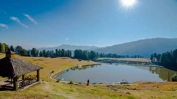
Sanasar Alpine Cup Meadow

A quiet, cup-shaped alpine meadow at 2,070m surrounded by coniferous pine forests and a tranquil lake—India’s premier paragliding and eco-viewing destination.

Krimchi Temple Valley View

The 8th-century Nagara stone spires (*Shikharas*) rising dramatically against a backdrop of green Shivalik hills, terraced fields, and mountain streams.

Mantalai Himalayan Ridge

Pine-forested valley leading to Mantalai at the foot of snow-capped peaks, where the sacred Devak stream flows through lush alpine meadows.

Ramnagar Fort & Tawi Gorge

Perched high on a rocky cliff, the 1844 Ramnagar Fort commands sweeping views of the winding Tawi river gorge and surrounding forested hills.

Skyview Patnitop Cable Car

Asia's highest ropeway tower spanning Sanget to Patnitop, providing an unforgettable aerial view over pine treetops, terraced farms, and mountain cliffs.

🗺️ Scenic Destinations & Eco-Tourism

Top Travel Spots in Ramban District

Explore the secluded alpine hamlets, thermal hot springs, historic mountain forts, and roaring river gorges of Ramban District along the Western Himalayas.

Gool Tatapani Thermal Hot Springs Ramban
Gool Tatapani Hot Springs: Natural thermal mineral sulfur spring pools set amidst pine-forested mountain glades in Gool, Ramban.
Chenab River Gorge Ramban Landscape
Chenab River Gorge & Valleys: The roaring Chenab river carving deep granite gorges through pine-forested Pir Panjal slopes.

Gool Tatapani Hot Springs

A famous natural thermal hot spring resort in Gool valley, renowned for therapeutic sulfur baths surrounded by pine forests, mountain streams, and camping grounds.

Pogal-Paristan ("Virgin Valley")

An unspoiled, secluded alpine valley featuring wooden Pahadi houses, step-terraced maize farms, crystal-clear streams, and cold mountain breeze.

Gajpat Fort & Ridge

A historic mountain fort perched high on a steep ridge above Ramban town, offering panoramic views of the Chenab river loop and the National Highway 44 mountain pass.

Mahu-Mangit Alpine Meadows

High-altitude alpine pastures located along the upper Pir Panjal range, ideal for summer wilderness trekking, pastoral transhumance viewing, and photography.

Sanasar-Ramban Border Meadows

Rolling green alpine pastures along the Ramban-Udhampur district border, popular for paragliding, eco-camping, and pine forest nature walks.

Banihal Pass & Qazigund Tunnel

The gateway town of Banihal at the northern foot of Ramban, home to the 8.45 km Navayuga Banihal-Qazigund all-weather tunnel and high-speed railway engineering works.

🛕 World-Famous Shrines & Engineering Marvels

Reasi as a Tourist & Pilgrimage Sanctuary

Reasi District is one of the world's most famous spiritual and eco-tourism hubs—home to the sacred Shri Mata Vaishno Devi Shrine, the world's highest Chenab Railway Arch Bridge, Shiv Khori cave shrine, and pristine waterfalls.

Reasi Chenab Railway Arch Bridge Engineering Marvel
World's Highest Chenab Rail Arch Bridge (359m): Spanning the Chenab river gorge, 29m taller than Eiffel Tower (359m vs 330m).
Reasi Scenic City Landscape & Bhimgarh Fort
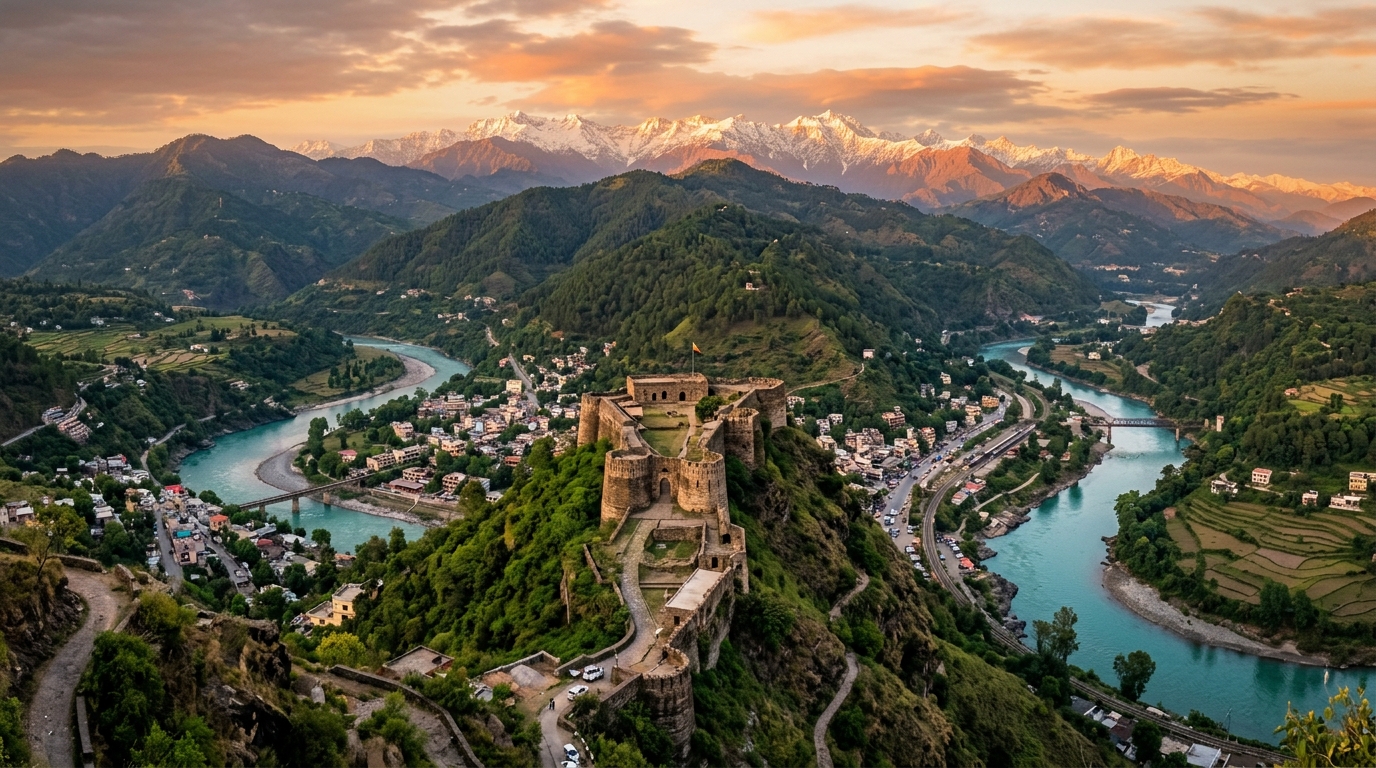
Reasi Scenic City Panorama: Historic Bhimgarh Fort overlooking Reasi town, Chenab River, and Pir Panjal peaks.
Baba Dhansar & Siar Baba Nature Waterfalls Reasi
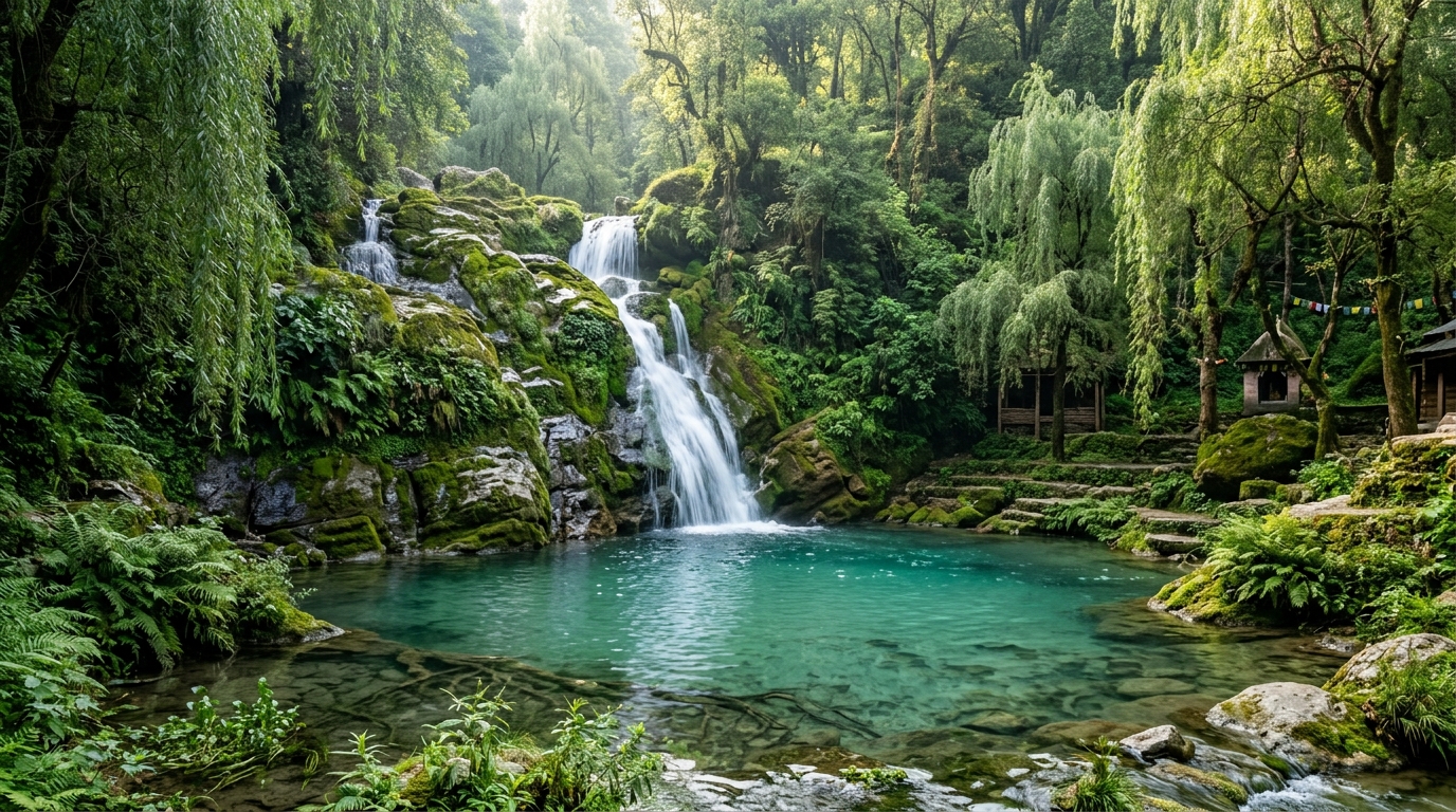
Baba Dhansar & Siar Baba Nature: Sacred turquoise water spring pool and cascading natural waterfalls surrounded by weeping willows.

Shri Mata Vaishno Devi Shrine (Katra)

India's premier pilgrimage destination drawing 8–9 million devotees annually. Base camp Katra leads to the 13km sacred mountain trek to the holy natural cave containing the three Pindies.

Chenab Railway Arch Bridge (359m)

A global engineering marvel: the world's highest railway arch bridge standing 359 meters above the Chenab riverbed (29 meters taller than Paris's Eiffel Tower, 359 m vs 330 m) linking Kashmir to India's railway grid.

Shiv Khori Cave Shrine (Ransoo)

Famous natural limestone cave shrine dedicated to Lord Shiva. Features a naturally formed 4-foot-high Shivling, continuous water drips, and limestone formations resembling Lord Shiva's hair locks (*Jata*).

Baba Dhansar & Siar Baba Waterfalls

Baba Dhansar features sacred turquoise water spring pools and a natural Shiva cave, while Siar Baba is a roaring 100-foot natural waterfall cascading into a deep pool along the Chenab.

Bhimgarh Fort (Reasi Town)

Historic 17th-century hill fort built by Raja Bhim Dev and renovated by Maharaja Gulab Singh using stone masonry, high defensive walls, and an impressive entrance gate (*Vijay Pol*).

Salal Dam & Lake Reservoir

Majestic hydroelectric power project built across the mighty Chenab River forming a turquoise artificial reservoir surrounded by steep forested Shivalik mountains.

🌲 Alpine Eco-Sanctuaries & Glacial Valleys

Kashmir Valley: High-Altitude Basins & Pristine Frontiers

Beyond the urban expanse of Srinagar, the Kashmir Valley encompasses secluded glacial valleys, high-altitude alpine bowls, and protected wildlife reserves framed by the Pir Panjal and Great Himalayan crests.

Gurez Valley (Dardic Shina Frontier)

A high-altitude glacial valley along the roaring Kishanganga River beneath the pyramid-shaped Habba Khatoon peak, preserving ancient Dardic Shina language and wooden architecture.

Elevation: 2,400 m · Bandipora

Lolab Valley ("The Fruit Bowl")

Celebrated by poet Sir Walter Lawrence as the most charming valley in Kashmir: oval deodar-fringed meadows, cold springs at Sogam, and dense groves of walnut and almond trees.

Elevation: 1,590 m · Kupwara

Bangus Valley (High Alpine Plateau)

A pristine, cup-shaped wilderness meadow sitting at 10,000 feet elevation, divided into Bod Bangus (Big Bangus) and Lokut Bangus, surrounded by conifer forests and horse pastures.

Elevation: 3,000 m · Kupwara

Aharbal Falls & Kousar Nag

The "Niagara of Kashmir" where the Veshav river plunges 25 meters through sheer granite gorges, fed upstream by the sacred high-altitude alpine lake of Kousar Nag (3,962 m).

Elevation: 2,266 m · Kulgam

Dachigam National Park & Hangul

The last sanctuary of the critically endangered Kashmir Stag (Hangul), covering 141 sq km of oak, pine, and alpine scree ranging from 1,700 m to 4,300 m near Srinagar.

Elevation: 1,700–4,300 m · Srinagar

Betaab & Aru Valleys (Pahalgam)

Glaciated river valleys carved by the Lidder River, featuring crystal trout pools, deodar woodlands, and trailheads to Kolahoi Glacier, Tarsar-Marsar, and Sheshnag.

Elevation: 2,400 m · Anantnag
🌸 Botanical Heritage & Floral Research

Jammu & Kashmir Botanical Gardens & Wild Floral Bloom Explorer

Discover Asia's largest Tulip garden, purple Saffron crocus, sky-blue alpine poppies, Dal lake lotuses, and lavender valleys with floriculture research facts!

Asia's Largest Tulip Reserve 📅 Late March – Mid April

Indira Gandhi Memorial Tulip Garden

📍 Srinagar (Zabarwan Foothills) · Tulipa gesneriana (1.5M+ Blooms · 68 Varieties)

Asia's largest tulip garden situated on terraced mountain slopes overlooking Dal Lake. Showcases striped Rembrandt, parrot, and fringed cultivars alongside daffodils and hyacinths.

🌿 Status: Protected Habitat Ecology Dossier →
GI No. 635 Heritage Flora 📅 Late October – Early November

Pampore Saffron Plateaus (Karewa Wudar)

📍 Pulwama District · Crocus sativus (GI Kashmiri Saffron)

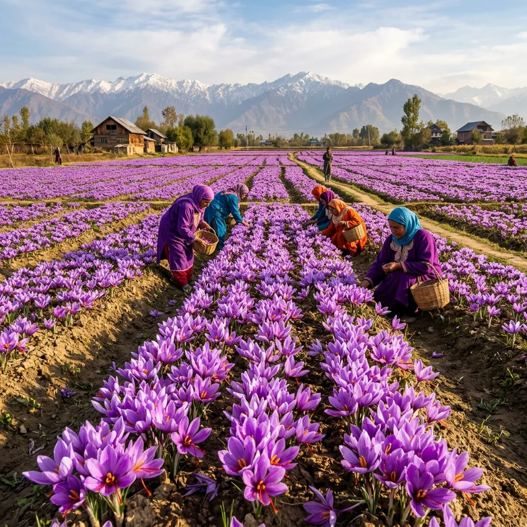
Vast purple carpets across lacustrine Karewa plateaus. Blooms are hand-plucked at dawn by hereditary farming families to extract the three crimson stigmas yielding pure Mongra saffron.

🌿 Status: Protected Habitat Ecology Dossier →
Purple Revolution Epicenter 📅 June – July

Bhaderwah & Ramban Lavender Valleys

📍 Doda & Ramban (Chenab Valley) · Lavandula angustifolia (CSIR Aroma Mission)

Pioneered under CSIR-IIIM Jammu, thousands of hilly acres in Bhaderwah and Assar produce high-grade organic lavender oil, driving rural agri-entrepreneurship and eco-tourism.

🌿 Status: Protected Habitat Ecology Dossier →
Aquatic Wetland Flora 📅 July – August

Sacred Dal & Nigeen Lake Lotuses (Pamposh)

📍 Srinagar Aquatic Corridors · Nelumbo nucifera (Sacred Indian Lotus)

Extensive wild aquatic lotus colonies forming floating green canopies and delicate pink blossoms across Dal and Nigeen lakes. The fibrous rhizomes are harvested as prized culinary Nadur.

🌿 Status: Protected Habitat Ecology Dossier →
High-Altitude Alpine Endemic 📅 July – August

Himalayan Blue Poppy (Queen of Wildflowers)

📍 Apharwat (Gulmarg) & Gurez Valleys · Meconopsis aculeata (Alpine Scree Flora)

Rare sky-blue petals with vibrant yellow stamens thriving in high-altitude rocky moraines and alpine screes between 3,300m and 4,500m elevation. Endemic to the western Himalayas.

🌿 Status: Protected Habitat Ecology Dossier →
80-Hectare Research Sanctuary 📅 April – October

Jawaharlal Nehru Botanical Garden & Arboretum

📍 Chashme Shahi (Srinagar) · 300+ Himalayan Conifers, Weeping Willows & Herbs

80-hectare research botanical sanctuary featuring four distinct zones: Plant Introduction, Research Garden, Recreational Garden, and Botanical Nursery surrounded by ancient Himalayan cedars.

🌿 Status: Protected Habitat Ecology Dossier →

Climate Challenges, Pollution & Ecological Watchdog

Glacier Retreat & Water Security

Major glaciers, including Kolahoi, Thajiwas, Machoi, and Drang-Drung, are retreating rapidly, threatening late-summer stream runoff and regional agriculture.

Diesel Emissions & Black Carbon

Heavy tourist vehicular transit releases black carbon soot that settles on glacier snowpack, reducing albedo and accelerating melting rates.

Cloudbursts & Flash Floods

Altered weather patterns have increased localized cloudburst frequencies, triggering sudden mountain flash floods along Veshaw and Lidder rivers.

Landslides & Slope Destabilization

Highway widening and tunnel excavation along NH-44 near Ramban cause frequent shooting stone hazards and seasonal blockades.

🏔️ Trans-Himalayan Physical Geography

Comprehensive Physical Geography & Geomorphology of Ladakh

An in-depth physical analysis of the Trans-Himalayan cold desert plateau, featuring the Karakoram and Zanskar ranges, glacial river basins, endorheic saline lakes, world-record mountain passes, and extreme alpine periglacial landforms.

Administrative Geography Note: The Union Territory of Ladakh officially comprises 7 notified administrative districts: Leh, Kargil, Zanskar, Drass, Sham, Nubra, and Changthang (formally notified on 27 April 2026 by the Ministry of Home Affairs, bringing the cumulative total across J&K UT [20] and Ladakh UT [7] to 27 districts).

Mountain Ranges & Tectonic Boundaries

Situated at an altitude ranging from 3,000m to over 7,500m, Ladakh is enclosed by two of the world's greatest mountain systems: the Karakoram Range to the north and the Great Himalayan Range to the south. The central Ladakh Range forms the watershed between the Indus and Shyok rivers, while the rugged Zanskar Range dominates the southern plateau.

Key Peaks: K2 (8,611m), Saser Kangri (7,672m), Nun Kun (7,135m)

Glacial River Hydrology & Valleys

The Indus River serves as the hydrological spine of Ladakh, flowing northwest through Leh and Skardu. Key glacial tributaries include the Shyok River (fed by Rimo Glacier), the Nubra River (fed by the 76-km Siachen Glacier), and the Zanskar River, famous for its winter frozen ice trek (Chadar).

Major Basins: Indus Valley, Nubra-Shyok Valley, Zanskar Canyon, Suru Valley

Endorheic High-Altitude Saline Lakes

Ladakh features closed-basin endorheic lakes formed by tectonic uplift and glacial runoff:
• Pangong Tso (4,350m): A 134-km long brackish lake extending into Tibet.
• Tso Moriri (4,522m): A Ramsar wetland sanctuary for black-necked cranes.
• Tso Kar (4,530m): A high-altitude salt lake with crystalline white evaporite deposits.

Status: Critical High-Altitude Avian & Wetland Ramsar Sites

Cold Desert Geomorphology & Passes

Lying in the rain shadow of the Himalayas, Ladakh receives under 100 mm of annual rainfall. It exhibits extreme diurnal temperature swings (+30°C in summer to -35°C in winter), intense frost-shattering weathering, and sand dunes in Hunder. High-altitude connectivity is maintained through world-record mountain passes:
• Umling La (5,798m / 19,024ft): World's highest motorable pass.
• Khardung La (5,359m) & Chang La (5,360m).

Geomorphology: Periglacial Solifluction & Cold Arid Weathering
TRANS-HIMALAYAN & KARAKORAM FRONTIERS

Greater Geographic & Frontier Valley Gazetteer

Comprehensive physical, cultural, and ecological survey of the Trans-Himalayan massifs, high Karakoram corridors, glacial lake basins, and frontier mountain settlements across the Greater Kashmir and Northern Karakoram region:

Constitutional & Geographic Demarcation: The constitutional and sovereign boundaries of the Union Territories of Jammu & Kashmir and Ladakh strictly adhere to the official cartography published by the Survey of India. The Trans-Himalayan and frontier entries below are catalogued strictly for comparative geomorphology, drainage hydrology, and historical Silk Road caravan route analysis across the wider Karakoram and Hindukush mountain systems.

1. Hunza Valley (The "Shangri-La")

Gojil & Karakoram

World-famous mountain valley celebrated for spring apricot blossoms, golden autumn poplar terraces, and centuries-old Wakhi and Burusho culture.

  • Attabad Lake: Turquoise glacial lake formed by a massive 2010 mountain landslide along the Karakoram Highway.
  • Passu Cones (Cathedral Peaks): Serrated, tooth-like granite needles rising dramatically against the sky.
  • Hussaini Suspension Bridge: Iconic aerial rope-and-plank bridge over the Hunza River torrent.
  • Baltit & Altit Forts: Ancient 700-year-old timber and stone fortified royal castles overlooking the valley.

2. Skardu & Baltistan ("Little Tibet")

Gateway to K2

The mountaineering capital of the Karakoram at the confluence of the Indus and Shigar rivers, acting as the primary launchpad for K2 (8,611m), Broad Peak, and the Gasherbrums.

  • Deosai Plains: The "Land of Giants"—the world's 2nd-highest plateau (4,114m), home to Himalayan brown bears and vast summer wildflowers.
  • Katpana Cold Desert: High-altitude white sand dunes nestled against snow-capped peaks (Sarfaranga).
  • Lower Kachura Lake (Shangrila): Serene lake basin with pagoda-style chalets on the water.
  • Manthoka & Khamosh Waterfalls: Glacial cascades plunging over high granite canyon walls.

3. Astore Valley (Minimarg & Rainbow Lake)

Deosai Gateway

Revered as "Heaven on Earth", an untouched high-altitude valley basin renowned for zero commercialization and dense fir-covered mountain passes.

  • Minimarg: High-altitude Swiss-style alpine bowl with carpeted meadows, wooden chalets, and rushing streams.
  • Rainbow Lake (Domel): Color-shifting high tarn that reflects turquoise, emerald, and amber hues throughout the day.
  • Rama Lake & Meadow: Pine-encircled glacial lake at the base of the southern flank of Nanga Parbat.
  • Gudai Valley: Virgin conifer-clad defile with crystal trout streams and pastoral livestock trails.

4. Fairy Meadows & Nanga Parbat

8,126m Giant

A high grassland plateau (3,300m) situated near the Raikot Glacier, offering an unobstructed up-close view of Nanga Parbat (8,126m), the 9th-highest peak in the world.

  • Raikot Bridge Jeep Trail: One of the world's most dramatic mountain cliff roads carved into the Indus gorge.
  • Beyal Camp: High alpine birch forest campsite on the edge of the churning Raikot glacial moraine.
  • Nanga Parbat Basecamp: Glacial amphitheater looking directly up the colossal 4,000-meter sheer ice face.

5. Neelum Valley & Sharda Peeth

Kishanganga Basin

A 240-km long bow-shaped gorge along the Kishanganga (Neelum) River, dense with deodar forests, wooden hamlets, and historic civilizational ruins.

  • Sharda Peeth Ruins: 6th–8th century university and temple dedicated to the goddess of learning, the ancient heart of Kashmiri Sanskrit scholarship.
  • Arang Kel: The "Pearl of Neelum"—a scenic plateau village perched 8,379 ft above the valley floor.
  • Taobat (Tao Bat): The final frontier village at the confluence of the Neelum and Kutton rivers.
  • Pir Chinasi: High-altitude mountain ridge (9,500 ft) offering sweeping 360° views across Neelum and Jhelum valleys.

6. Jhelum Valley, Leepa & Baboon Valley

Pir Panjal Ridges

Dense pine valleys, roaring river gorges, and remote alpine lakes located along the southern flank of the Pir Panjal Range.

  • Leepa Valley & Reshipora: Emerald terraced rice fields and multi-storied traditional wooden houses in Danna village.
  • Chitta Katha Lake: A holy high-altitude glacial tarn (13,500 ft) with milky turquoise waters surrounded by alpine flowers.
  • Cham Waterfall: Massive multi-tiered waterfall cascading through dense foliage in Chinari village.
  • Baboon Valley: Untouched wilderness meadow basin home to mountain wildlife and raw trekking trails.

7. Ghizer District ("The Land of Lakes")

Trout & Glaciers

Westernmost high mountain district linking Gilgit towards the Shandur Pass, renowned for crystal turquoise waters and serene trout-rich river valleys.

  • Phander Lake ("Blue Diamond"): Emerald-green lake nestled in a wide poplar basin, famous for brown trout angling.
  • Handarap Lake: High-altitude crystal tarn framed by snow-capped peaks near the Shandur Pass.
  • Ishkoman & Yasin Valleys: Deep glaciated valleys leading to Phuparash (Golden Peak) and ancient Sher Qila Fort.

8. Karakoram Glaciers & Frontier Enclaves

Extreme High Valleys

Isolated alpine frontiers, historic Silk Road corridors, and ancient cultural bastions:

  • Nagar Valley & Hoper Glacier: Walk-up black glacier ice wall and Duikar (Eagle's Nest) views of Rakaposhi (7,788m) and Diran.
  • Shimshal Valley (3,100m): Highest permanent settlement in Hunza, Wakhi mountaineers, Yazghil Glacier, and Minglik Sar.
  • Khaplu & Ghangche: 900-yr-old Chaqchan Mosque, Khaplu Royal Palace, Shyok River, and Siachen-facing Hushe Valley.
  • Naltar Valley: High alpine turquoise lake chain, winter ski slopes, and golden autumn birch forests.
  • Broghil Valley & Karambar Lake (4,304m): Land of 30+ lakes on the Wakhan Corridor border with traditional yak polo.
  • Hispar & Biafo Glaciers: Continental-scale Karakoram ice highways forming the legendary 100-km glacial traverse across the central Karakoram crest.
🗺️ Master Geospatial Archive

Comprehensive J&K Geography Registry (118+ Topics)

Searchable encyclopedic gazetteer covering major rivers, high glaciated massifs, strategic mountain passes, alpine tarns, lacustrine Karewa plateaus, mineral thermal springs, limestone cave networks, and Ramsar wetland ecosystems across Jammu, Kashmir, and Ladakh.

118+ Topics Indexed
River 📍 Kashmir

Jhelum River

Root: Sanskrit / Vedic / Kashmiri · Ancient: Vitasta (Kashmiri: Vyeth)

"The literal translation of Jhelum refers to the 'Waters of the Cold River' in regional dialects, while its Vedic name Vitasta translates to 'wide-spread' or 'measured by a hand's span' (Vitasti), signifying the legend of its divine origin and the width of the river channel when it was struck open by Lord Shiva's trident."

In the sacred Nilamata Purana, it is recorded that the entire Kashmir valley was once a vast, high-altitude alpine lake known as Satisar, inhabited by the demon Jalodbhava. After sage Kashyapa drained the lake, Lord Shiv...

Ecological Condition: The Jhelum faces critical ecological threats from uncontrolled urban sewage dumping, unchecked domestic effluents, and severe solid waste di...
River 📍 Jammu

Chenab River

Root: Persian (Chand + Ab) / Sanskrit · Ancient: Asikni / Chandrabhaga

"Derived from the Persian words 'Chand' meaning moon and 'Ab' meaning water, representing the 'River of the Moon'. In Sanskrit, its Rigvedic name Asikni translates to 'dark-colored' or 'blackish water', which directly refers to the heavy silt load and dark sediment carried by the river's fast currents as it cuts through the mountains."

Formed at the high-altitude junction of Tandi by two distinct glacial streams: the Chandra (symbolizing the cool moon) and the Bhaga (symbolizing the solar sun). In ancient Vedic literature, the river is celebrated for i...

Ecological Condition: The Chenab's natural flow is highly fragmented by a dense concentration of major run-of-the-river hydroelectric power projects, such as the ...
River 📍 Ladakh

Indus River

Root: Sanskrit / Classical Tibetan · Ancient: Sindhu

"The Sanskrit name Sindhu means 'a massive body of water' or 'ocean-like roaring stream', signifying its vast size and power. In Ladakh, its classical Tibetan name is Sengge Zangbo, which translates to 'Lion River' or 'river emerging from the mouth of a lion', describing its roaring flow through the trans-Himalayan gorges."

The Indus is the historical cradling river of the Indus Valley Civilization. In Ladakhi Buddhist folklore, the river is revered as a spiritual lifeline flowing directly from the sacred Mount Kailash. Its roaring path thr...

Ecological Condition: The Indus basin is highly vulnerable to global warming and climate change, which has caused rapid retreat of its feeding glaciers. Additiona...
River 📍 Jammu

Tawi River

Root: Sanskrit / Proto-Dogri · Ancient: Taushi

"The ancient Sanskrit name Taushi translates to 'the one that runs hot' or 'the sun-blessed torrent'. In local Dogri folklore and scriptures, it is reverently called Surya Putri, meaning the 'Daughter of the Sun God', representing its fast-flowing, warm waters during the hot summer months."

Mentioned in the historical chronicle Rajatarangini. According to Dogra legends, the river was brought down from the sacred Kailash Glacier by Baba Pehar Devta, a local hero who performed intense penance to bring the div...

Ecological Condition: The Tawi River is severely degraded within Jammu city limits due to direct discharge of raw municipal sewage, garbage dumping, and extensive...
River 📍 Jammu

Ravi River

Root: Sanskrit / Vedic · Ancient: Iravati

"The Sanskrit name Iravati translates to 'the one who brings refreshment' or 'the swift-moving water'. It is also named after Iravati, the mother of the multi-tusked celestial white elephant Airavata, who is the divine mount of Lord Indra, signifying power, purity, and rapid acceleration."

The Ravi is historically celebrated as one of the key rivers of the Punjab region. In Vedic lore, its banks were the site of the Battle of the Ten Kings (Dasarajna), a historic Vedic conflict. The river's waters have bee...

Ecological Condition: The construction of the Thein Dam (Ranjit Sagar Dam) has heavily fragmented the river's flow. Siltation, agricultural runoff containing chem...
River 📍 Kashmir

Lidder River

Root: Sanskrit / Kashmiri · Ancient: Lambodari

"Derived from the Sanskrit word 'Lambodari', which translates to 'the elephant-bellied torrent' or 'wide-bellied stream'. This refers to the broad, expansive gravel beds and wide river basin that the river occupies as it blocks through the mountains near Pahalgam."

Born from the confluence of the glacial meltwaters of the Kolahoi Glacier and Sheshnag Lake. In ancient Kashmiri Shaivite texts, the river is linked to Lord Ganesha (Lambodar). The roaring, foaming rapids are mythologica...

Ecological Condition: The Lidder Valley faces extreme ecological pressure from tourist activities. The river is the main source of water for the region, but it is...
River 📍 Kashmir

Sindh River

Root: Sanskrit · Ancient: None

"Derived from the Sanskrit root 'Sindhu', meaning 'the ocean stream' or 'roaring torrent', reflecting its massive water volume and high-velocity flow as it descends from the high-altitude glaciers of the Zojila range."

The Sindh River plays a key role in Kashmiri Hindu rituals. Its confluence with the Jhelum at Shadipura is considered highly sacred, serving as a site for immersion of ancestral ashes and spiritual bathing. The river run...

Ecological Condition: Unregulated sand extraction and gravel mining along its bed have caused the river to run muddy, destroying the natural habitat of the Himala...
River 📍 Kashmir

Kishanganga River

Root: Sanskrit / Shina · Ancient: None

"The Sanskrit name Kishanganga translates to 'the Ganges of Lord Krishna' or 'the blue sapphire river'. In Sharda script manuscripts, it is described as having deep, blackish-blue waters. In Pakistan-administered Kashmir, the river is known as the Neelum River, named after its deep blue gemstone color."

The river is sacred to the ancient Sharda Temple civilization. It is believed that the waters of the Kishanganga were blessed by Goddess Saraswati to flow as a source of wisdom. The river windingly connects Gurez Valley ...

Ecological Condition: The construction of the Kishanganga Hydroelectric Project has diverted the river's natural water flow through a massive mountain tunnel to B...
River 📍 Ladakh

Zanskar River

Root: Ladakhi / Tibetan · Ancient: None

"Derived from the Ladakhi terms meaning 'white copper' or 'the copper-colored valley'. This refers to the rich mineral deposits of copper along the canyon walls, which give the riverbed a metallic, shining appearance when viewed under direct sunlight."

The Zanskar River is famous for the winter 'Chadar Trek'. During winter, the river freezes into a solid sheet of ice, creating a path for the isolated people of Zanskar to travel to Leh. In local mythology, the frozen pa...

Ecological Condition: Global warming has made the winter ice sheet thin and unstable, making the Chadar Trek hazardous. Unregulated tourism along the river banks ...
River 📍 Ladakh

Shyok River

Root: Yarkandi Turki / Tibetan · Ancient: None

"In the Yarkandi Turki language, Shyok translates to 'the River of Death'. This name was given by Central Asian silk-route caravans due to the sudden, violent flash floods and hidden quicksands that swallowed entire merchant expeditions trying to cross its waters."

Flowing through the rugged Karakoram range, the Shyok River has been a barrier for travelers. Caravans carrying silk, spices, and tea feared its changing currents. In Ladakhi folklore, the river is seen as a sleeping dra...

Ecological Condition: The river basin is highly prone to Glacier Lake Outburst Floods (GLOFs). As climate change accelerates the melting of glaciers, sudden block...
Lake 📍 Kashmir

Dal Lake

Root: Old Balti / Tibetan · Ancient: None

"In the ancient dialects of Balti and Tibetan border tribes, 'Dal' or 'Dhal' was a generic word meaning 'still, open water' or 'calm lake'. Over centuries of local usage, it became a proper noun designating the iconic water body of Srinagar."

Dal Lake is the center of Srinagar's cultural life. It features floating gardens (Rad), traditional houseboats, and wooden shikaras. In Kashmiri oral traditions, the lake is seen as a mirror reflecting the Zabarwan mount...

Ecological Condition: The lake is facing severe eutrophication. Sewage discharge from houseboats, agricultural runoff from floating gardens, and urban encroachmen...
Lake 📍 Kashmir

Wular Lake

Root: Sanskrit Root (Ullola) · Ancient: Mahapadmasar

"Derived from the Sanskrit word 'Ullola', meaning 'jumping waves' or 'lake of high waves', describing the sudden, violent windstorms that create high waves. Its ancient name, Mahapadmasar, translates to 'the lake of the great lotus'."

In the Nilamata Purana, Wular Lake is the home of the serpent king Mahapadma. Legend says a city ruled by a wicked king was submerged to form the lake, and only the righteous were saved by the serpent king. The lake hist...

Ecological Condition: Siltation has reduced the lake's depth and area. The conversion of its wetlands into willow plantations, along with municipal sewage inflows...
Lake 📍 Kashmir

Nigeen Lake

Root: Kashmiri / Persian · Ancient: None

"Derived from the Kashmiri/Persian word 'Nagina', meaning 'the jewel in the ring'. This refers to the lake's appearance, as it is a deep, circular pool surrounded by a green canopy of willow and poplar trees."

Nigeen Lake is considered a quieter counterpart to Dal Lake. Historically, it was used by houseboats and swimmers who favored its clear, deep waters. It is celebrated in local love songs as a symbol of tranquility and hi...

Ecological Condition: Suffer from pollution due to direct sewage connections from surrounding residential areas. Blockages in the channels connecting it to Dal La...
Lake 📍 Kashmir

Manasbal Lake

Root: Sanskrit · Ancient: None

"Named after Lake Manasarovar in Tibet, translating to 'the lake of the pure mind' or 'lake of spiritual thought'. This reflects its deep, clear waters and the peaceful, isolated location in Ganderbal district."

Manasbal Lake is believed to be the deepest lake in the Kashmir Valley. Local folklore tells of a saint who spent his life tying ropes together to measure the lake's bottom. Unable to reach the bottom, he chose to live i...

Ecological Condition: Runoff from surrounding limestone quarries has deposited dust into the lake. Pesticide runoff from agricultural orchards has also caused wee...
Lake 📍 Ladakh

Pangong Tso

Root: Tibetan / Ladakhi · Ancient: None

"Derived from the Tibetan word 'Pang', meaning 'high-altitude meadow' or 'grassland', and 'Tso', meaning 'lake'. It refers to the narrow strips of grass that grow along the shores of this saltwater endorheic lake."

Spanning across India and Tibet, Pangong Tso is famous for its color-changing waters, which shift from blue to green and red. In Ladakhi folklore, the lake is seen as a sacred border guarded by high-altitude mountain spi...

Ecological Condition: Unregulated tourist camps along the lake have created a waste crisis. The lack of waste recycling facilities leads to plastic accumulation, ...
Lake 📍 Ladakh

Tso Moriri

Root: Tibetan · Ancient: None

"Derived from Tibetan, translating to 'the mountain lake'. It refers to the high mountains that surround this wetland lake in the Changthang plateau."

According to Changpa nomadic folklore, the lake is named after a Buddhist nun named Tsomo who was dragged into the waters while riding a yak. Her desperate cries of 'Ri, Ri!' (mountain) gave the lake its name....

Ecological Condition: The fragile high-altitude wetland ecosystem is threatened by unregulated tourist vehicles. Off-road driving near the shores disturbs the nes...
Lake 📍 Jammu

Mansar & Surinsar Lakes

Root: Sanskrit / Mahabharata Legend · Ancient: Manas-Sarovar & Surayan-Sar

"Mansar is derived from 'Manasarovar', meaning 'lake of the mind'. Surinsar is derived from 'Surayan-Sar', translating to 'the lake of the arrow shot', describing its origin in epic legend."

In the Mahabharata, the warrior Babruvahana accidentally killed his father Arjuna. To revive him, he shot an arrow at Surinsar (the entry point), which created a tunnel to the underworld. The arrow emerged at Mansar, cre...

Ecological Condition: Urbanization, tourism runoff, and plastic disposal have led to water pollution. This has threatened the freshwater turtles that live in the ...
Lake 📍 Kashmir

Gangabal Lake

Root: Sanskrit · Ancient: None

"Derived from Sanskrit, translating to 'the lake of Ganga's strength'. It refers to the spiritual status of the lake as a northern manifestation of the Ganges river."

Perched beneath Mount Harmukh, Gangabal is sacred to Kashmiri Pandits. Historically, the ashes of ancestors were immersed in its waters during the annual Harmukh Ganga Yatra pilgrimage....

Ecological Condition: Trekking groups have left behind plastic garbage and non-biodegradable waste along the trail, polluting the lake's water source....
Lake 📍 Kashmir

Vishansar & Kishansar Lakes

Root: Sanskrit · Ancient: None

"Vishansar translates to 'the lake of Lord Vishnu', and Kishansar translates to 'the lake of Lord Krishna', representing the spiritual energy of the twin alpine lakes."

Twin alpine lakes feeding into each other. In Shaivite folklore, Vishansar's green color represents Vishnu, while Kishansar's blue represents Krishna. The surrounding peaks are named after the Saptarishi....

Ecological Condition: Over-angling of trout and waste left by trekking groups have degraded the fragile alpine environment around the lakes....
Lake 📍 Kashmir

Gadsar Lake

Root: Kashmiri · Ancient: Yemsar

"In Kashmiri, Gadsar translates to 'the lake of fish', referring to its trout population. Its ancient name, Yemsar, translates to 'the lake of Yama (God of Death)'."

Famed for its trout, but feared in folklore as Yemsar. Legend warns of a lake monster that emerges at night to drag cattle into the depths, symbolizing the hazards of high-altitude alpine lakes....

Ecological Condition: Rising temperatures have accelerated ice melt, changing the lake's water levels and affecting the local ecosystem....
Lake 📍 Kashmir

Sheshnag Lake

Root: Sanskrit · Ancient: None

"Derived from Sanskrit, translating to 'the lake of the seven-headed serpent king Sheshnag', describing the seven mountain peaks that surround the lake."

Legend says Lord Shiva left his serpent king Sheshnag at this lake while traveling to the Amarnath cave, ensuring the secrets of immortality remained hidden from the world....

Ecological Condition: Sits on the Amarnath pilgrimage route. High human activity has introduced organic waste and micro-plastics into this high-altitude watershed...
Lake 📍 Kashmir

Kausar Nag

Root: Arabic / Sanskrit · Ancient: Kramasaras

"In Sanskrit, Kramasaras translates to 'footprint lake'. Following cultural shifts, it was renamed Kausar Nag after 'Kauthar', the sacred river of paradise in the Quran."

In Hindu texts, the lake is believed to hold the footprint of Lord Vishnu. The surrounding peaks are associated with Vedic deities. It remains a site of pilgrimage and local folklore....

Ecological Condition: Over-grazing by nomadic herds has damaged the fragile alpine turf around the lake, leading to soil erosion....
Lake 📍 Jammu

Sanasar Lake

Root: Dogri Blend · Ancient: None

"Derived from the names of two local villages and their lakes, Sana and Sar, representing the twin village lakes of the Ramban region."

Sanasar is a center for adventure sports in Jammu. In local folklore, the twin lakes were water sources for nomadic pastoralists moving between the hills and the plains....

Ecological Condition: The lake is shrinking due to siltation from soil runoff and weed growth, impacting the local tourist spot's aesthetic appeal....
Tourist Spot 📍 Kashmir

Gulmarg

Root: Shifting Sanskrit to Persian · Ancient: Gaurimarg

"Originally called Gaurimarg, meaning 'the meadow of Goddess Gauri'. It was renamed Gulmarg, translating to 'the meadow of flowers' in Persian."

Renamed by Sultan Yusuf Shah Chak in the 16th century, inspired by its wild spring blossoms. It served as a summer retreat for Mughal emperors and later became a ski resort....

Ecological Condition: Faces waste management issues and unregulated hotel constructions. The high number of tourists has put strain on its alpine meadow ecosystem...
Tourist Spot 📍 Kashmir

Pahalgam

Root: Kashmiri Compound · Ancient: None

"Derived from Kashmiri, translating to 'the village of shepherds'. This refers to its history as a seasonal camp for nomadic shepherds."

Serving as the base camp for the Amarnath Yatra, Pahalgam has transitioned from an isolated shepherd camp into a major tourism hub. It remains a symbol of rural Kashmiri life....

Ecological Condition: Unregulated commercialization has led to waste dumping and habitat loss along the Lidder River basin, threatening local wildlife....
Tourist Spot 📍 Kashmir

Sonamarg

Root: Kashmiri / Dardic · Ancient: None

"Derived from Kashmiri, translating to 'the meadow of gold'. This refers to the golden light that strikes the glaciers during sunset."

Historically a gateway on the Silk Route connecting India with Central Asia. The valley was prized by traders and travelers who rested in its meadows before crossing the Zojila pass....

Ecological Condition: High vehicle emissions have accelerated the melting of the Thajiwas Glacier. Vehicles are now banned from driving past the main town....
Tourist Spot 📍 Kashmir

Yusmarg

Root: Hebrew / Kashmiri Alteration · Ancient: None

"Derived from Kashmiri, translating to 'the meadow of Jesus'. This refers to local legends of Jesus traveling through the valley."

Local oral traditions claim that Jesus Christ visited Kashmir and rested in this quiet, pine-fringed meadow. The area is prized for its serene, isolated beauty....

Ecological Condition: Meadow topsoil erosion has increased due to horse-riding activities and unchecked tourist footfalls....
Tourist Spot 📍 Kashmir

Gurez Valley

Root: Shina / Dardic Origin · Ancient: None

"Derived from Dardic, translating to 'the place of refuge' or 'gateway of horses'. This refers to its history as a sanctuary along the border."

Surrounded by mountain walls along the Line of Control, Gurez served as a sanctuary for tribes escaping wars. It is dominated by the limestone face of Habba Khatoon peak....

Ecological Condition: Lacks solid-waste processing plants. Unregulated tourist camps have led to garbage accumulation along the Kishanganga River....
Tourist Spot 📍 Jammu

Katra

Root: Old Dogri / Punjabi · Ancient: None

"Derived from Dogri, translating to 'a small market' or 'walled commercial gateway', describing its role as a trading post in the foothills."

Built as a base camp for the Vaishno Devi pilgrimage. Katra was historically a secure market square where travelers rested before climbing the Trikuta mountains....

Ecological Condition: Massive daily tourist footfall strains the water table and leads to large-scale plastic and waste accumulation in the foothills....
Tourist Spot 📍 Jammu

Patnitop

Root: Dogri Dialect · Ancient: Patan-da-Talab

"Derived from Dogri, translating to 'the pond of the princess'. It is a corruption of the original name Patan-da-Talab."

In ancient times, a beautiful freshwater pond sat in the middle of this meadow, where the royal princess of the ruling kingdom would go to bathe....

Ecological Condition: Heavy weekend tourist traffic from Jammu city has led to severe littering and root compaction of the ancient deodar trees....
Tourist Spot 📍 Jammu

Bhaderwah

Root: Sanskrit · Ancient: Bhadrakashi

"Derived from Sanskrit, translating to 'the good and beautiful dwelling' or 'auspicious Kashi', describing its spiritual status."

Historically called Bhadrakashi due to its geological resemblance to Varanasi. It is renowned for its ancient serpent worship centered around the Vasuki Naag temple....

Ecological Condition: Unregulated road constructions through high alpine passes like Padri Pass have triggered landslides and soil instability....
Tourist Spot 📍 Kashmir

Verinag

Root: Sanskrit · Ancient: None

"Derived from Sanskrit, translating to 'the piercing of the serpent'. It refers to the spring associated with the serpent deity Nilanaga."

Named after Nilanaga, the son of sage Kashyapa. Verinag is the octagonal spring built by Mughal Emperor Jahangir that marks the official birth point of the Jhelum River....

Ecological Condition: Urbanization surrounding the Verinag town risks contaminating the underground aquifers feeding this historic spring....
Tourist Spot 📍 Kashmir

Kokernag

Root: Kashmiri · Ancient: None

"Derived from Kashmiri, translating to 'the claw of the hen'. This refers to the layout of the natural springs that split into tiny streams."

The natural mountain springs in this area split and flow outward into several tiny streams, resembling the claw prints left behind by a wild hen in local folklore....

Ecological Condition: Faces water diversion pressures and local plastic littering inside the public botanical garden perimeter....
Tourist Spot 📍 Kashmir

Achabal

Root: Sanskrit · Ancient: Akshayapath

"Derived from Sanskrit, translating to 'the place of indestructible strength' or 'eternal water source'."

Home to a gushing spring converted into a royal pleasure garden by Mughal Empress Nur Jahan. The ancient text refers to it as a place where life-giving waters never run dry....

Ecological Condition: High tourist footfalls during peak summer degrade the cleanliness of the dynamic water channels....
Tourist Spot 📍 Kashmir

Aharbal

Root: Kashmiri / Persian · Ancient: None

"Derived from Kashmiri/Persian, translating to 'the place of the roaring force', describing its waterfall."

Famous for its powerful waterfall, nicknamed the 'Niagara Falls of Kashmir'. The name describes the thundering sound of the Veshu River crashing down a volcanic rock drop....

Ecological Condition: Safety barriers are lacking and localized garbage throwing by day-trippers has damaged the waterfall's pristine pool....
Tourist Spot 📍 Kashmir

Daksum

Root: Kashmiri · Ancient: None

"Derived from Kashmiri, translating to 'the lost sound'. This refers to the river plunging into underground caverns."

An off-grid forest retreat where the Bringhi River suddenly plunges into a hidden underground limestone cavern system, turning the roaring river completely silent....

Ecological Condition: Remains off-grid, but rising tourist picnics create localized non-biodegradable waste issues in the pine reserves....
Tourist Spot 📍 Kashmir

Lolab Valley

Root: Persian / Kashmiri Blend · Ancient: None

"Derived from Persian/Kashmiri, translating to 'the valley of love and longing'. This refers to its serene, romantic isolation."

Celebrated by poets like Allama Iqbal for its dense forests of deodar trees and fruit orchards. The name describes the serene, romantic isolation of the landscape....

Ecological Condition: Faces threats of illegal logging and lacks structured garbage processing systems to handle future tourism....
Tourist Spot 📍 Kashmir

Bangus Valley

Root: Kashmiri · Ancient: Bun + Gus

"Derived from Kashmiri, translating to 'the hidden meadow within the forest' (Bun meaning forest floor, Gus meaning grass)."

A massive, untouched alpine grassland near the border. The name highlights its isolated location deep within a dense pine forest canopy....

Ecological Condition: Lacks proper road connectivity, which shields it, but unregulated trekking and camping could damage its delicate peat soil....
Tourist Spot 📍 Ladakh

Drass

Root: Shina / Dardic · Ancient: None

"Derived from Shina, translating to 'the land of the shivering cold', describing its sub-zero temperatures."

Renowned as the second coldest inhabited place on earth. The ancient Dardic name warns travelers of the freezing winds that sweep down from the mountain passes....

Ecological Condition: High dependency on fossil fuels for heating creates heavy indoor pollution during the long freezing winters....
Tourist Spot 📍 Ladakh

Leh

Root: Classical Tibetan · Ancient: None

"Derived from Tibetan, translating to 'the oasis of clay' or 'the high enclosure', describing its layout in the mountain bowl."

Named because the ancient city sits inside a protective ring of high-altitude mud hills and rock faces, shielding it from the high-velocity desert winds....

Ecological Condition: High resort numbers strain the shallow water table. Sewage management is a critical issue in Leh's dry high-altitude desert....
Historical Treaty 📍 Jammu & Kashmir

Treaty of Amritsar (1846)

Root: British Raj / Dogra Princely State · Ancient: Treaty of 16 March 1846

"Signed on 16 March 1846 between the British East India Company (represented by Governor-General Sir Henry Hardinge) and Maharaja Gulab Singh, creating the unified Princely State of Jammu & Kashmir."

Following the First Anglo-Sikh War and the Treaty of Lahore, the British transferred all mountainous country east of the Indus and west of the Ravi to Maharaja Gulab Singh for a sum of 75 lakh Nanakshaahi rupees (Article...

Ecological Condition: Historians describe the treaty as a sale deed of territory and inhabitants without popular consultation, creating a complex feudal framework...
Legal Document 📍 Jammu & Kashmir

Instrument of Accession (1947)

Root: Constitutional Law · Ancient: Accession Deed of 26 October 1947

"The legal document executed by Maharaja Hari Singh of Jammu & Kashmir on 26 October 1947 and accepted by Governor-General Lord Mountbatten on 27 October 1947, acceding the state to the Dominion of India."

Executed during the armed invasion by tribal raiders backed by the Pakistani army. Under the Instrument of Accession, the J&K ruler surrendered authority over three subjects: Defense, External Affairs, and Communications...

Ecological Condition: Subject to intense geopolitical debate; led to the first Indo-Pakistani War (1947–48) and the establishment of the Line of Control (LoC)....
Historical Chronicle 📍 Kashmir

Kalhana's Rajatarangini (1148–1149 CE)

Root: Sanskrit Kavya Historiography · Ancient: Rajatarangini ('The River of Kings')

"Composed in 7,826 Sanskrit verses divided into 8 Tarangas (books) by Kalhana between 1148 and 1149 CE; widely celebrated as South Asia's first true objective work of political history."

Kalhana examined 11 earlier chronicle texts, royal land grants, coins, and temple inscriptions. The text documents the Karkota dynasty under King Lalitaditya Muktapida (who built Martand Sun Temple), the Utpala dynasty u...

Ecological Condition: Earlier Tarangas (Books I–III) mix mythological timelines with historical records, requiring modern cross-validation with archaeological and...
Ancient Text 📍 Kashmir

Nilamata Purana (4th–8th Century CE)

Root: Sanskrit Purana / Kashmir Shaivism · Ancient: Kasmira Mahatmya

"An ancient Sanskrit Purana from Kashmir containing detailed records of its geography, sacred river origins, folk rituals, flora, fauna, and religious festivals."

Cited by Kalhana as his chief source for Kashmir's early history. It records the geological myth of Satisar — the alpine lake drained by Sage Kashyapa to defeat the demon Jalodbhava — and sets out the annual ritual calen...

Ecological Condition: Underwent textual interpolations between the 9th and 11th centuries CE to align early rituals with developing Kashmir Shaivite philosophical...
Land Revenue System 📍 Jammu & Kashmir

Khasra Girdawari & Land Revenue Records

Root: Persico-Urdu Land Administration · Ancient: Girdawari Harvest Inspection

"The official harvest inspection ledger maintained biannually (Kharif autumn & Rabi spring) by the Patwari to record crop cultivation, soil classification, tenancy, and ownership."

Instituted during the Dogra revenue settlements under Walter Lawrence (1889–1895) to abolish forced labor (Begar) and secure hereditary tenancy rights (Assami) for Kashmiri peasants. Today digitized under the J&K Land Re...

Ecological Condition: Historical discrepancies in manual paper ledgers (*Latha*) created long-standing property disputes and land litigation across agrarian rural...
Land Revenue System 📍 Jammu & Kashmir

Jamabandi (Record of Rights)

Root: Revenue Law · Ancient: Misal Haqiyat / RoR

"The master Record of Rights (RoR) revised every four years by revenue officers, documenting exact parcel ownership, tenancy shares, mortgages, land tax assessment, and irrigation rights."

Forms the central legal proof of land title in J&K revenue courts. Accompanied by the *Shajra Khasra* (cadastral map showing exact field boundaries drawn on cloth)....

Ecological Condition: Unscrupulous alteration of Jamabandi entries during conflict eras led to unauthorized encroachments on state (*Khalsa Sarkar*) and common (*...
International Treaty 📍 Jammu & Kashmir

Indus Waters Treaty (1960)

Root: Hydro-Geopolitics / World Bank · Ancient: Water Distribution Accord

"Signed on 19 September 1960 by Indian Prime Minister Jawaharlal Nehru and Pakistani President Ayub Khan, brokered by the World Bank to divide the Indus river basin."

Assigned the Eastern Rivers (Ravi, Beas, Sutlej) to India and the Western Rivers (Indus, Jhelum, Chenab) to Pakistan. India retained non-consumptive run-of-the-river hydroelectric generation rights on J&K's Western river...

Ecological Condition: J&K state leaders have argued that the treaty restricts J&K's capacity to build large storage reservoirs, impacting winter power generation ...
Hydro Project 📍 Jammu

Baglihar Hydroelectric Power Project

Root: Run-of-the-River Engineering · Ancient: Baglihar HEP (Ramban)

"A 900 MW run-of-the-river hydroelectric power station built across the Chenab River near Chanderkote in Ramban district."

Commissioned in two phases (Phase I in 2008, Phase II in 2015) by Jammu & Kashmir State Power Development Corporation (JKSPDC). Features a 143m high concrete gravity dam and an underground powerhouse generating 3,770 GWh...

Ecological Condition: Subject to international arbitration by a Neutral Expert appointed by the World Bank following objections by Pakistan regarding spillway gat...
Hydro Project 📍 Kashmir

Kishanganga Hydroelectric Project

Root: Mountain Tunnel Engineering · Ancient: Kishanganga HEP (Bandipora)

"A 330 MW run-of-the-river power project diverting water from the Kishanganga (Neelum) River in Gurez Valley to an underground powerhouse near Wular Lake in Bandipora."

Inaugurated in May 2018. Features a 24 km long headrace tunnel driven through the rocky mountain interior of the Pir Panjal range using advanced Tunnel Boring Machines (TBM)....

Ecological Condition: Water diversion significantly reduced winter flow through the Gurez Valley section of the river, impacting local aquatic ecosystems and trig...
Wildlife 📍 Kashmir

Hangul (Kashmir Stag - Cervus hanglu hanglu)

Root: Endangered Species Conservation · Ancient: Kashmir Red Deer

"The critically endangered subspecies of Red Deer native to high-altitude temperate coniferous forests of Kashmir, designated as the State Animal of J&K."

Primary habitat is Dachigam National Park near Srinagar. Known for its magnificent 11–16 tined antlers. Once numbering over 5,000 in the 1900s, intensive protection by J&K Wildlife Protection Department has helped stabil...

Ecological Condition: Critically threatened by habitat fragmentation, summer livestock grazing encroachment in upper alpine pastures, low fawn survival rate, and ...
Wildlife 📍 Jammu & Kashmir

Snow Leopard (Panthera uncia)

Root: Trans-Himalayan Wildlife · Ancient: 'Ghost of the Mountains'

"The elusive apex predator of high-altitude trans-Himalayan ecosystems above 3,000 meters, protected under Schedule I of the Wildlife Protection Act."

Found in Kishtwar High Altitude National Park (Jammu Division) and Hemis National Park (Ladakh). Adapted to steep rocky cliffs with thick fur, wide paws acting as snowshoes, and a long heavy tail used for balance....

Ecological Condition: Threatened by illegal poaching for pelts, reduction of wild prey base (ibex and blue sheep), and retaliatory killing by pastoralists followi...
Constitutional Law 📍 Jammu & Kashmir

Article 370 & J&K Reorganisation Act (2019)

Root: Indian Constitutional Law · Ancient: Reorganisation Act of 5 August 2019

"The constitutional and statutory restructuring passed by the Indian Parliament on 5–6 August 2019, abrogating Article 370's special status and reorganizing J&K into two Union Territories (J&K UT and Ladakh UT)."

On 11 December 2023, a 5-judge Constitution Bench of the Supreme Court of India unanimously upheld the constitutional validity of the abrogation, holding that Article 370 was a temporary transitional provision....

Ecological Condition: Triggered extensive legal debates, temporary communications curfews, and administrative restructuring of land laws and domicile definitions ...
Recruitment Board 📍 Jammu & Kashmir

JKPSC & KAS Combined Competitive Examination

Root: Public Service Commission · Ancient: Kashmir Administrative Service (KAS)

"Conducted by Jammu & Kashmir Public Service Commission (JKPSC, website: jkpsc.nic.in) for Gazetted administrative posts, Assistant Professors, and Medical Officers at Pay Level 10 (₹56,100 - ₹1,77,500)."

The premier civil services exam of J&K comprising Prelims (GS-1 & CSAT), 8 Mains papers, and Personality Interview. In-hand starting salary ranges from ₹75,000 to ₹85,000 per month....

Ecological Condition: Rigorous competition with over 50,000 candidates competing for limited gazetted vacancies each recruitment cycle....
Entrance Examinations 📍 Jammu & Kashmir

JKBOPEE Professional Admissions & NEET UG State Quota

Root: Board of Professional Entrance Examinations · Ancient: JKBOPEE

"Statutory board managing NEET UG MBBS/BDS state quota admissions, B.Ed, B-Pharmacy, D-Pharmacy, and Paramedical degree courses (website: jkbopee.gov.in)."

Manages 85% state quota medical seats across GMC Srinagar, GMC Jammu, SKIMS Soura, GMC Anantnag, GMC Baramulla, GMC Rajouri, GMC Kathua, and GMC Doda....

Ecological Condition: Strict seat matrix quotas require verified Domicile Certificates and Category Certificates (RBA, ALC/IB, OSC, ST/SC, EWS)....
Education Portal 📍 Jammu & Kashmir

JKHED Faculty Academic Arrangements & JKBose Board

Root: Higher & School Education Departments · Ancient: JKHED / JKBOSE

"JKHED handles degree college academic arrangements and guest faculty (jkhighereducation.nic.in); JKBOSE conducts Class 10th, 11th, and 12th annual board exams (jkbose.nic.in)."

Academic Arrangement window opens annually in July. Merit API points are awarded for NET/SET, Ph.D, and research publications....

Ecological Condition: Academic contracts require annual re-verification and online application submission through the higher education portal....

🏛️ Authoritative Data Sources & Cartographic Provenance
Official Gazettes & Survey Baselines

All administrative, demographic, and geographic records across this atlas are cross-referenced directly against official public domain repositories: Survey of India (surveyofindia.gov.in) topographical sheets, Census of India 2011 District Census Handbooks (DCHB), statutory reorganization notifications published in the Gazette of India (egazette.nic.in), and hydrological bulletins of the Central Water Commission (cwc.gov.in).
🛡️ Editorial Policy: Research & Verification Methodology 📬 Grievance & Corrections: Editorial Desk ⚖️ Terms: Educational Public Research & Reference

Related Jammu & Kashmir Knowledge Dossiers & Research Clusters

Unified Archive Grid
📜 5,000-Year History & Dogra Era 🎓 JKSSB & Recruitment Examination Hub 🌦️ 20-District Weather & IMD Forecasts 🏔️ 100 Best J&K Travel Destinations 🚗 Live NH-44 Highway Advisory & TCUs 🧶 GI Crafts, Pashmina & Heritage 🌉 Reasi District: 9 Tehsils & Chenab Bridge 🚡 Srinagar to Gulmarg Transit Guide ❄️ Gulmarg Winter Gondola & Ski Slopes 🏛️ About Harshya Editorial Desk 🔒 Privacy Policy & Security Shield 📬 Editorial Contact & Corrections Desk