Discover the historic frontiers of Jammu, Kashmir, and Ladakh. From the Zero Line Banyan Tree at Suchetgarh (28 km from Jammu) on the 200 km International Border, to the Batalik Sector Indus Flank (Kargil), the village-to-village river border of Teetwal (Chilhana) & Keran Valley, the northernmost frontier of Turtuk & Thang (overlooking the Indus & Shyok in PoK), Chorbat La Pass, and the Line of Control trade crossing at Chakan Da Bagh (Poonch).
🌳 1. Suchetgarh Post (Jammu, 28 km):100-year-old Zero Line Banyan tree, view of Sialkot (11 km), watchtowers, and BSF retreat ceremony on the 200 km IB.
🏔️ 2. Batalik Sector (Kargil, LoC):The Indus Flank where the river flows towards Pakistan; towering Pakistani military posts on right flank peaks; 1999 Kargil battleground.
🏘️ 3. Teetwal & Keran (Kupwara, LoC):Closest village-to-village river border. Indian Teetwal faces Pakistani Chilhana across the narrow Kishanganga River; hear voices across.
🌊 4. Turtuk & Thang (Nubra / Ladakh):Northernmost border village. View where Shyok joins the Indus in PoK; panoramic view into Khaplu & Chorbat Valley.
Frontier Photographic Archive: Border Viewpoints
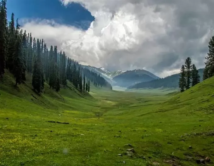
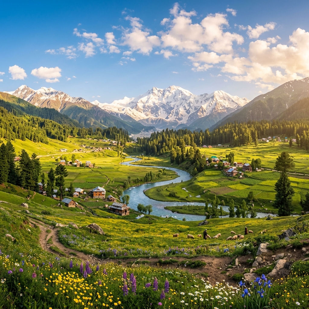
📷 Bungus Valley & Lolab Kupwara
High-altitude virgin meadows and scenic border tourism destinations.
High-definition captures of Suchetgarh, Batalik Indus canyon, Teetwal, Turtuk-Thang, and Kargil frontier bridges.
Reviewed Frontier Records
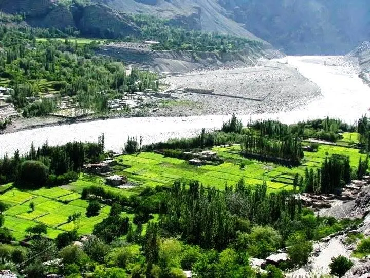
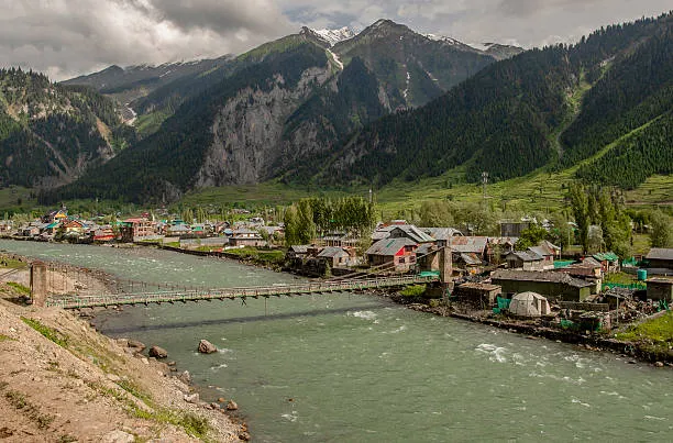
Batalik Sector (Indus Flank, Kargil)
Lush green Aryan valley fields along the Indus River with Pakistani-held mountain heights towering on the right flank.
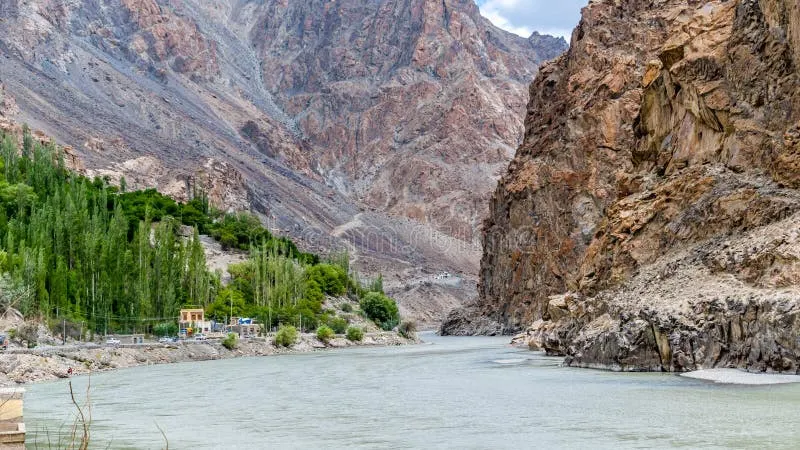
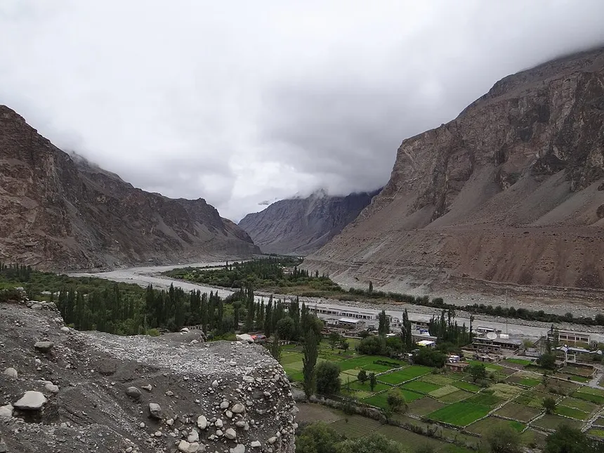
Indus River Canyon (Batalik Gorge)
The Indus cutting through towering sheer granite walls as it flows downstream towards the Line of Control into Baltistan.
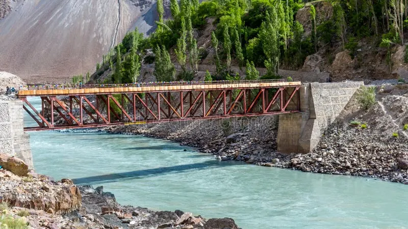
Batalik Frontier Indus Bridge
Strategic bridge across the turquoise Indus river connecting border settlements in the Kargil frontier zone.
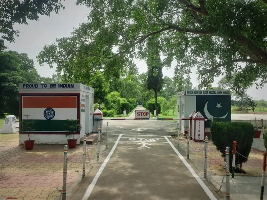
Suchetgarh Zero Line Border Gate
The official Zero Line crossing with Indian Tricolor (BSF) and Pakistani Post under the 100-year-old border Banyan tree.
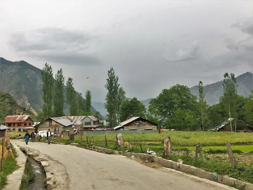
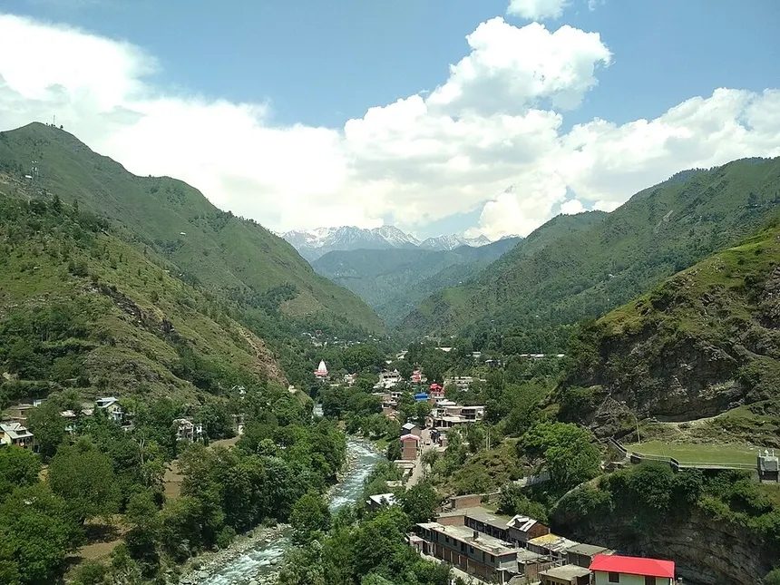
Teetwal (Karnah Valley LoC)
Indian village street of Teetwal directly facing the Pakistani village of Chilhana across the narrow Kishanganga River.
Turtuk & Thang Border Fields
Lush green agricultural plots of India's northernmost village against the towering barren Karakoram gorges.
Detailed Profiles of Border Tourism Hubs
1. The Indus Flank • Kargil District (LoC)
Batalik Sector: The Indus River Sandwiched Between Border Heights
📷 Geographical Landscape of J&K
Spanning Pir Panjal, Great Himalayas, and Zanskar mountain ranges across 20 districts.
Distance: ~55 km from Kargil Town
The Batalik sector in Kargil district lies along the historic Indus River valley, situated right against the Line of Control (LoC). While the Indus flows through Indian territory here, the towering high mountains on the right flank (North/West) are held by Pakistan.
🔭 What You See:Visitors can observe the Indus River flowing downstream directly towards Pakistan, with Pakistani military posts clearly visible on the towering glaciated peaks immediately surrounding the river gorge.
🎖️ Historic 1999 Battleground:Batalik was one of the most critical battlegrounds during the 1999 Kargil War (Jubar Ridge, Point 4812, Khalubar). The valley demonstrates how the Indus is geographically "sandwiched" between Indian and Pakistani heights.
🌿 Aryan Valley Heritage:Home to the ancient Brokpa / Dard Aryan villages of Dha, Hanu, Garkon, and Darchiks, preserving distinct customs, floral headgear, and Indo-Aryan linguistic heritage along the Indus banks.
2. Premier International Border Post • Jammu District
Suchetgarh (RS Pura): The Best Viewpoint on the International Border
Distance: 28 km from Jammu City
Located just 28 km from Jammu city in the RS Pura sector, Suchetgarh is the most accessible spot on the entire International Border (IB). Features a 100-year-old Banyan tree standing on the Zero Line with branches in both countries, view of Sialkot (11 km away), and the daily BSF retreat ceremony.
3. Closest Village-to-Village View • Karnah Valley (Kupwara)
Teetwal: The Village-to-Village Border with Chilhana (PoK)
📷 Gurez Valley & Kishanganga River
Pristine border valley with Dardic Shina culture beneath Habba Khatoon peak.
Distance: ~160 km from Srinagar
The narrow Kishanganga (Neelum) River separates the Indian village of Teetwal from the Pakistani village of Chilhana. Houses on both banks are so remarkably close that visitors can hear sounds, Azan calls, and people talking from across the border. Features the reconstructed Mata Sharda Devi Temple and Gurdwara.
4. Northernmost Frontier • Nubra Valley (Ladakh)
Turtuk & Thang: Closest View of the Indus in Pakistan-Occupied Baltistan
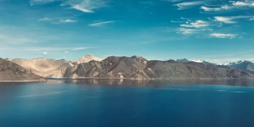
📷 Pangong Tso & Ladakh High Lakes
Deep turquoise alpine lake at 14,270 ft in the cold desert plateau.
Distance: ~205 km from Leh
From the high ridges of Turtuk and the forward border village of Thang, you can clearly see where the Shyok River merges with the Indus River just a few kilometers away in Pakistan-administered Baltistan, overlooking the Pakistani villages of Khaplu and the Chorbat Valley.
Keran Valley (River Border) & Chakan Da Bagh (Poonch LoC Trade Gate)
📷 Gurez Valley & Kishanganga River
Pristine border valley with Dardic Shina culture beneath Habba Khatoon peak.
In Keran Valley, the Kishanganga river is the sole unfenced border overlooking the Pakistani village of Sharda in Neelum Valley. At Chakan Da Bagh (Poonch), tourists look directly across into Tatrinote in Pakistan-administered Kashmir, visiting the designated crossing point for cross-LoC trade and official military flag meetings.
Master Comparison Matrix of Frontier Border Tourism Points
📷 Chakan Da Bagh Border Route Poonch
Historic cross-LoC trade and peace point in Poonch district.
Detailed breakdown of location, border classification, permit requirements, and visual sights.
Suchetgarh (RS Pura)
Region / District
Jammu
Classification
International Border (IB)
Distance from Hub
28 km from Jammu City
Permits & Key Visual Highlights
Valid ID; 100-yr Banyan tree at Zero Line; Sialkot view (11 km); BSF retreat.
Batalik Sector (Indus Flank)
Region / District
Ladakh (Kargil)
Classification
Line of Control (LoC)
Distance from Hub
55 km from Kargil Town
Permits & Key Visual Highlights
ILP required; Indus river gorge; Pakistani military posts on right flank heights; 1999 war site.
Teetwal & Karnah
Region / District
Kashmir (Kupwara)
Classification
Line of Control (LoC)
Distance from Hub
160 km from Srinagar
Permits & Key Visual Highlights
ILP required; village-to-village view with Chilhana (PoK); Sharda Devi Temple.
Turtuk & Thang Village
Region / District
Ladakh (Nubra)
Classification
Line of Control (LoC)
Distance from Hub
205 km from Leh
Permits & Key Visual Highlights
ILP / Army Permit; view where Shyok joins Indus in PoK; view of Khaplu & Chorbat.
Chorbat La Pass
Region / District
Ladakh (Nubra)
Classification
Line of Control (LoC)
Distance from Hub
Near Turtuk / Thang
Permits & Key Visual Highlights
Army Permit; traditional pass looking down into deep Indus gorge in PoK.
Keran Valley
Region / District
Kashmir (Kupwara)
Classification
Line of Control (LoC)
Distance from Hub
130 km from Srinagar
Permits & Key Visual Highlights
Inner Line Permit (ILP); Kishanganga river border; view of Pakistani Sharda village.
Chakan Da Bagh
Region / District
Jammu (Poonch)
Classification
Line of Control (LoC)
Distance from Hub
8 km from Poonch Town
Permits & Key Visual Highlights
Valid ID; Cross-LoC Trade Gate; view of Tatrinote (Pak-administered Kashmir).
Baba Chamliyal Shrine
Region / District
Jammu (Samba)
Classification
International Border (IB)
Distance from Hub
45 km from Jammu City
Permits & Key Visual Highlights
Annual mela at Zero Line; sacred 'Shakkar' & 'Sharbat' exchanged with Pakistan.
Frequently Asked Questions About Border Tourism
What is the significance of the Batalik Sector (The Indus Flank) in Kargil?
The Batalik sector in Kargil district lies along the Indus River valley directly adjacent to the Line of Control. While the Indus flows through Indian territory here, the high mountains on the right flank (North/West) are held by Pakistan with visible Pakistani military posts on the surrounding peaks. It was a crucial battleground in the 1999 Kargil War (Jubar, Khalubar) and home to the ancient Aryan Dardic villages (Dha, Hanu).
What can tourists see at Teetwal village in Kupwara district?
In Teetwal (Karnah Valley), the Line of Control passes right through the settlement along the narrow Kishanganga River. Tourists can see the Indian village of Teetwal and the Pakistani village of Chilhana facing each other so closely that sounds and daily voices can be heard across the water. It also features the reconstructed Mata Sharda Devi Temple and Gurdwara at the historic crossing point.
What is unique about the border view from Turtuk and Thang in Nubra Valley?
Turtuk is the northernmost village in India, reclaimed from Pakistan in the 1971 war. From the high vantage points of Turtuk and Thang village, tourists can look directly into Pakistan-occupied Baltistan, observing where the Shyok River flows down to merge with the Indus River. On clear days, the Pakistani villages of Khaplu and Chorbat Valley in the deep Indus gorge are visible.
What can tourists see at Suchetgarh Border Post in Jammu?
Located just 28 km from Jammu city in RS Pura, Suchetgarh is the most accessible spot on the International Border. Visitors can see a 100-year-old Banyan Tree that stands directly on the Zero Line with branches in both countries, Pakistani watchtowers, agricultural fields, and the town of Sialkot (just 11 km away). It is the only place in Jammu sector where tourists are allowed right up to the Zero Line fence with valid ID.
🏛️Official Data Sources & Fact-Checking Transparency
Public Domain & Statutory Archives
All historical, demographic, examination, and geographic records across this portal are compiled from public domain repositories, including the Official Gazette of India (egazette.nic.in), Census of India Demographic Data, India Meteorological Department (IMD), and statutory notifications issued by the J&K Administration & Examination Boards.