🚗 3. Batote (~1,800m) & Banihal (~1,650m):Highway snow zones on NH-44 receiving 1–4 ft snow; reliable snow experience without deep trekking (~2–3 hrs from Jammu).
❄️ 4. Gandoh Bhalesa (2,000m–2,500m):Very heavy snowfall (4+ ft in single spell); deep snow capital of Doda with winter road cutoffs.
Master Snowfall Intensity & Altitude Matrix
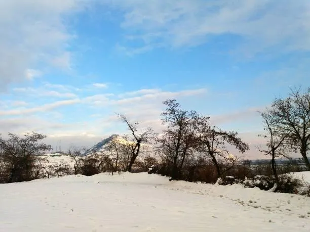
📷 Snowbound Himalayan Landscapes
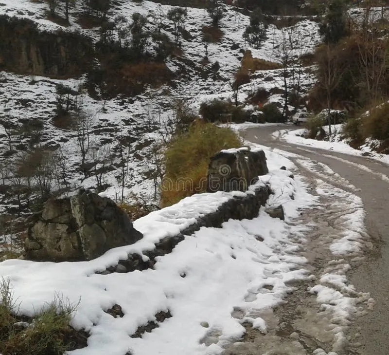
Winter snow cover transforming mountain slopes and pine canopies.
Standardized regional metrics comparing altitudes, snowfall depth, and intensity ratings across Jammu Division.
Gandoh (Bhalesa)
District
Doda
Approx. Altitude
2,000m – 2,500m
Snowfall Intensity
Very Heavy (4+ ft)
Winter Access & Terrain Highlights
Deep snow capital; single spell can drop 14"–4 ft; snowbound for months.
Sinthan Top & Mughal Maidan
District
Kishtwar
Approx. Altitude
3,784m *(Pass)* / 2,000–2,500m *(Maidan)*
Snowfall Intensity
Extreme (5+ ft)
Winter Access & Terrain Highlights
Snowbound 5–6 months; popular for winter camping & alpine skiing on NH-244.
Machail Shrine & Village
District
Kishtwar (Paddar)
Approx. Altitude
1,829m *(Peaks >3,000m)*
Snowfall Intensity
Heavy (3–4 ft)
Winter Access & Terrain Highlights
High pilgrimage site; route closed Dec to Feb due to deep snow accumulation.
Gulabgarh (Paddar)
District
Kishtwar
Approx. Altitude
Avg 2,225m *(1,780m–3,295m)*
Snowfall Intensity
Moderate to Heavy
Winter Access & Terrain Highlights
Basecamp for Machail Yatra; dense deodars; early snow spells.
Patnitop & Nathatop
District
Ramban / Udhampur
Approx. Altitude
2,024m – 2,700m
Snowfall Intensity
Moderate (2–3 ft)
Winter Access & Terrain Highlights
Most popular resort (~112 km from Jammu); Skyview Gondola & ski slopes.
Batote & Banihal
District
Ramban
Approx. Altitude
Batote 1,800m / Banihal 1,650m
Snowfall Intensity
Moderate (1–2 ft)
Winter Access & Terrain Highlights
Highway towns on NH-44; easy road access; reliable snow in Jan–Feb.
Bhaderwah Town & Padri
District
Doda
Approx. Altitude
1,600m *(Town)* / 3,200m *(Padri)*
Snowfall Intensity
Moderate (2–3 ft in Town, 8+ ft at Padri)
Winter Access & Terrain Highlights
"Kashmir of Jammu"; Jai Valley, Guldanda snow bowls, and Padri pass.
Trikuta Hills (Vaishno Devi)
District
Reasi
Approx. Altitude
1,584m *(Bhawan)* / 2,014m *(Bhairon)*
Snowfall Intensity
Light to Moderate (2–6 inches)
Winter Access & Terrain Highlights
Holy pilgrimage shrine; Bhairon Ghati & Himkoti; chopper service suspended during snow.
Northern Reasi Ridges (Mahore)
District
Reasi
Approx. Altitude
1,800m – 3,000m+
Snowfall Intensity
Moderate (1–2 ft)
Winter Access & Terrain Highlights
Upper forested ridges north of Pouni & Mahore bordering Pir Panjal / Ramban.
Bufliaz (Bafliaz)
District
Poonch
Approx. Altitude
~2,000+ meters
Snowfall Intensity
Consistent (7" – 2 ft)
Winter Access & Terrain Highlights
Base of Mughal Road; serene, uncrowded authentic village winter life.
Visual Photographic Archive: Jammu Snowfall
📷 Snowbound Himalayan Landscapes
Winter snow cover transforming mountain slopes and pine canopies.
Reviewed field captures across Trikuta Hills (Vaishno Devi), Sinthan Top, Mughal Maidan, Kishtwar peaks, Batote, and Machail.
Reviewed Field Gallery
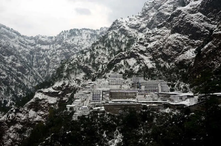
Vaishno Devi Bhawan under Snow
The holy shrine complex nestled beneath snow-capped Trikuta peaks (1,584m / 5,200 ft).
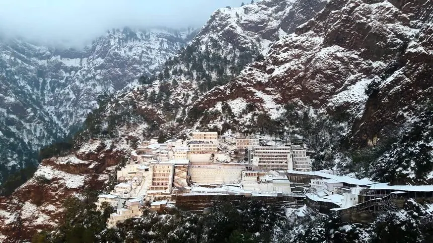
Trikuta Shrine Snow Panorama
Elevated panoramic perspective of the snow-clad pilgrimage structures and forested slopes.
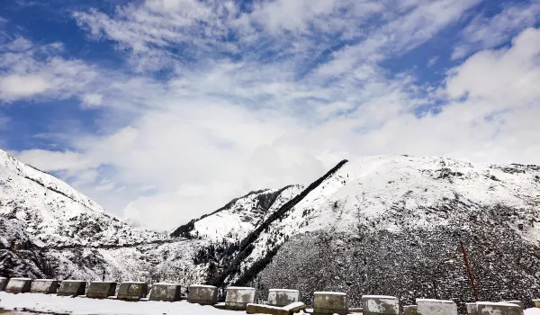
Sinthan Top (3,784m) Pass Road
Snowbanks along the high-altitude NH-244 pass connecting Kishtwar to Anantnag.
Mughal Maidan Snow Plateau
Vast snow-covered alpine meadow (2,000–2,500m) popular for winter camping and skiing.
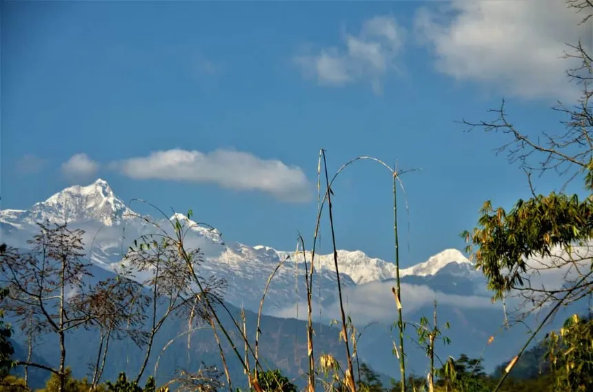
Kishtwar Himalayan Ranges
Towering glaciated summits exceeding 6,000m rising above the Chenab valley floor.
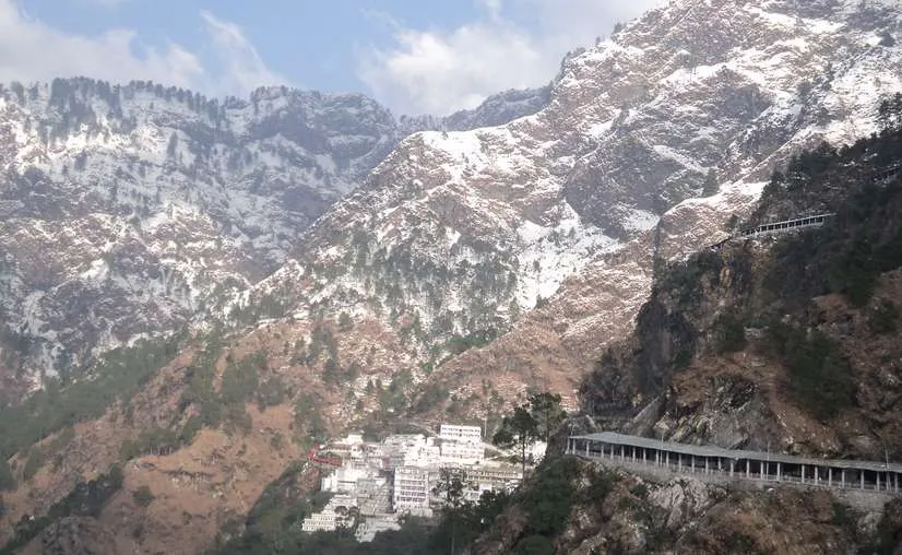
Vaishno Devi Track & Snowy Peaks
Wide-angle capture of the covered pilgrim track winding below soaring snow-capped Trikuta summits.
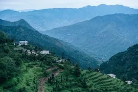
Reasi & Mahore Hillside Terraces
High agricultural terraces and mountain villages in the northern Himalayan ridges of Reasi.
Detailed Profiles of Jammu Snowfall Hubs
📷 Snowbound Himalayan Landscapes
Winter snow cover transforming mountain slopes and pine canopies.
Holy cave shrine in the Trikuta hills drawing millions of pilgrims.
Altitude: 1,584m *(Bhawan)* | 2,014m *(Bhairon)*
The most prominent snowfall location in Reasi district is the Trikuta Hills range, where the revered Mata Vaishno Devi Shrine is located. The shrine itself sits at an altitude of approximately 1,584 meters (5,200 ft), while upper ridges like Bhairon Ghati (2,014m / 6,600 ft), Himkoti, and Sanjichhat receive moderate snowfall of 2 to 6 inches. Fresh snow frequently covers the three sacred peaks, creating an enchanting winter wonderland for pilgrims.
🚁 Operational Impact:Snowfall and cloud cover frequently lead to precautionary suspension of Katra–Sanjichhat helicopter services and ropeway operations.
🛕 Snow Experience:Covered track from Katra ensures pedestrian yatra continues safely with hot water facilities and winter blankets provided by the Shrine Board.
Higher Northern Reaches of Reasi (Mahore & Pir Panjal Ridges)
The northern parts of Reasi bordering the Pir Panjal range and high Himalayas (altitudes 1,800m to over 3,000m north of Pouni, Mahore, and the Gool-Gulabgarh border) receive light to moderate snowfall (1–2 ft), often coinciding with weather events across neighboring Ramban (Patnitop) and Doda (Bhaderwah).
2. Extreme Pass • Kishtwar District
Sinthan Top (3,784m) & Mughal Maidan
📷 High Himalayan Mountain Passes
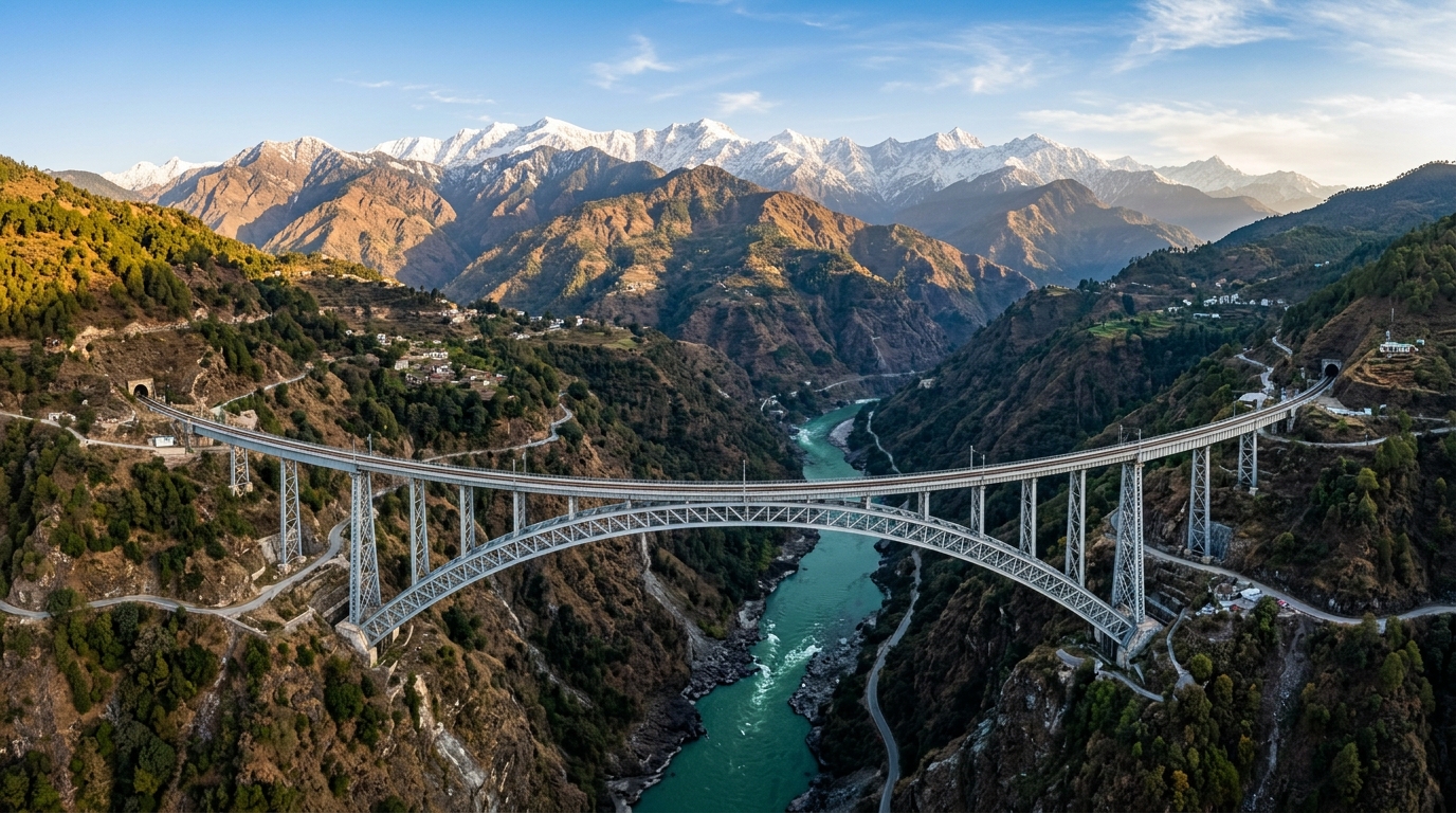
Strategic alpine passes offering connectivity across scenic mountain ranges.
While Sinthan Top is a towering high-altitude pass at 3,784 meters on NH-244, the surrounding alpine meadows and valleys like Mughal Maidan (on the border of Kishtwar and Anantnag) receive massive snow accumulation, often exceeding 4 to 5+ feet. The pass remains snowbound for 5 to 6 months of the year and is a renowned destination for winter camping and backcountry skiing.
Winter snow cover transforming mountain slopes and pine canopies.
Altitude: Batote 1,800m | Banihal 1,650m
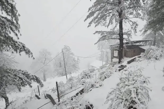
Located directly on the Jammu-Srinagar National Highway (NH-44), Batote and Banihal frequently receive 1 to 4 feet of snow, causing temporary highway closures during intense winter spells. These accessible towns offer a reliable, authentic snow experience without requiring deep off-road trekking, located just 2 to 3 hours' drive from Jammu city.
4. Deep Snow Capital • Doda District
Gandoh (Bhalesa): Deep Snow Epicenter (4+ ft)
📷 Snowbound Himalayan Landscapes
Winter snow cover transforming mountain slopes and pine canopies.
Altitude: 2,000m – 2,500m
Notorious for receiving the deepest single-spell snowfalls in Jammu (14" to 5 ft), Gandoh and surrounding hamlets (Bhalla, Thathri, Kahara) remain snowbound for months with sub-zero Himalayan winters.
Frequently Asked Questions About Jammu Snowfall
📷 Shri Mata Vaishno Devi Shrine
Holy cave shrine in the Trikuta hills drawing millions of pilgrims.
Does it snow at Mata Vaishno Devi Shrine and Trikuta Hills?
Yes, the Trikuta Hills range in Reasi district receives moderate snowfall (2–6 inches) during January and February. The holy Vaishno Devi Bhawan sits at 1,584 meters (5,200 ft), while higher vantage points like Bhairon Ghati (2,014m / 6,600 ft) and Sanjichhat receive thicker snow. Snowfall often leads to temporary suspension of helicopter services from Katra.
Where does it snow in northern Reasi district?
The higher northern reaches of Reasi district bordering the Pir Panjal range (altitudes 1,800m to over 3,000m north of Mahore and Pouni) experience light to moderate snow (1–2 ft), coinciding with winter storms across neighboring Ramban and Doda districts.
What are the snowfall characteristics of Sinthan Top & Mughal Maidan?
Sinthan Top sits at an altitude of 3,784 meters (12,415 ft) on NH-244, while Mughal Maidan sits between 2,000–2,500 meters on the Kishtwar-Anantnag border. These areas receive extreme snowfall exceeding 4 to 5+ feet, remaining snowbound for 5 to 6 months.
How accessible are Batote & Banihal for winter snow experiences?
Located along the Jammu-Srinagar National Highway (NH-44), Batote (~1,800m) and Banihal (~1,650m) in Ramban district receive 1 to 4 feet of snow during January and February, accessible within 2 to 3 hours from Jammu city without deep trekking.
Explore Related Jammu & Kashmir Portals & Guides
📷 Weather & Hydrological Monitoring
Real-time IMD updates and river gauge tracking across Jhelum and Chenab basins.
🏛️Official Data Sources & Fact-Checking Transparency
Public Domain & Statutory Archives
All historical, demographic, examination, and geographic records across this portal are compiled from public domain repositories, including the Official Gazette of India (egazette.nic.in), Census of India Demographic Data, India Meteorological Department (IMD), and statutory notifications issued by the J&K Administration & Examination Boards.