🏔 Master Himalayan Trans-Boundary Archive

Ladakh, Zanskar & Kargil Travel Encyclopedia

Comprehensive field intelligence covering all 72 high-altitude lakes, ancient Buddhist gompas, extreme motorable passes, secluded valleys, and border hamlets with 325+ authentic high-resolution photographs.

Administrative Context: On 27 April 2026, the Administration of Union Territory of Ladakh formally notified 7 revenue districts: Leh, Kargil, Zanskar, Drass, Sham, Nubra, and Changthang.
72 Destinations Mapped
325+ Authentic Photos
19,024 ft Highest Pass (Umling La)
22 Ancient Monasteries
7 Notified Districts
12 Glacial & Salt Lakes

Iconic Trans-Himalayan Visual Showcase

Curated photography across high glacial lakes, extreme mountain passes, and ancient monastic cliff forts.

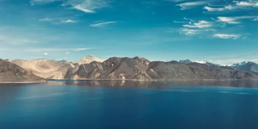
Pangong Tso Lake
High-Altitude Salt Lake

Pangong Tso (14,270 ft)

Thiksey Monastery
12-Storey Gelugpa Gompa

Thiksey Monastery

Umling La Pass
World's Highest Motorable Pass

Umling La (19,024 ft)

Phugtal Cave Monastery
Honeycomb Cliff Cave

Phugtal Gompa (Zanskar)

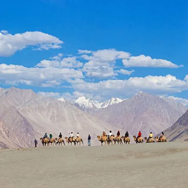
Nubra Valley Hunder Dunes
Sand Dunes & Camels

Nubra Valley (Hunder)

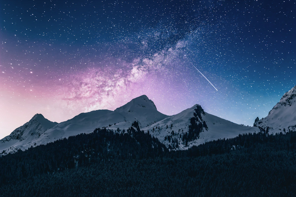
Hanle Dark Sky Reserve
Dark Sky Reserve & Observatory

Hanle Changthang (14,760 ft)

🔍
Showing 72 destinations
Pangong Tso (Pangong Lake) 📷 5 Photos 🏔 14,270 ft (4,350 m) High-Altitude Lake & Ramsar Site
Pangong Tso (Pangong Lake) photo 1
Pangong Tso (Pangong Lake) photo 2
Pangong Tso (Pangong Lake) photo 3
Pangong Tso (Pangong Lake) photo 4
📍 Changthang, Leh District 🚗 160 km from Leh

Pangong Tso (Pangong Lake)

The Enchanted Trans-Boundary Azure Lake

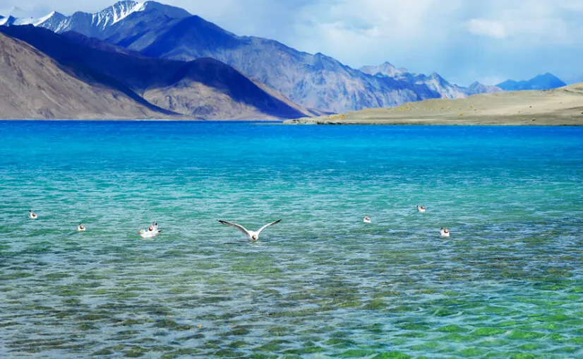
Pangong Tso is an endorheic salt lake situated at 14,270 ft, extending over 134 km from India into the Tibetan Autonomous Region. Renowned for its shifting shades of sapphire, turquoise, and deep cobalt blue against stark brown peaks, the lake completely freezes solid in winter despite its salinity.

14,270 ft Altitude134 km Trans-Boundary LakeHigh-Altitude Salt Lake
Tso Moriri (Mountain Lake) 📷 4 Photos 🏔 14,836 ft (4,522 m) High-Altitude Lake & Ramsar Site
Tso Moriri (Mountain Lake) photo 1
Tso Moriri (Mountain Lake) photo 2
Tso Moriri (Mountain Lake) photo 3
Tso Moriri (Mountain Lake) photo 4
📍 Rupshu Plateau, Changthang 🚗 220 km from Leh

Tso Moriri (Mountain Lake)

Sacred Turquoise Sanctuary of the Changpa Nomads

Tso Moriri is a pristine Ramsar wetland site located at 14,836 ft in the remote Rupshu valley. Flanked by snowcapped peaks rising above 6,000 meters, this sacred lake is home to the ancient Korzok Monastery and serves as a vital breeding habitat for endangered Black-necked Cranes and Tibetan wild asses.

14,836 ft ElevationDesignated Ramsar WetlandChangpa Nomad Heartland
Nubra Valley (Valley of Flowers) 📷 5 Photos 🏔 10,000 ft (3,048 m) Valley & Cold Desert
Nubra Valley (Valley of Flowers) photo 1
Nubra Valley (Valley of Flowers) photo 2
Nubra Valley (Valley of Flowers) photo 3
Nubra Valley (Valley of Flowers) photo 4
📍 North of Leh across Khardung La 🚗 125 km from Leh

Nubra Valley (Valley of Flowers)

Double-Humped Camels & Towering Glacial Valleys

Nubra Valley, originally Dumra (Valley of Flowers), is a high-altitude cold desert where the Shyok and Siachen rivers converge. Known for the rolling white sand dunes of Hunder with double-humped Bactrian camels, apricot orchards, and the dramatic 106-ft Maitreya Buddha statue at Diskit Monastery.

10,000 ft ElevationBactrian Camel Safari106 ft Maitreya Buddha
Khardung La Pass 📷 5 Photos 🏔 17,582 ft (5,359 m) High Mountain Pass
Khardung La Pass photo 1
Khardung La Pass photo 2
Khardung La Pass photo 3
Khardung La Pass photo 4
📍 Ladakh Mountain Range 🚗 40 km from Leh

Khardung La Pass

Gateway to Nubra Valley & Siachen Glacier

Khardung La is a world-renowned high mountain pass at 17,582 ft maintained by Border Roads Organisation Project Himank. Serving as the vital strategic lifeline between Leh and the Nubra and Siachen sectors, it offers sweeping vistas across the Karakoram range.

17,582 ft Motorable PassGateway to SiachenBRO Himank Engineering Marvel
Zanskar Valley 📷 5 Photos 🏔 11,500 – 14,500 ft (3,500 – 4,400 m) High Valley & Adventure Trek
Zanskar Valley photo 1
Zanskar Valley photo 2
Zanskar Valley photo 3
Zanskar Valley photo 4
📍 Kargil District (Padum Center) 🚗 240 km from Leh

Zanskar Valley

Home of the Frozen River Chadar Trek & Ancient Monasteries

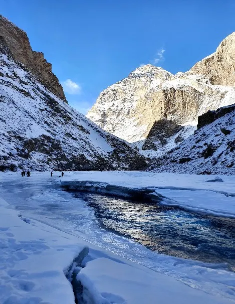
Zanskar is one of the most secluded and culturally intact valleys in the Himalayas, nestled between the Great Himalayan and Zanskar mountain ranges. Famous for dramatic rock canyons, cliffside monasteries like Phugtal and Karsha, and the winter Chadar Trek over the frozen Zanskar River.

13,000 ft Average ElevationChadar Frozen River TrekDrang-Drung Glacier
Thiksey Monastery (Mini Potala) 📷 5 Photos 🏔 11,800 ft (3,600 m) Monastery & Heritage
Thiksey Monastery (Mini Potala) photo 1
Thiksey Monastery (Mini Potala) photo 2
Thiksey Monastery (Mini Potala) photo 3
Thiksey Monastery (Mini Potala) photo 4
📍 19 km east of Leh, Indus Valley 🚗 19 km from Leh

Thiksey Monastery (Mini Potala)

Grand Gelugpa Gompa Resembling Lhasa's Potala Palace

Thiksey Monastery is a magnificent 12-storey Gelugpa complex founded in 1430 AD by Changsem Sherab Zangpo. Perched on a hillock overlooking the Indus River, it enshrines the iconic 49-foot Maitreya Buddha statue consecrated by the 14th Dalai Lama.

11,800 ft Elevation49-ft Maitreya BuddhaMorning Puja Ceremony
Hemis Monastery 📷 5 Photos 🏔 12,000 ft (3,657 m) Monastery & Heritage
Hemis Monastery photo 1
Hemis Monastery photo 2
Hemis Monastery photo 3
Hemis Monastery photo 4
📍 45 km south of Leh, Indus Gorge 🚗 45 km from Leh

Hemis Monastery

Home of the World-Renowned Hemis Festival & Cham Dances

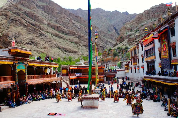
Hemis Monastery is the spiritual headquarters of the Drukpa Kagyu lineage in Ladakh, established in 1630 by King Sengge Namgyal and Stagsang Raspa. Hidden inside a mountain gorge, it houses priceless antiquities, golden stupas, and hosts the colorful annual Hemis Tsechu festival.

12,000 ft AltitudeHemis Tsechu Masked DanceAncient Drukpa Lineage
Leh Palace (Lhachen Palkhar) 📷 5 Photos 🏔 11,550 ft (3,520 m) Heritage Fort & Palace
Leh Palace (Lhachen Palkhar) photo 1
Leh Palace (Lhachen Palkhar) photo 2
Leh Palace (Lhachen Palkhar) photo 3
Leh Palace (Lhachen Palkhar) photo 4
📍 Namgyal Hill, Old Town Leh 🚗 1 km from Leh

Leh Palace (Lhachen Palkhar)

The Grand Royal Seat of the Namgyal Dynasty

Built in 1553-1600 by King Sengge Namgyal, this 9-storey fortress palace was modeled on Lhasa's Potala Palace. Dominating the skyline of Leh, it features historic timber balconies, royal prayer shrines, and panoramic vistas across the Stok Kangri mountain range.

11,550 ft Altitude9-Storey Mud-Brick ArchitectureStok Kangri Panoramic Views
Shanti Stupa 📷 5 Photos 🏔 11,840 ft (3,609 m) Monument & Viewpoint
Shanti Stupa photo 1
Shanti Stupa photo 2
Shanti Stupa photo 3
Shanti Stupa photo 4
📍 Chanspa Hilltop, Leh 🚗 4 km from Leh

Shanti Stupa

Golden Relic Stupa Overlooking the Indus Valley

Shanti Stupa is a brilliant white-domed Buddhist chorten inaugurated in 1991 by the 14th Dalai Lama. Built by Japanese Buddhist monk Bhikshu Gyomyo Nakamura, it houses holy relics of the Buddha and offers the most breathtaking 360-degree sunset view in Ladakh.

11,840 ft AltitudeInaugurated by Dalai Lama360-Degree Valley Vistas
Hall of Fame, Leh 📷 5 Photos 🏔 11,500 ft (3,505 m) Museum & War Memorial
Hall of Fame, Leh photo 1
Hall of Fame, Leh photo 2
Hall of Fame, Leh photo 3
Hall of Fame, Leh photo 4
📍 Leh-Kargil Road (Near Airport) 🚗 5 km from Leh

Hall of Fame, Leh

Honoring the Bravehearts of Operation Vijay & Siachen

Built and maintained by the Indian Army, Hall of Fame is a stirring museum and memorial dedicated to Indian soldiers who made the supreme sacrifice in wars fought in Ladakh. Features exhibits on Operation Vijay (Kargil War), Siachen Glacier equipment, and Ladakhi cultural history.

11,500 ft ElevationIndian Army Op Vijay ExhibitsSiachen Living Simulator
Magnetic Hill 📷 5 Photos 🏔 11,000 ft (3,350 m) Natural Phenomenon & Highway Sight
Magnetic Hill photo 1
Magnetic Hill photo 2
Magnetic Hill photo 3
Magnetic Hill photo 4
📍 Srinagar-Leh Highway, 30 km west of Leh 🚗 30 km from Leh

Magnetic Hill

The Famous Hill Where Vehicles Defy Gravity

Magnetic Hill is a famous optical illusion on the Srinagar-Leh highway where the layout of surrounding slopes creates the impression that vehicles parked in neutral roll uphill against gravity at speeds of 10 to 20 km/h.

11,000 ft ElevationGravity Defying IllusionNH-1 Scenic Drive
Gurudwara Pathar Sahib 📷 4 Photos 🏔 11,000 ft (3,350 m) Pilgrimage & Heritage
Gurudwara Pathar Sahib photo 1
Gurudwara Pathar Sahib photo 2
Gurudwara Pathar Sahib photo 3
Gurudwara Pathar Sahib photo 4
📍 Srinagar-Leh Highway, 25 km west of Leh 🚗 25 km from Leh

Gurudwara Pathar Sahib

Sacred Boulder Commemorating Guru Nanak Dev Ji's 1517 Visit

Constructed in 1517 to commemorate Guru Nanak Dev Ji's travels through Tibet and Ladakh, this revered Gurudwara enshrines a giant boulder carrying the miraculous imprint of Guru Nanak's back and the footmark of a defeated demon. Maintained with deep devotion by the Indian Army.

11,000 ft Elevation1517 AD Historic VisitIndian Army Langar
Alchi Monastery (Alchi Chos-khor) 📷 5 Photos 🏔 10,200 ft (3,100 m) Monastery & UNESCO Tentative List
Alchi Monastery (Alchi Chos-khor) photo 1
Alchi Monastery (Alchi Chos-khor) photo 2
Alchi Monastery (Alchi Chos-khor) photo 3
Alchi Monastery (Alchi Chos-khor) photo 4
📍 Alchi Village, Indus Valley, 66 km west of Leh 🚗 66 km from Leh

Alchi Monastery (Alchi Chos-khor)

Priceless Kashmiri Frescoes & 1,000-Year-Old Carvings

Built in the 11th century by Great Translator Lotsawa Rinchen Zangpo, Alchi is unique as the only monastery in Ladakh built on flat ground. Celebrated for its extraordinarily preserved Indo-Kashmiri style frescoes, wood carvings, and the three-tiered Sumtseg Temple.

10,200 ft Elevation11th-Century Kashmiri ArtUNESCO Tentative Heritage
Lamayuru Monastery (Yuru Gompa) 📷 5 Photos 🏔 11,520 ft (3,510 m) Monastery & Geological Wonder
Lamayuru Monastery (Yuru Gompa) photo 1
Lamayuru Monastery (Yuru Gompa) photo 2
Lamayuru Monastery (Yuru Gompa) photo 3
Lamayuru Monastery (Yuru Gompa) photo 4
📍 Srinagar-Leh Highway, 127 km west of Leh 🚗 127 km from Leh

Lamayuru Monastery (Yuru Gompa)

11th-Century Drikung Sanctuary Perched on Surreal Lunar Formations

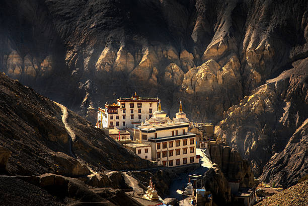
Lamayuru is one of the oldest and most photogenic monasteries in Ladakh, founded in the 11th century by Mahasiddha Naropa. Perched on yellow sedimentary clay formations known as 'Moonland' (a desiccated prehistoric lakebed), it offers unmatched surreal geology.

11,520 ft ElevationPrehistoric Lakebed MoonlandFounded by Naropa
Phugtal Monastery (Phuktal Cave Gompa) 📷 5 Photos 🏔 12,600 ft (3,850 m) Monastery & Trekking Wonder
Phugtal Monastery (Phuktal Cave Gompa) photo 1
Phugtal Monastery (Phuktal Cave Gompa) photo 2
Phugtal Monastery (Phuktal Cave Gompa) photo 3
Phugtal Monastery (Phuktal Cave Gompa) photo 4
📍 Lungnak Valley, Southeastern Zanskar 🚗 310 km from Leh

Phugtal Monastery (Phuktal Cave Gompa)

The World's Most Isolated Monastery Carved into a Cliff Cave

Phugtal Monastery is an extraordinary 12th-century Gelugpa monastery built like a honeycomb around a massive natural limestone cave in the sheer cliff face of Lungnak River gorge. Founded by Gangsem Sherap Sampo, it is reached exclusively on foot through stunning alpine gorges.

12,600 ft ElevationHoneycomb Cave ArchitectureSacred Natural Spring
Turtuk Village 📷 4 Photos 🏔 9,846 ft (3,001 m) Cultural Village & Border Tourism
Turtuk Village photo 1
Turtuk Village photo 2
Turtuk Village photo 3
Turtuk Village photo 4
📍 Nubra Valley, near Line of Control 🚗 205 km from Leh

Turtuk Village

The Last Indian Village with Living Balti Royal Heritage

Turtuk is a picturesque Balti village on the banks of the Shyok River, liberated by the Indian Army in 1971. Rich in apricot and walnut groves, it features traditional stone houses, ancient wooden irrigation canals, and the wooden palace of the Yabgo royal dynasty.

9,846 ft ElevationBalti Royal HeritageLast Indian Frontier Before PoK
Chang La Pass 📷 5 Photos 🏔 17,688 ft (5,391 m) High Mountain Pass
Chang La Pass photo 1
Chang La Pass photo 2
Chang La Pass photo 3
Chang La Pass photo 4
📍 Route from Leh to Pangong Tso 🚗 75 km from Leh

Chang La Pass

The Mighty 17,688 ft Gateway to Changthang

Chang La is the third-highest motorable mountain pass in the world at 17,688 ft, crossing the Ladakh Range. Guarded by the holy Changla Baba Temple, the pass is framed by towering snowfields and serves as the gateway to the nomadic Changthang plateau.

17,688 ft AltitudeGateway to PangongSnowbound Year-Round
Hanle (Dark Sky Reserve & Observatory) 📷 4 Photos 🏔 14,764 ft (4,500 m) Astronomy & Dark Sky Sanctuary
Hanle (Dark Sky Reserve & Observatory) photo 1
Hanle (Dark Sky Reserve & Observatory) photo 2
Hanle (Dark Sky Reserve & Observatory) photo 3
Hanle (Dark Sky Reserve & Observatory) photo 4
📍 Eastern Changthang, near Tibet border 🚗 255 km from Leh

Hanle (Dark Sky Reserve & Observatory)

India's First Dark Sky Reserve & World's Highest Optical Telescope

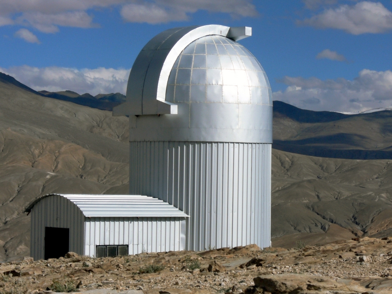
Hanle is a secluded high-altitude valley home to India's first designated Dark Sky Reserve and the Indian Astronomical Observatory at Mt. Saraswati (14,764 ft). Crowned by the historic 17th-century Hanle Gompa, it offers the clearest stargazing and Milky Way views on planet Earth.

14,764 ft ElevationCertified Dark Sky ReserveWorld-Class Stargazing
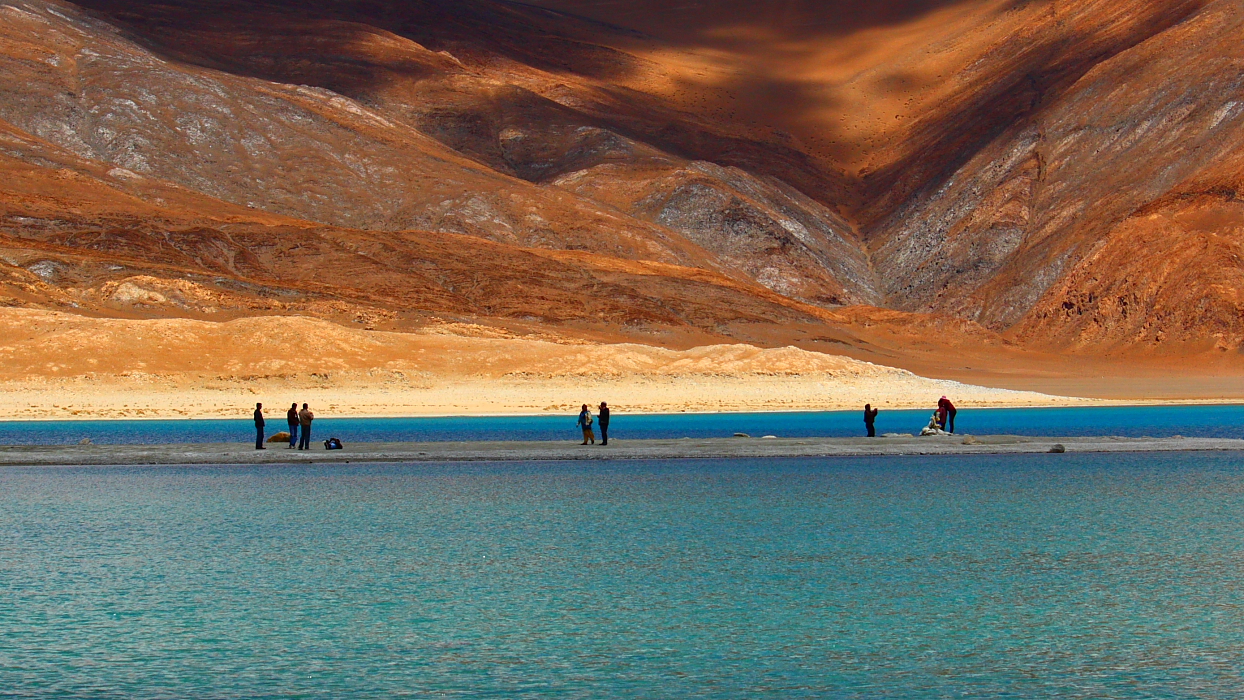
Tso Kar (White Lake) 📷 5 Photos 🏔 14,860 ft (4,530 m) High-Altitude Lake & Ramsar Site
Tso Kar (White Lake) photo 1
Tso Kar (White Lake) photo 2
Tso Kar (White Lake) photo 3
Tso Kar (White Lake) photo 4
📍 Rupshu Valley, Changthang 🚗 150 km from Leh

Tso Kar (White Lake)

Salt Encrusted Shores & Pristine Wildlife Wetland

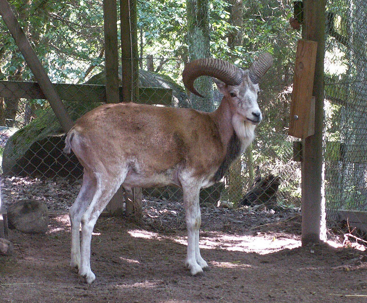
Tso Kar is a fluctuating hypersaline lake situated at 14,860 ft in the Rupshu plateau, recognized as a Ramsar Wetland of International Importance. Its brilliant white salt crust contrasts with deep blue waters, attracting rare wildlife like Tibetan argali, kiang, and migratory waterfowl.

14,860 ft AltitudeDesignated Ramsar WetlandSalt-Crusted Shorelines
Basgo Palace & Monastery Ruins 📷 5 Photos 🏔 10,800 ft (3,292 m) Heritage Fort & UNESCO Site
Basgo Palace & Monastery Ruins photo 1
Basgo Palace & Monastery Ruins photo 2
Basgo Palace & Monastery Ruins photo 3
Basgo Palace & Monastery Ruins photo 4
📍 40 km west of Leh, Indus Valley 🚗 40 km from Leh

Basgo Palace & Monastery Ruins

UNESCO World Heritage Watch Listed Medieval Citadel

Basgo was the historic political capital of Lower Ladakh, fortified in the 15th century. Standing dramatically on reddish sandstone pinnacles, the ruins include mud-brick battlements and the sacred Chamba Lhakhang housing a towering copper-gilded statue of Maitreya Buddha.

10,800 ft Elevation15th-Century Capital RuinsWorld Monuments Watch Site
General Zorawar Fort, Leh 📷 5 Photos 🏔 11,500 ft (3,500 m) Heritage Fort
General Zorawar Fort, Leh photo 1
General Zorawar Fort, Leh photo 2
General Zorawar Fort, Leh photo 3
General Zorawar Fort, Leh photo 4
📍 Skara, Leh Town 🚗 2 km from Leh

General Zorawar Fort, Leh

Historic Fort of the 'Napoleon of India' General Zorawar Singh

Constructed in 1836 by Dogra General Zorawar Singh Kahluria following his legendary conquest of Ladakh and Western Tibet. Built of sun-dried clay bricks and wooden beams, it houses a military museum of cannons, old currency, and artifacts from the Dogra campaigns.

11,500 ft AltitudeBuilt in 1836 ADDogra Dynasty Conquest Landmark
Shey Palace and Monastery 📷 5 Photos 🏔 11,200 ft (3,415 m) Heritage Palace & Monastery
Shey Palace and Monastery photo 1
Shey Palace and Monastery photo 2
Shey Palace and Monastery photo 3
Shey Palace and Monastery photo 4
📍 15 km south of Leh 🚗 15 km from Leh

Shey Palace and Monastery

Home to the Colossal Gilded Shakyamuni Buddha

Shey Palace was built in 1655 by King Deldan Namgyal as a summer retreat. Famous for its 12-meter-tall seated Shakyamuni Buddha statue made of gilded copper and brass, and the historic sacred fish pond fed by crystal mountain springs.

11,200 ft ElevationBuilt in 1655 AD12-Meter Gilded Buddha
Namgyal Tsemo Monastery & Red Fort 📷 5 Photos 🏔 11,900 ft (3,627 m) Monastery & Fort
Namgyal Tsemo Monastery & Red Fort photo 1
Namgyal Tsemo Monastery & Red Fort photo 2
Namgyal Tsemo Monastery & Red Fort photo 3
Namgyal Tsemo Monastery & Red Fort photo 4
📍 Peak above Leh Palace 🚗 3 km from Leh

Namgyal Tsemo Monastery & Red Fort

The Crown of Leh Built by King Tashi Namgyal

Founded in 1430 AD by King Tashi Namgyal on the craggy summit above Leh Palace, Namgyal Tsemo features a three-storey gold statue of Maitreya Buddha and historic frescoes of guardian deities, offering breathtaking bird's-eye views of the entire Leh valley.

11,900 ft AltitudeBuilt in 1430 ADHighest Viewpoint Over Leh
Central Asian Museum, Leh 📷 5 Photos 🏔 11,500 ft (3,505 m) Museum & Cultural Center
Central Asian Museum, Leh photo 1
Central Asian Museum, Leh photo 2
Central Asian Museum, Leh photo 3
Central Asian Museum, Leh photo 4
📍 Main Bazaar, Old Town Leh 🚗 Leh District

Central Asian Museum, Leh

The Living Crossroads of Tibet, Kashmir & Yarkand Caravans

Located in an authentic four-storey stone tower replica of a traditional Lhasa mansion, this museum chronicles Leh's historical role as the premier nexus of the trans-Himalayan Silk Route connecting Yarkand, Kashgar, Tibet, and India.

11,500 ft ElevationSilk Route Caravan ArchivesOld Town Leh Cultural Hub
Hemis National Park 📷 5 Photos 🏔 10,800 – 19,700 ft (3,300 – 6,000 m) National Park & Wildlife
Hemis National Park photo 1
Hemis National Park photo 2
Hemis National Park photo 3
Hemis National Park photo 4
📍 Eastern Ladakh (Rumbak & Markha Valleys) 🚗 40 km from Leh

Hemis National Park

India's Largest High-Altitude Wildlife Sanctuary

Spanning 4,400 sq km, Hemis National Park is globally famous as the foremost sanctuary for the elusive Snow Leopard (Shan). Surrounded by rugged gorges and alpine meadows, it also shelters Tibetan wolves, Eurasian brown bears, blue sheep (bharal), and golden eagles.

4,400 sq km SanctuaryHighest Snow Leopard DensityAlpine Himalayan Wilderness
Dah and Hanu Villages (Aryan Valley) 📷 4 Photos 🏔 9,000 ft (2,743 m) Tribal Heritage Village
Dah and Hanu Villages (Aryan Valley) photo 1
Dah and Hanu Villages (Aryan Valley) photo 2
Dah and Hanu Villages (Aryan Valley) photo 3
Dah and Hanu Villages (Aryan Valley) photo 4
📍 Lower Indus Valley, 160 km northwest of Leh 🚗 160 km from Leh

Dah and Hanu Villages (Aryan Valley)

Unique Indo-Aryan Enclave with Distinct Costumes & Traditions

Dah and Hanu are villages of the indigenous Brokpa (Drokpa) community, who claim direct descent from the soldiers of Alexander the Great. Distinct in language, animist Bon-Buddhist rituals, and vibrant floral headdresses (Kho), the valley is famous for warm climates, lush grapes, and sweet apricots.

9,000 ft Low ElevationBrokpa Aryan CultureFloral Headgear Traditions
Uleytokpo 📷 4 Photos 🏔 10,000 ft (3,048 m) Riverside Camping & Nature
Uleytokpo photo 1
Uleytokpo photo 2
Uleytokpo photo 3
Uleytokpo photo 4
📍 Indus Valley, 70 km west of Leh 🚗 70 km from Leh

Uleytokpo

Peaceful River Retreat for Acclimatization

Uleytokpo is a peaceful village on the banks of the Indus River, nestled among dense apricot, apple, and walnut orchards. Renowned as the most relaxing eco-resort and camping enclave in Ladakh, it serves as the ideal hub for exploring Alchi, Mangyu, and Ridzong monasteries.

10,000 ft ElevationLush Fruit OrchardsIdeal Acclimatization Base
Chiling Village 📷 4 Photos 🏔 10,500 ft (3,200 m) Artisan Village & Adventure Hub
Chiling Village photo 1
Chiling Village photo 2
Chiling Village photo 3
Chiling Village photo 4
📍 Zanskar River Gorge, 65 km southwest of Leh 🚗 65 km from Leh

Chiling Village

Traditional Metalcraft Capital & Chadar Trek Base

Chiling is an ancient village of master metalsmiths descended from Nepalese artisans invited to Ladakh in the 17th century by King Sengge Namgyal. Located at the dramatic entry of the Zanskar River canyon, it is the primary launching point for winter's Chadar Trek and summer river rafting.

10,500 ft Elevation300-Year Metalcraft LegacyChadar Trek Launchpad
Kargil and Drass 📷 5 Photos 🏔 8,780 ft (Kargil) & 10,800 ft (Drass) Historic Valley & War Memorial
Kargil and Drass photo 1
Kargil and Drass photo 2
Kargil and Drass photo 3
Kargil and Drass photo 4
📍 Kargil District (Srinagar-Leh Highway) 🚗 215 km from Leh

Kargil and Drass

The Second Coldest Inhabited Place on Earth & Patriotic Shrine

Drass is globally known as the 'Gateway to Ladakh' and the second coldest permanently inhabited place on earth (dropping to -45°C). The Kargil War Memorial at the foot of Tololing Ridge honors the heroes of the 1999 Kargil War, while Kargil town sits at the fertile crossroads of the Suru and Wakha rivers.

10,800 ft Altitude (Drass)Second Coldest Place on EarthKargil War Memorial
Puga Valley 📷 4 Photos 🏔 14,435 ft (4,400 m) Geothermal & Natural Wonder
Puga Valley photo 1
Puga Valley photo 2
Puga Valley photo 3
Puga Valley photo 4
📍 Changthang (near Tso Kar & Polokongka La) 🚗 165 km from Leh

Puga Valley

India's Geothermal Wonderland with Steam Vents & Borax Deposits

Puga Valley is a surreal geothermal valley in Changthang known for boiling natural sulfur hot springs, bubbling mud pots, and white borax mineral deposits. Surrounded by rolling nomadic mountains, it is the focus of India's premier geothermal green energy exploration.

14,435 ft ElevationGeothermal Energy FieldTherapeutic Sulfur Waters
Markha Valley 📷 5 Photos 🏔 12,000 – 17,060 ft (3,700 – 5,200 m) Trekking & High Alpine Circuit
Markha Valley photo 1
Markha Valley photo 2
Markha Valley photo 3
Markha Valley photo 4
📍 Hemis National Park 🚗 45 km from Leh

Markha Valley

Iconic High Trek Across Ganda La & Kongmaru La

Markha Valley is Ladakh's most celebrated multi-day trekking route, passing through ancient mud fortresses, rushing glacial streams, isolated Buddhist hamlets, and high alpine pastures of Nimaling beneath the dramatic 21,000-ft summit of Kang Yatse.

17,060 ft High PassKang Yatse Peak ViewsCommunity Homestay Model
Panamic Hot Springs 📷 4 Photos 🏔 10,430 ft (3,180 m) Hot Springs & Heritage
Panamic Hot Springs photo 1
Panamic Hot Springs photo 2
Panamic Hot Springs photo 3
Panamic Hot Springs photo 4
📍 Northern Nubra Valley (near Siachen) 🚗 140 km from Leh

Panamic Hot Springs

Historic Silk Route Sulfur Springs & Gateway to Karakoram

Panamic is the northernmost village accessible to tourists in the Nubra Valley, located near the Siachen River. Famous for natural thermal sulfur springs piped into dedicated bathhouses, it was historically the final staging post for merchant caravans crossing the high Karakoram Pass into Central Asia.

10,430 ft ElevationCurative Sulfur BathsSilk Route Gateway
Umling La Pass 📷 5 Photos 🏔 19,024 ft (5,798 m) High Mountain Pass & World Record
Umling La Pass photo 1
Umling La Pass photo 2
Umling La Pass photo 3
Umling La Pass photo 4
📍 Eastern Ladakh (Chisumle-Demchok Road) 🚗 290 km from Leh

Umling La Pass

Guinness World Record Summit at 19,024 Feet

Umling La is officially certified by the Guinness World Records as the highest motorable road and pass on planet Earth at an astronomical elevation of 19,024 ft (5,798 m). Engineered by the Border Roads Organisation under Project Himank, it stands higher than Mount Everest Base Camp.

19,024 ft World Record ElevationHigher than Everest Base CampBRO Engineering Masterpiece
Shinku La Pass (Shingo La) 📷 4 Photos 🏔 16,580 ft (5,053 m) Mountain Pass & Strategic Road
Shinku La Pass (Shingo La) photo 1
Shinku La Pass (Shingo La) photo 2
Shinku La Pass (Shingo La) photo 3
Shinku La Pass (Shingo La) photo 4
📍 Border of Lahaul (Himachal) and Zanskar (Ladakh) 🚗 310 km from Leh

Shinku La Pass (Shingo La)

The Modern Gateway Linking Darcha to Padum

Shinku La is a high mountain pass at 16,580 ft connecting Lahaul in Himachal Pradesh with Zanskar in Ladakh. Border Roads Organisation is constructing the world's highest twin-tube road tunnel under the pass to establish an all-weather third corridor to Ladakh.

16,580 ft ElevationAll-Weather CorridorGonbo Rangjon Holy Monolith
Taglang La Pass (Tanglang La) 📷 5 Photos 🏔 17,480 ft (5,328 m) High Mountain Pass
Taglang La Pass (Tanglang La) photo 1
Taglang La Pass (Tanglang La) photo 2
Taglang La Pass (Tanglang La) photo 3
Taglang La Pass (Tanglang La) photo 4
📍 Leh-Manali Highway (NH-3) 🚗 110 km from Leh

Taglang La Pass (Tanglang La)

The 17,480 ft Colossal Pass Overlooking More Plains

Taglang La is the second-highest motorable pass on the Leh-Manali Highway at 17,480 ft. Situated at the northern edge of the surreal More Plains, it offers a breathtaking drive with sweeping views of the Zanskar range and the Changthang plateau.

17,480 ft AltitudeSecond Highest on Leh-Manali HighwayStunning Hairpins
Rangdum & Rangdum Monastery 📷 4 Photos 🏔 11,998 ft (3,657 m) Monastery & Wild Valley
Rangdum & Rangdum Monastery photo 1
Rangdum & Rangdum Monastery photo 2
Rangdum & Rangdum Monastery photo 3
Rangdum & Rangdum Monastery photo 4
📍 Suru Valley, midway between Kargil and Padum 🚗 210 km from Leh

Rangdum & Rangdum Monastery

The Remote 18th-Century Fortress Gompa Amidst Glacial Peaks

Rangdum is an isolated settlement in upper Suru Valley situated at 11,998 ft, dominated by an 18th-century Gelugpa monastery built atop an amphitheater hillock. Flanked by colorful bifurcation mountains and Nun-Kun peaks, it is the threshold of the Zanskar valley.

11,998 ft ElevationAmphitheater Fort ArchitectureDrang-Drung Glacier Access
Sumur Village & Samstanling Monastery 📷 4 Photos 🏔 10,170 ft (3,100 m) Village & Monastery
Sumur Village & Samstanling Monastery photo 1
Sumur Village & Samstanling Monastery photo 2
Sumur Village & Samstanling Monastery photo 3
Sumur Village & Samstanling Monastery photo 4
📍 Nubra Valley (East bank of Nubra River) 🚗 115 km from Leh

Sumur Village & Samstanling Monastery

Home to the Colorful 1841 Samstanling Gompa

Sumur is a peaceful, lush village in the Nubra Valley, renowned for its apricot groves, traditional houses, and the prestigious Samstanling Monastery founded in 1841 by Lama Tsultim Nima. The monastery features striking red-and-gold murals, lush poplars, and serene prayer halls.

10,170 ft ElevationBuilt in 1841 ADScenic Poplar Groves
Rumtse Village 📷 4 Photos 🏔 14,000 ft (4,260 m) Nomadic Village & Trailhead
Rumtse Village photo 1
Rumtse Village photo 2
Rumtse Village photo 3
Rumtse Village photo 4
📍 Leh-Manali Highway (80 km southeast of Leh) 🚗 80 km from Leh

Rumtse Village

The Last Village Before Taglang La Pass

Rumtse is a traditional stone-and-clay settlement at 14,000 ft, nestled in a dramatic red canyon along the Gya River. It marks the final permanent village before the ascent to Taglang La and serves as the premier trailhead for the trans-Changthang wilderness trek to Tso Moriri.

14,000 ft AltitudeTrailhead for Tso MoririDramatic Red Rock Canyons
Upshi 📷 4 Photos 🏔 11,150 ft (3,400 m) Transit Hub & Scenic Junction
Upshi photo 1
Upshi photo 2
Upshi photo 3
Upshi photo 4
📍 47 km south of Leh, at Indus-Gya Confluence 🚗 47 km from Leh

Upshi

The Strategic Crossroads of Manali, Leh & Changthang

Upshi is an essential junction town on the banks of the Indus River where the Leh-Manali Highway diverges toward the Changthang plateau, Mahe, and Tso Moriri. Surrounded by terraced barley fields and red cliffs, it has a famous roadside customs post and vibrant dhabas.

11,150 ft ElevationIndus River ConfluenceStrategic Highway Crossroads
Chumathang Hot Springs 📷 4 Photos 🏔 13,200 ft (4,023 m) Hot Springs & Health Retreat
Chumathang Hot Springs photo 1
Chumathang Hot Springs photo 2
Chumathang Hot Springs photo 3
Chumathang Hot Springs photo 4
📍 Banks of Indus River, on route to Tso Moriri 🚗 140 km from Leh

Chumathang Hot Springs

Boiling Natural Springs Bubbling Out of the Icy Indus

Chumathang is renowned for its boiling natural sulfur mineral springs that emerge right along the banks of the icy Indus River. Rich in therapeutic minerals, the hot springs are piped into roadside guest houses and baths, offering relaxing warmth to weary travelers heading to Changthang.

13,200 ft ElevationNatural Geothermal SpringsIndus Riverbank Setting
Nyoma 📷 4 Photos 🏔 13,700 ft (4,180 m) Frontier Town & Monastery
Nyoma photo 1
Nyoma photo 2
Nyoma photo 3
Nyoma photo 4
📍 Southern Changthang (Indus River) 🚗 180 km from Leh

Nyoma

Strategic Frontier Hub with Ancient Monastery & IAF Airfield

Nyoma is a prominent administrative and frontier town in Changthang on the banks of the Indus River. Known for its upgraded Indian Air Force Advanced Landing Ground (ALG) and the ancient 17th-century Nyoma Gompa, it serves as the staging base for trips to Umling La and Hanle.

13,700 ft AltitudeHigh Strategic Airfield17th-Century Nyoma Gompa
Likir Monastery (Klu-khyil Gompa) 📷 5 Photos 🏔 12,140 ft (3,700 m) Monastery & Heritage
Likir Monastery (Klu-khyil Gompa) photo 1
Likir Monastery (Klu-khyil Gompa) photo 2
Likir Monastery (Klu-khyil Gompa) photo 3
Likir Monastery (Klu-khyil Gompa) photo 4
📍 52 km west of Leh, Indus Valley 🚗 52 km from Leh

Likir Monastery (Klu-khyil Gompa)

Majestic 11th-Century Gelugpa Monastery and Giant Buddha

Founded in 1065 AD by King Lhachen Gyalpo, Likir is crowned by a colossal 75-foot outdoor gold-covered statue of Maitreya Buddha. Known for an ancient repository of thangkas, a rich library of Buddhist manuscripts, and traditional clay pottery in the village below.

12,140 ft Elevation75-ft Gilded Maitreya BuddhaFounded in 1065 AD
Spituk Monastery (Pethup Gompa) 📷 5 Photos 🏔 10,850 ft (3,307 m) Monastery & Heritage
Spituk Monastery (Pethup Gompa) photo 1
Spituk Monastery (Pethup Gompa) photo 2
Spituk Monastery (Pethup Gompa) photo 3
Spituk Monastery (Pethup Gompa) photo 4
📍 8 km southwest of Leh town 🚗 8 km from Leh

Spituk Monastery (Pethup Gompa)

Home to the Sacred Mahakala Kali Temple

Founded in the 11th century by Od-de and blessed by Lotsawa Rinchen Zangpo, Spituk stands like a fortress on an isolated cliff above the Indus River. Celebrated for its shrine of Goddess Kali (Palden Lhamo), whose veil is lifted once a year during the Spituk Gustor festival.

10,850 ft Altitude11th-Century Fortress MonasteryFierce Kali Mahakala Shrine
Chemrey Monastery (Chemrey Gompa) 📷 5 Photos 🏔 12,500 ft (3,810 m) Monastery & Architectural Wonder
Chemrey Monastery (Chemrey Gompa) photo 1
Chemrey Monastery (Chemrey Gompa) photo 2
Chemrey Monastery (Chemrey Gompa) photo 3
Chemrey Monastery (Chemrey Gompa) photo 4
📍 40 km east of Leh, Kharu Valley 🚗 40 km from Leh

Chemrey Monastery (Chemrey Gompa)

17th-Century Drukpa Citadel with Gold-Lettered Scriptures

Built in 1664 by Lama Tagsang Raspa as a royal funeral monument for King Sengge Namgyal, Chemrey is a stunning multi-tiered monastery crowning a conical hill. It preserves a monumental one-storey statue of Padmasambhava and 29 volumes of sacred scriptures handwritten in pure gold and silver.

12,500 ft ElevationPyramidal Hilltop ArchitectureGold & Silver Handwritten Scriptures
Stakna Monastery (Tiger's Nose) 📷 4 Photos 🏔 11,200 ft (3,415 m) Monastery & Viewpoint
Stakna Monastery (Tiger's Nose) photo 1
Stakna Monastery (Tiger's Nose) photo 2
Stakna Monastery (Tiger's Nose) photo 3
Stakna Monastery (Tiger's Nose) photo 4
📍 21 km southeast of Leh, Indus River 🚗 21 km from Leh

Stakna Monastery (Tiger's Nose)

Bhutanese Drukpa Citadel Overlooking the Meandering Indus

Founded in the late 16th century by Bhutanese saint Chosje Jamyang Palkar, Stakna gets its name ('Tiger's Nose') from the shape of the solitary rock upon which it is built. Famous for housing the sacred marble Arya Avalokiteshvara statue brought from Assam and vibrant tantric frescoes.

11,200 ft AltitudeTiger-Shaped Rock OutcropBhutanese Drukpa Heritage
Phyang Monastery (Gagang Choskhor) 📷 5 Photos 🏔 11,800 ft (3,600 m) Monastery & Museum
Phyang Monastery (Gagang Choskhor) photo 1
Phyang Monastery (Gagang Choskhor) photo 2
Phyang Monastery (Gagang Choskhor) photo 3
Phyang Monastery (Gagang Choskhor) photo 4
📍 20 km west of Leh 🚗 20 km from Leh

Phyang Monastery (Gagang Choskhor)

900-Year-Old Kashmiri Bronzes & Phyang Tsedup Festival

Founded in 1515 by Chosje Denma Kunga Drakpa, Phyang is one of only two Drikung Kagyu monasteries in Ladakh. The monastery houses a museum of ancient Kashmiri bronze statues dating back 900 years, Tibetan armory, and a colossal 2-storey gilded Buddha.

11,800 ft Elevation900-Year-Old Kashmiri BronzesHome of the Ice Stupa Project
Wanla Monastery 📷 5 Photos 🏔 10,700 ft (3,260 m) Monastery & Ancient Art
Wanla Monastery photo 1
Wanla Monastery photo 2
Wanla Monastery photo 3
Wanla Monastery photo 4
📍 Wanla Village (off Lamayuru-Zanskar route) 🚗 135 km from Leh

Wanla Monastery

Ancient Temple of the 11-Headed Avalokiteshvara

Wanla is an ancient 11th-century monument attributed to Rinchen Zangpo. Perched on a high ridge overlooking Wanla village, its three-storey sanctuary enshrines a magnificent ancient statue of the 11-headed Avalokiteshvara (Chuchikzhal) and vibrant Gupta-Kashmiri style wall paintings.

10,700 ft Altitude11th-Century ChuchikzhalAncient Kashmiri Frescoes
Mitpal Tso & Yaye Tso (Yaya Tso Lake) 📷 4 Photos 🏔 15,700 ft (4,785 m) High-Altitude Lake & Biodiversity Site
Mitpal Tso & Yaye Tso (Yaya Tso Lake) photo 1
Mitpal Tso & Yaye Tso (Yaya Tso Lake) photo 2
Mitpal Tso & Yaye Tso (Yaya Tso Lake) photo 3
Mitpal Tso & Yaye Tso (Yaya Tso Lake) photo 4
📍 Changthang (near Chumathang & Mahe) 🚗 155 km from Leh

Mitpal Tso & Yaye Tso (Yaya Tso Lake)

The Protected High-Altitude Birds' Paradise

Yaya Tso (at 15,700 ft) is a secluded freshwater alpine lake designated as Ladakh's FIRST Biodiversity Heritage Site under the Biological Diversity Act. Revered as 'Birds' Paradise', it is one of the highest known nesting grounds in India for the vulnerable Black-necked Crane and Bar-headed Goose.

15,700 ft ElevationFirst Biodiversity Heritage SiteBlack-necked Crane Sanctuary
Chushul Valley & Rezang La Memorial 📷 4 Photos 🏔 14,230 ft (4,337 m) Frontier & War Memorial
Chushul Valley & Rezang La Memorial photo 1
Chushul Valley & Rezang La Memorial photo 2
Chushul Valley & Rezang La Memorial photo 3
Chushul Valley & Rezang La Memorial photo 4
📍 Eastern Ladakh (Line of Actual Control) 🚗 205 km from Leh

Chushul Valley & Rezang La Memorial

The Heroic Stand of Rezang La (1962 War of Honor)

Chushul Valley is an open high-altitude bowl adjacent to the Spanggur Gap along the Line of Actual Control. Famous for the legendary Battle of Rezang La (18 November 1962), where Major Shaitan Singh and Charlie Company 13 Kumaon stood firm against overwhelming odds; home to the newly renovated Rezang La War Memorial.

14,230 ft AltitudeBattle of Rezang La MonumentLAC Border Line
Demchok 📷 4 Photos 🏔 13,800 ft (4,200 m) Border Village & Hot Springs
Demchok photo 1
Demchok photo 2
Demchok photo 3
Demchok photo 4
📍 Southern Changthang (LAC Border) 🚗 300 km from Leh

Demchok

The Easternmost Indian Village on the Banks of the Indus

Demchok is the easternmost inhabited frontier village in Ladakh on the Line of Actual Control, where the Indus River flows across from Tibet into India. It features hot natural sulfur springs, nomadic grazing grounds, and marks the historic caravan route to Mount Kailash.

13,800 ft AltitudeLAC Frontier Border PointHistoric Kailash Caravan Trail
Siachen Base Camp 📷 4 Photos 🏔 12,000 ft (3,657 m) Glacier & Military Heritage
Siachen Base Camp photo 1
Siachen Base Camp photo 2
Siachen Base Camp photo 3
Siachen Base Camp photo 4
📍 Nubra Valley (Snout of Siachen Glacier) 🚗 200 km from Leh

Siachen Base Camp

Historic Operational Base for Operation Meghdoot

Siachen Base Camp is the gateway to the world's highest and coldest battlefield, the 76-km-long Siachen Glacier. Now open to domestic tourists, visitors can pay homage at the OP Baba shrine and the Siachen War Memorial while viewing the colossal glacial snout where the Nubra River is born.

12,000 ft ElevationWorld's Highest BattlefieldGlacier Snout & OP Baba Shrine
Kyon Tso Lakes (Twin Lakes) 📷 4 Photos 🏔 16,400 ft (5,000 m) Hidden Alpine Lakes
Kyon Tso Lakes (Twin Lakes) photo 1
Kyon Tso Lakes (Twin Lakes) photo 2
Kyon Tso Lakes (Twin Lakes) photo 3
Kyon Tso Lakes (Twin Lakes) photo 4
📍 Remote Plateau between Hanle and Nyoma 🚗 230 km from Leh

Kyon Tso Lakes (Twin Lakes)

Two Enigmatic Sapphire Pools at 16,400 Feet

Kyon Tso (or Kyun Tso) is a pair of high-altitude glacial twin lakes nestled at 16,400 ft in an isolated desert plateau. Visited only by self-sufficient 4x4 overland expeditions, the twin lakes shimmer in striking contrast with the desolate brown mountain landscape.

16,400 ft High ElevationTwin Alpine LakesComplete Wilderness Solitude
Ryul Tso and Chiling Tso Lakes 📷 4 Photos 🏔 16,700 ft (5,090 m) Glacial Lakes
Ryul Tso and Chiling Tso Lakes photo 1
Ryul Tso and Chiling Tso Lakes photo 2
Ryul Tso and Chiling Tso Lakes photo 3
Ryul Tso and Chiling Tso Lakes photo 4
📍 Southeastern Changthang (Chumur Route) 🚗 260 km from Leh

Ryul Tso and Chiling Tso Lakes

Pristine Glacial Jewels of the Extreme Southern Frontier

Ryul Tso and Chiling Tso are twin ultra-high altitude glacial tarns situated at 16,700 ft near the border of Changthang and Tibet. Fed directly by permanent snowfields, their untouched turquoise waters reflect the immense skies of the Rupshu plateau.

16,700 ft AltitudePristine Glacial MeltwaterUntouched Wilderness
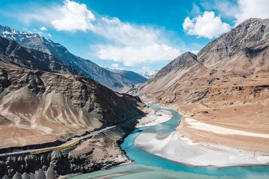
Yarab Tso Lake 📷 4 Photos 🏔 10,400 ft (3,170 m) Sacred Lake & Short Hike
Yarab Tso Lake photo 1
Yarab Tso Lake photo 2
Yarab Tso Lake photo 3
Yarab Tso Lake photo 4
📍 Nubra Valley (near Sumur) 🚗 120 km from Leh

Yarab Tso Lake

Miraculous High-Altitude Crater Lake of Visions

Yarab Tso is an enchanting, holy natural lake hidden inside a volcanic rock crater in the Nubra Valley, reached by a scenic 20-minute uphill walking trail. Held deeply sacred by Ladakhi Buddhists, it is believed that the ripples on its clear water surface reveal visions of the future.

10,400 ft ElevationSacred Vision LakeSecluded Crater Setting
Tirido and Teriphu Villages 📷 5 Photos 🏔 10,300 ft (3,140 m) Heritage Village
Tirido and Teriphu Villages photo 1
Tirido and Teriphu Villages photo 2
Tirido and Teriphu Villages photo 3
Tirido and Teriphu Villages photo 4
📍 Upper Nubra River Valley 🚗 130 km from Leh

Tirido and Teriphu Villages

Stone Hamlets Preserving Ancient Silk Road Agriculture

Tirido and Teriphu are pristine, traditional stone-and-willow hamlets situated along the upper Nubra River canyon. Retaining ancient agricultural methods, stone water channels, and traditional wool spinning, these hamlets offer an authentic glimpse of peaceful pastoral life in northern Ladakh.

10,300 ft AltitudeUntouched Rural LadakhTraditional Wool Weaving
Chumur Village & Chumur Gompa 📷 4 Photos 🏔 14,800 ft (4,510 m) Nomadic Village & Border Monastery
Chumur Village & Chumur Gompa photo 1
Chumur Village & Chumur Gompa photo 2
Chumur Village & Chumur Gompa photo 3
Chumur Village & Chumur Gompa photo 4
📍 Southern Changthang (bordering Himachal & Tibet) 🚗 270 km from Leh

Chumur Village & Chumur Gompa

The Deepest Nomadic Village of High Changthang

Chumur is the southernmost village in Ladakh, located at 14,800 ft near the tri-junction of Ladakh, Himachal Pradesh, and Tibet. Dominated by the 300-year-old Chumur Gompa, it is an essential center for Changpa nomads rearing world-class Cashmere/Pashmina goats.

14,800 ft AltitudePashmina Goat Herding HeartlandCenturies-Old Border Gompa
Shara Village 📷 4 Photos 🏔 12,000 ft (3,650 m) Rural Village & Agriculture
Shara Village photo 1
Shara Village photo 2
Shara Village photo 3
Shara Village photo 4
📍 Indus Valley (between Kharu and Upshi), 60 km from Leh 🚗 60 km from Leh

Shara Village

Golden Mustard Fields and Centuries-Old Heritage Homes

Shara is a picturesque, fertile village situated in a green side valley of the Indus River. Known for golden mustard blossoms, organic barley terraces, and traditional Ladakhi earthen homes, it is an idyllic destination for peaceful village walks and cultural immersion.

12,000 ft ElevationTraditional Ladakhi ArchitectureOrganic Himalayan Farming
Lingshed Village & Monastery 📷 4 Photos 🏔 13,100 ft (4,000 m) Monastery & Secluded Village
Lingshed Village & Monastery photo 1
Lingshed Village & Monastery photo 2
Lingshed Village & Monastery photo 3
Lingshed Village & Monastery photo 4
📍 North of Padum, across Singge La Pass 🚗 185 km from Leh

Lingshed Village & Monastery

The 14th-Century Cliff Sanctuary Founded by Tsongkhapa's Disciple

Lingshed is one of the most secluded and serene settlements in the Trans-Himalayas, home to a magnificent Gelugpa monastery founded in the 14th century by Changsem Sherabs Zangpo. Surrounded by vertical rock walls and barley fields, it is celebrated for sustainable solar village development.

13,100 ft Elevation14th-Century Gelug MonasteryPioneering Solar Himalayan Village
Nyarma Ruins (Ancient Monastic University) 📷 4 Photos 🏔 11,500 ft (3,500 m) Archaeological Site & Heritage
Nyarma Ruins (Ancient Monastic University) photo 1
Nyarma Ruins (Ancient Monastic University) photo 2
Nyarma Ruins (Ancient Monastic University) photo 3
Nyarma Ruins (Ancient Monastic University) photo 4
📍 Near Thiksey, Indus Valley 🚗 18 km from Leh

Nyarma Ruins (Ancient Monastic University)

The Sacred 996 AD Monastic Center of Rinchen Zangpo

Nyarma contains the historic ruins of one of the earliest Buddhist monastic universities in Ladakh, established in 996 AD by the Great Translator Lotsawa Rinchen Zangpo under King Yeshe-Ö of Guge. The sprawling mud-brick walls and stupa bases predate Thiksey by hundreds of years.

11,500 ft AltitudeFounded 996 ADEarliest Monastic University in Ladakh
Stongdey Monastery (Marpaling Gompa) 📷 5 Photos 🏔 11,600 ft (3,535 m) Monastery & Viewpoint
Stongdey Monastery (Marpaling Gompa) photo 1
Stongdey Monastery (Marpaling Gompa) photo 2
Stongdey Monastery (Marpaling Gompa) photo 3
Stongdey Monastery (Marpaling Gompa) photo 4
📍 Stongdey, 18 km north of Padum (Zanskar) 🚗 250 km from Leh

Stongdey Monastery (Marpaling Gompa)

Dramatic Cliffside Gelugpa Citadel Overlooking Padum Plain

Founded in 1052 AD by Lama Marpa Choky Lodos and later expanded by Gelugpa masters, Stongdey is the second-largest monastery in Zanskar. Standing dramatically on a sheer rocky spur 300 meters above the valley floor, its seven temples house breathtaking tantric frescoes and golden statues.

11,600 ft ElevationFounded 1052 ADSecond Largest in Zanskar
Ensa Monastery (Ensa Gompa) 📷 4 Photos 🏔 10,800 ft (3,290 m) Cave Hermitage & Monastery
Ensa Monastery (Ensa Gompa) photo 1
Ensa Monastery (Ensa Gompa) photo 2
Ensa Monastery (Ensa Gompa) photo 3
Ensa Monastery (Ensa Gompa) photo 4
📍 Nubra Valley (Cliff across from Panamic) 🚗 145 km from Leh

Ensa Monastery (Ensa Gompa)

600-Year-Old Solitary Retreat with Sacred Rock Imprints

Ensa Gompa is a tranquil 600-year-old Buddhist hermitage perched high on an isolated cliff in northern Nubra. Renowned for its holy rock footprints of holy masters and deep meditation caves, it offers total spiritual seclusion and sweeping views of the Nubra River canyon.

10,800 ft Altitude600-Year Cave HermitageSacred Rock Imprints
Matho Monastery (Mangtro Gompa) 📷 5 Photos 🏔 12,300 ft (3,750 m) Monastery & Museum
Matho Monastery (Mangtro Gompa) photo 1
Matho Monastery (Mangtro Gompa) photo 2
Matho Monastery (Mangtro Gompa) photo 3
Matho Monastery (Mangtro Gompa) photo 4
📍 26 km southeast of Leh, Indus Valley 🚗 26 km from Leh

Matho Monastery (Mangtro Gompa)

Home of the Prophetic Matho Nagrang Oracle Festival

Founded in 1410 by Lama Dugpa Dorje, Matho is the only monastery in Ladakh belonging to the Sakya lineage. Renowned worldwide for the Matho Nagrang Festival, where two selected lamas channel protective oracles in trance, perform dramatic blindfolded feats, and deliver future prophecies.

12,300 ft AltitudeOnly Sakya Monastery in LadakhMatho Nagrang Oracle Tradition
Takthok Monastery (Rock Roof Gompa) 📷 4 Photos 🏔 12,800 ft (3,900 m) Monastery & Sacred Cave
Takthok Monastery (Rock Roof Gompa) photo 1
Takthok Monastery (Rock Roof Gompa) photo 2
Takthok Monastery (Rock Roof Gompa) photo 3
Takthok Monastery (Rock Roof Gompa) photo 4
📍 Sakti Village, 46 km east of Leh 🚗 46 km from Leh

Takthok Monastery (Rock Roof Gompa)

Sacred 8th-Century Meditation Cave of Guru Padmasambhava

Takthok is the sole monastery in Ladakh belonging to the ancient Nyingmapa (Red Hat) school of Tibetan Buddhism. The name translates as 'Rock Roof', as the entire temple complex is built around the cave where 8th-century master Guru Padmasambhava (Rinpoche) meditated.

12,800 ft AltitudeOnly Nyingma Gompa in LadakhMeditation Cave of Guru Rinpoche
Stakmo Village 📷 4 Photos 🏔 12,000 ft (3,660 m) Traditional Village & Homestays
Stakmo Village photo 1
Stakmo Village photo 2
Stakmo Village photo 3
Stakmo Village photo 4
📍 Thiksey Valley, 25 km from Leh 🚗 25 km from Leh

Stakmo Village

Traditional Terraced Hamlet of Water Mills & Homestays

Stakmo is an idyllic agricultural village situated in the upper valley above Thiksey Monastery. Renowned for pure mountain spring water, apricot and apple orchards, traditional clay pottery, and homestays, it is the perfect spot for quiet cultural immersion away from crowds.

12,000 ft ElevationTraditional Earthen ArchitecturePristine Valley Setting
Sankar Gompa 📷 5 Photos 🏔 11,600 ft (3,535 m) Monastery & Heritage
Sankar Gompa photo 1
Sankar Gompa photo 2
Sankar Gompa photo 3
Sankar Gompa photo 4
📍 3 km north of Leh town (Chubi) 🚗 3 km from Leh

Sankar Gompa

Home to the Gilded 1,000-Armed Avalokiteshvara

Sankar Gompa is a peaceful subsidiary branch of Spituk Monastery, located within walking distance of Leh town among lush poplar groves. It serves as the official residence of the venerable Kushok Bakula Rinpoche and enshrines a magnificent gold statue of Avalokiteshvara with 1,000 arms and 1,000 heads.

11,600 ft Altitude1,000-Armed AvalokiteshvaraWalking Distance from Leh
Kongmaru La Pass 📷 4 Photos 🏔 17,060 ft (5,200 m) High Trekking Pass
Kongmaru La Pass photo 1
Kongmaru La Pass photo 2
Kongmaru La Pass photo 3
Kongmaru La Pass photo 4
📍 Hemis National Park (Markha Valley) 🚗 55 km from Leh

Kongmaru La Pass

The 17,060 ft Panoramic Summit Overlooking Kang Yatse

Kongmaru La is a high Himalayan pass at 17,060 ft (5,200 m) forming the dramatic finale of the Markha Valley trek. Adorned with colorful Buddhist prayer flags, it offers an astonishing 360-degree panorama of the Kang Yatse massif (6,400 m) and the distant Karakoram peaks.

17,060 ft ElevationApex of Markha TrekViews of K2 & Karakoram on Clear Days
Stok Village, Palace & Museum 📷 4 Photos 🏔 11,400 ft (3,475 m) Royal Palace & Living Heritage
Stok Village, Palace & Museum photo 1
Stok Village, Palace & Museum photo 2
Stok Village, Palace & Museum photo 3
Stok Village, Palace & Museum photo 4
📍 15 km south of Leh, foot of Stok Kangri 🚗 15 km from Leh

Stok Village, Palace & Museum

The 1834 Royal Palace Housing the Queen's Turquoise Perak Crown

Stok Palace is the official residence of the royal Namgyal dynasty of Ladakh since 1834. Overlooking Stok village and the towering Stok Kangri peak (20,187 ft), its museum showcases the precious Queen's turquoise perak crown, ancient armor, royal jewelry, and jewel-encrusted thangkas.

11,400 ft ElevationLiving Royal Palace of LadakhQueen's Turquoise Perak Crown
Hunderman Village (Museum of Memories) 📷 5 Photos 🏔 8,850 ft (2,700 m) Border Heritage & Partition Museum
Hunderman Village (Museum of Memories) photo 1
Hunderman Village (Museum of Memories) photo 2
Hunderman Village (Museum of Memories) photo 3
Hunderman Village (Museum of Memories) photo 4
📍 Kargil District (10 km from Kargil town) 🚗 225 km from Leh

Hunderman Village (Museum of Memories)

Historic Border Village & The Poignant Museum of Memories

Hunderman is an ancient border village on the Line of Control, under Pakistani administration until liberated by the Indian Army in the 1971 war. The village's abandoned stone houses now host the 'Museum of Memories' (Unlock Hunderman), curating wartime artifacts, pre-1971 letters, and everyday items.

8,850 ft ElevationPartitioned in 1971Museum of Memories
Sindhu Ghat 📷 5 Photos 🏔 10,800 ft (3,290 m) Sacred Ghat & Cultural Site
Sindhu Ghat photo 1
Sindhu Ghat photo 2
Sindhu Ghat photo 3
Sindhu Ghat photo 4
📍 Shey, on the banks of Indus River, 13 km from Leh 🚗 13 km from Leh

Sindhu Ghat

The Holy Riverbank Host of the Sindhu Darshan Festival

Sindhu Ghat is a peaceful riverside cultural ghat built on the banks of the sacred Indus (Sindhu) River in Shey. The cradle of Indian civilization, it hosts the annual Sindhu Darshan Festival celebrating communal harmony, and offers a tranquil setting for prayer and riverfront walks.

10,800 ft AltitudeSacred Indus RiverbankSindhu Darshan Festival Host
Mulbekh Chamba 📷 4 Photos 🏔 10,500 ft (3,200 m) Archaeological Rock Relief & Heritage
Mulbekh Chamba photo 1
Mulbekh Chamba photo 2
Mulbekh Chamba photo 3
Mulbekh Chamba photo 4
📍 Srinagar-Leh Highway (NH-1), 45 km east of Kargil 🚗 170 km from Leh

Mulbekh Chamba

30-Foot Ancient Maitreya Relief Carved in Solid Rock

Mulbekh Chamba is a monumental 30-foot (9-meter) high rock relief carving of Maitreya Buddha (Future Buddha) carved directly into a limestone cliff face in the 8th century. Blending Kashmiri and Gupta artistic styles, it marks the historic transition from Kargil to Buddhist Ladakh.

10,500 ft Elevation30-Foot Rock-Cut Buddha8th-Century Gupta-Kashmiri Art
Sheela Waterfall 📷 5 Photos 🏔 11,800 ft (3,600 m) Waterfall & Nature
Sheela Waterfall photo 1
Sheela Waterfall photo 2
Sheela Waterfall photo 3
Sheela Waterfall photo 4
📍 Sheela Village, 8 km from Padum (Zanskar) 🚗 245 km from Leh

Sheela Waterfall

Rare Cascading Glacial Waterfall in the Arid Trans-Himalayas

Sheela Waterfall is an enchanting, rare natural waterfall in the high arid desert of Zanskar. Fed by glacial meltwaters tumbling from high alpine peaks above Padum, it cascades down rocky cliffs into a lush green poplar and willow grove.

11,800 ft ElevationRare Zanskar WaterfallGlacial Meltwater Oasis
Chuchot Yokma (Chuchot Polo Village) 📷 4 Photos 🏔 10,700 ft (3,260 m) Polo Heritage & Cultural Village
Chuchot Yokma (Chuchot Polo Village) photo 1
Chuchot Yokma (Chuchot Polo Village) photo 2
Chuchot Yokma (Chuchot Polo Village) photo 3
Chuchot Yokma (Chuchot Polo Village) photo 4
📍 Left bank of Indus River, 14 km south of Leh 🚗 14 km from Leh

Chuchot Yokma (Chuchot Polo Village)

Traditional Home of Ladakhi Horse Polo Since the 17th Century

Chuchot Yokma is a culturally vibrant village on the banks of the Indus River, famous for keeping alive the traditional sport of horse polo (Shagaran). Introduced from Baltistan in the 17th century by King Sengge Namgyal's mother Gyal Khatun, the village features historic polo grounds, traditional archery festivals, and willow craft.

10,700 ft ElevationTraditional Horse Polo400-Year-Old Balti Heritage
Fotu La Pass (13,478 ft) 📷 2 Photos 🏔 13,478 ft (4,108 m) High Pass & Viewpoint
Fotu La Pass (13,478 ft) photo 1
Fotu La Pass (13,478 ft) photo 2
📍 NH-1, Zanskar Range between Kargil and Leh 🚗 165 km from Leh

Fotu La Pass (13,478 ft)

Highest Crest on the Historic Srinagar-Leh Trans-Himalayan Highway

Standing at an elevation of 4,108 m (13,478 ft) in the Zanskar Range, Fotu La is the highest point on the entire Srinagar-Leh Highway (NH-1), surpassing Zoji La and Namika La. Characterized by breathtaking lunar desert terrain, wind-swept prayer flags, and the high-altitude Prasar Bharati television transmitter relaying to Lamayuru.

13,478 ft Highest NH-1 PassZanskar Range SpineDescent into Lamayuru
Zojila Pass (11,578 ft) 📷 2 Photos 🏔 11,578 ft (3,528 m) High Pass & Viewpoint
Zojila Pass (11,578 ft) photo 1
Zojila Pass (11,578 ft) photo 2
📍 NH-1, Great Himalayan Range between Baltal/Sonamarg and Drass 🚗 315 km from Leh

Zojila Pass (11,578 ft)

Historic High Mountain Threshold Between Kashmir Valley and the Cold Desert

Perched at 3,528 m (11,578 ft), Zojila is the strategic mountain pass linking Kashmir Valley to Drass, Kargil, and Leh. Renowned for dramatic drop-offs, historic 1948 Operation Bison tank battles, and the upcoming 14.15 km bi-directional Zojila Tunnel which will ensure all-weather 365-day connectivity.

11,578 ft ElevationKashmir-Ladakh Threshold14.15 km Zojila Tunnel
DEFINITIVE TRANS-HIMALAYAN FIELD COMPASS

Ladakh Master Travel Circuits, Permits & Health Protocols

Everything you need to navigate the high-altitude desert plateaus, extreme passes, and historic river corridors of Ladakh and Zanskar.

Circuit 1: Leh Central Valley & Monastery Trail

Base at Leh (11,562 ft). Explore the 9-storey 17th-century Leh Palace, Shanti Stupa, and the historic Indus Valley monasteries: Thiksey (resembling Potala Palace), Hemis (largest Drukpa monastery hosting the annual Hemis festival), Shey Palace, and Alchi (celebrated for 11th-century Kashmiri-style Buddhist frescoes).

Recommended Duration: 3 Days (inclusive of 48-hr mandatory rest).

Circuit 2: Nubra Valley, Khardung La & Turtuk

Cross Khardung La (17,582 ft) into the Shyok river valley. Experience the cold sand dunes of Hunder with double-humped Bactrian camel safaris, Diskit Monastery's 106-ft Maitreya Buddha, and proceed north-west to Turtuk — the northernmost Balti border village on the LoC with distinct apricot orchards.

Permit Required: Inner Line Permit (ILP) Reviewed at North Pullu checkpost.

Circuit 3: Pangong Tso & Hanle Dark Sky Reserve

Travel via Chang La (17,590 ft) or direct Shyok river road to the 134-km long, deep-azure Pangong Lake (14,270 ft). Continue through Tsaga La and Chushul to Hanle (14,760 ft), home to India's first Dark Sky Reserve and the world's second-highest optical telescope at the Indian Astronomical Observatory.

Highlight: World-class stargazing, Milky Way astrophotography, and Tibetan Plateau wildlife.

Circuit 4: Suru Valley, Zanskar & Phugtal Cave

Route via Kargil and Sankoo into Suru Valley flanked by Nun-Kun twin peaks (7,135 m). Ascend Pensi La pass past the Drang-Drung Glacier into Zanskar (Padum). Trek to the iconic Phugtal Monastery built around a natural mountain cave, or cross into Himachal via the newly opened Shinkun La tunnel route.

Best Season: June to October for road connectivity.

High-Altitude Sickness (AMS) Medical Protocols

Acute Mountain Sickness (AMS) can affect anyone above 8,000 ft regardless of physical fitness.

  • Golden Rule: Rest completely for the first 48 hours in Leh. Do not sleep during the day; avoid alcohol and smoking.
  • Hydration: Drink 4 to 5 liters of water, garlic soup, and electrolyte liquids daily.
  • Prophylaxis: Consult your physician regarding Acetazolamide (Diamox 125/250 mg) started 24 hours prior to ascent.
  • Emergency Checkpoints: Portable oxygen cylinders are available for rent in Leh market. Major medical facilities exist at SNM Hospital Leh and Army General Hospitals.